Missing Gary Tweddle Book Part 19 – CHAPTER 6: OUR OWN ‘GROUND-TRUTHING’
There were a number of clues in the media as to the reason for Gary’s departure and subsequent disappearance and to where he went and to what likely happened, before the massive search even began. We have raised many of these already in the above chapters in this article. And that’s before we apply investigative insight and analysis. It’s not just the benefit of hindsight, but much evidence was readily available to the search co-ordinators on Day 1 – the morning of 17th July 2013.
Choosing to depart suddenly near midnight in dark freezing conditions with rather light clothing and choosing to walk in an area he had no familiarity with and no glasses to even attempt to use a map on his phone or take a taxi, confirmed that Gary’s state of mind was not compos mentis. This was a key factor in his disappearance – he was unprepared, desperate and lost in a outdoors environment he had no knowledge of. This meant that he was prone to make uninformed illogical decisions as to where he was going, of what to expect and what not to expect. He chose not to book another taxi for instance, despite him being completely unfamiliar with where he was.
Evidence showed that he was clearly under the influence of substance abuse (likely cocaine as it later turned out) and as his taxi driver from the restaurant accounted for to the media less and than an hour prior:
“He was wasted, seriously wasted.”
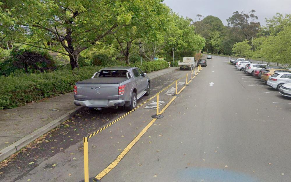
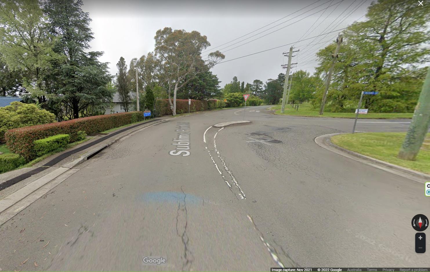
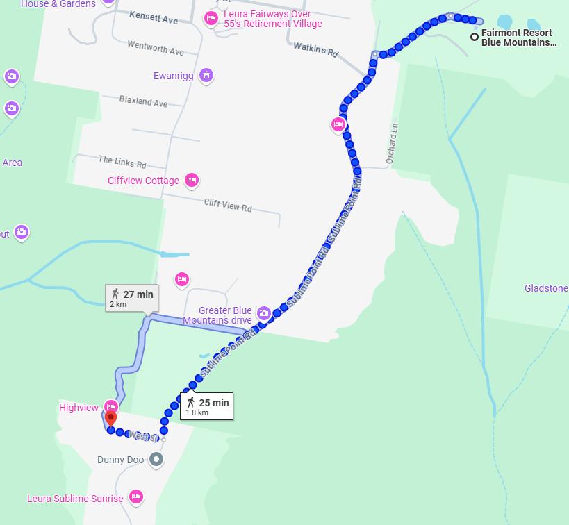
So, retracing Gary’s movements that night, the route on foot that Gary must have taken was left outside the Fairmont Resort’s main entrance (image again below). It was approachng midnight, very dark and Gary was seen running hurriedly out of the Fairmont Resort’s main entrance here and turn left toward the resort property’s exit.
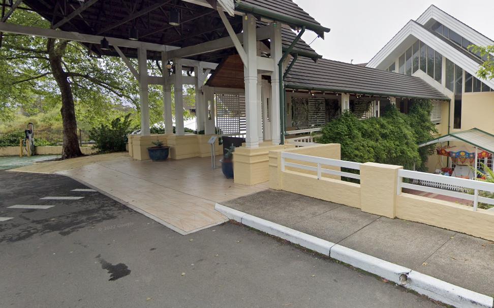
However, our subsequent ‘ground truthing’ reveals that there are no CCTV cameras located either in the guest driveway entrance, nor covered walkaway shown above. The only CCTV cameras we observed are located within the Fairmont Resort’s lobby. This means that given Gary was observed by CCTV “running” out of the Fairmont, this must have started from the lobby. Fairmont staff rostered on in the lobby presumably at the time, would have surely noticed a man running out at midnight. It would not be a usual encounter.
Human “running” speed is typically and conservatively 15kph, certainly not an Olympic pace of course. But Gary presumable on a cocaine drug high and if keeping up such a pace, would be consistent and quite feasible with Gary being able to travel by running in 10 minutes about 2.5 km along a road.
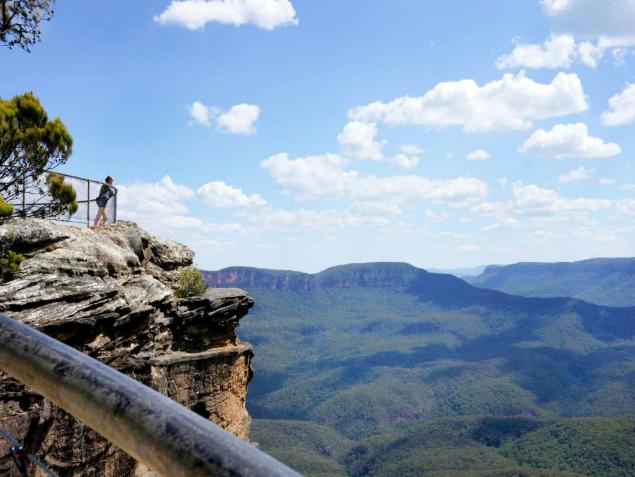
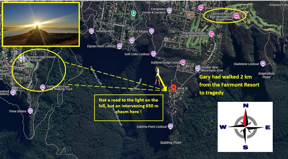
That distance happens to be beyond the distance between the Fairmont Resort and the southerly dead end of Sublime Point Road car park, just before track to the lookout to overlook the chasm of the Jamison Valley 650 metres below.
Why did police not to these known maths?
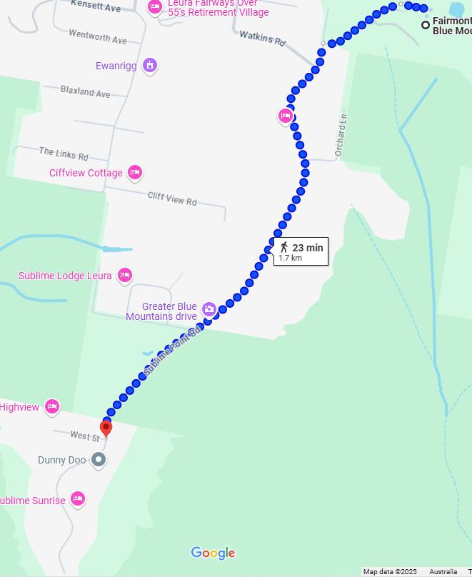
The initial distance on foot between the hotel building main entrance and the intersection of Sublime Point Road is just 400 metres. We offer sequential Google Maps street level photos of Fairmont Place leading eastward at this stage to the property entrance at Sublime Point Road as follows:
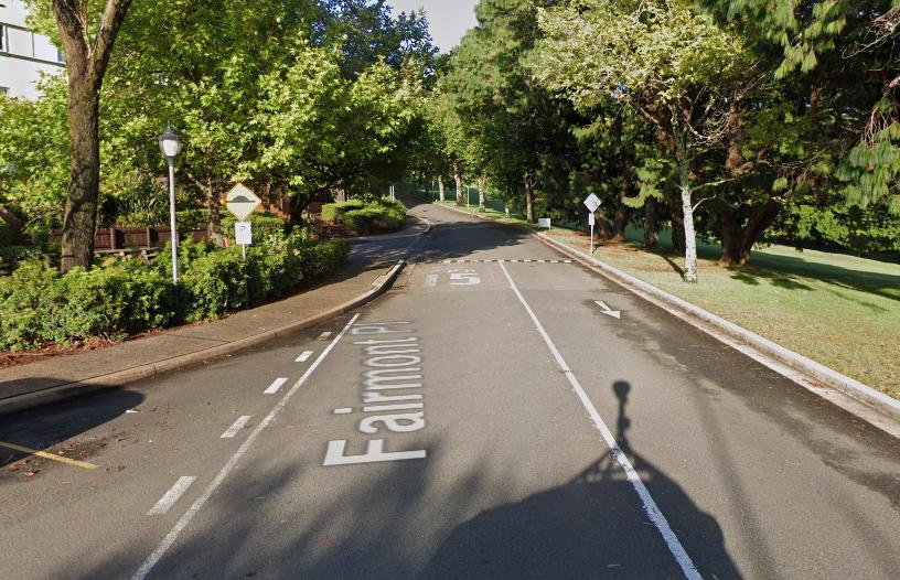
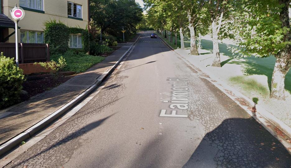
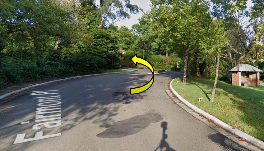
It is a this intersection at Sublime Point Road that Gary would have turned left to exit the Fairmont Resort property.
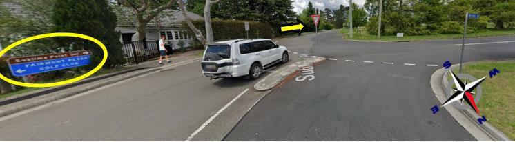
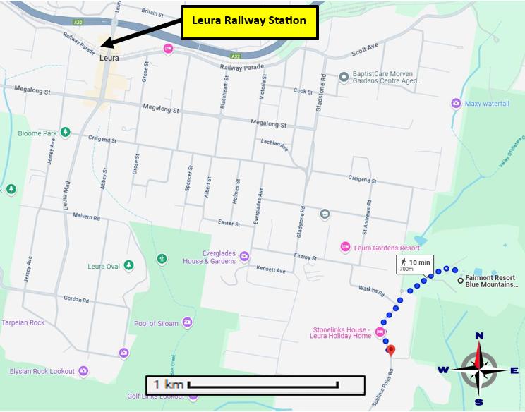
Later evidence would reveal that Gary was trying to walk to Leura Railway Station. But it was pitch black along Sublime Point Road. There is no directional signage and he was headed in the wrong direction.
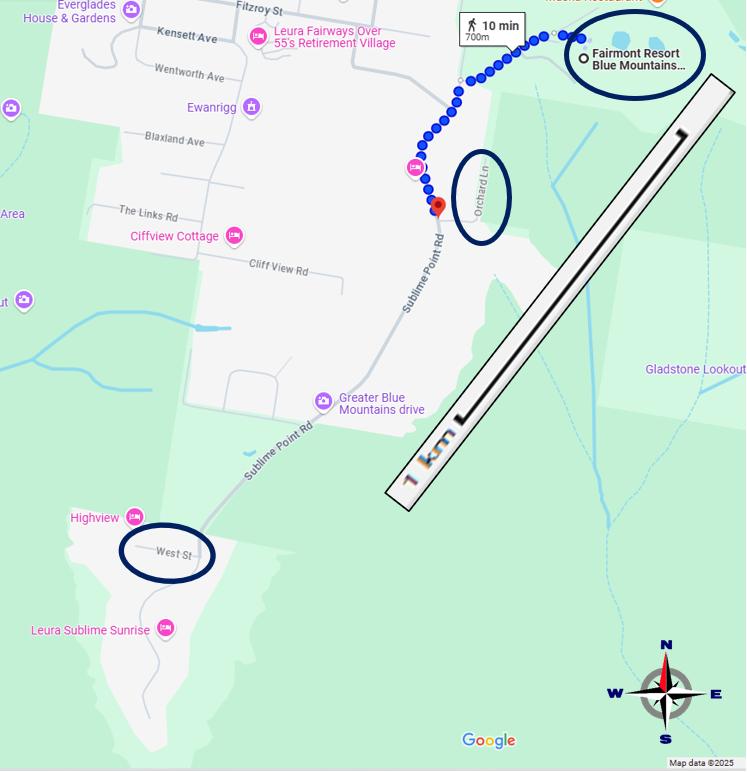
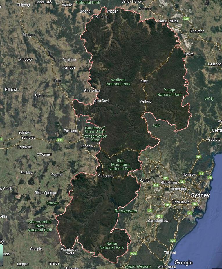
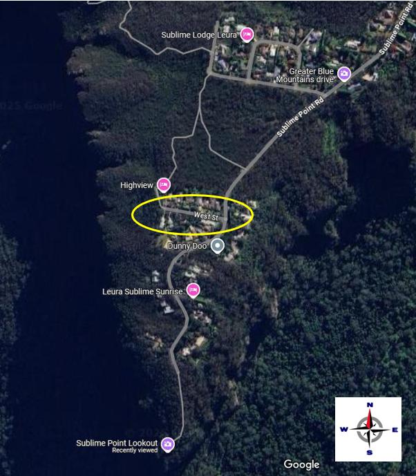
We include a distance scale and a compass bearing. We also here circle three critical locations based upon evidence received. Note that Sublime Point Road comes ultimately to a dead end at Sublime Point Lookout (over the chasm of the Jamison Valley below).
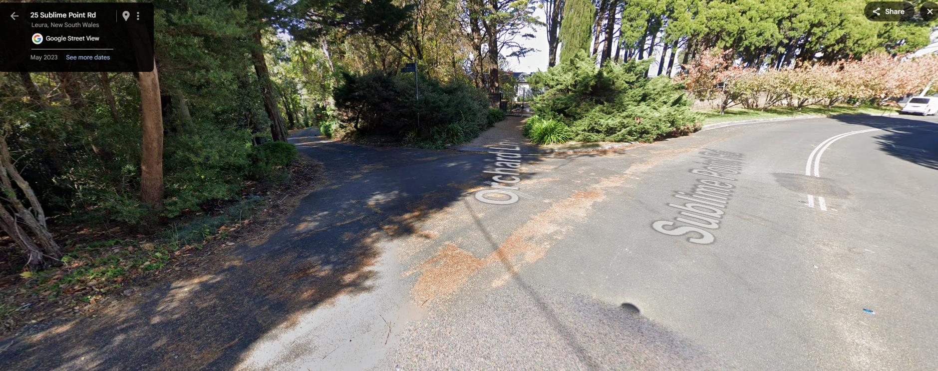
Orchard Lane intersection veering left off Sublime Point Road (daytime), barely visible at night.
Again, along the length of Sublime Point Road from the Fairmont intersection at Watkins Road (an overall distance of 2.2 km) there are no footpaths at either side.
There are also very few street lights in this residential on the outskirts of Leura. Our recent ground-truthing (by car and on foot at times) counted a total of just 12 street lights on timber electricity poles with most spaced over 300 meter apart and in two sections no lights at all.
One section was at the critical intersection of Sublime Point Road and Watkins Road just outside the Fairmont Resort property, where Gary made the wrong decision to go straight.
The second section was a 400 metre straight bushland section between Willoughby Road (heading westward) and West Street (also heading westward). Now significantly in Gary’s situation from the first intersection at Willoughby Road, the distant town light of Katoomba toward the west are not visible. Our ground-truthing shows Willoughby Road to have a right-hand bend in it with taller native vegetation blocking views beyond looking from Sublime Point Road. So with no incentive to turn down a side street, Gary would have just kept continuing southward along Sublime Point Road.
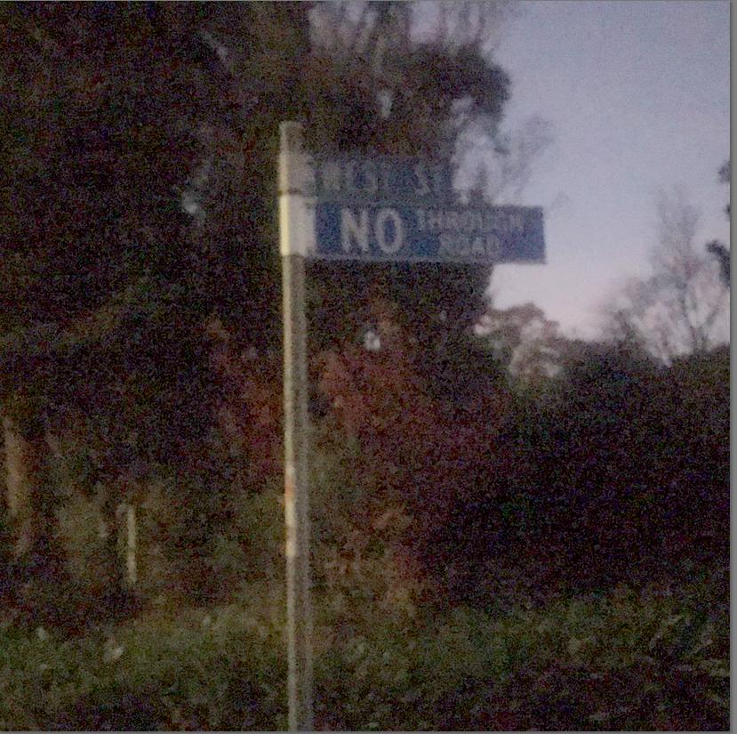
Then he reached West Street heading west – and quite a different sight of distant lights visible.
The precinct here is predominantly residential on the outskirts of Leura village surrounded by natural bushland all around. It is exclusive residential real estate with many multi-million dollar homes on large block holdings with million dollar views above the majestic Jamison Valley. So, at night only local residents would use Sublime Point Road and its five small side streets to access their homes. And there are few of them, since about 1 in 4 dwellings in this exclusive area are second homes as weekend retreats for some of Sydney’s elite.
We tried taking photos at night, but they came out black, so we waited to dawn. The following photos serve to provide samples of the road Gary took that night.
Whereas by day and especially at weekends, many day-tripping tourists mostly driving up from Sydney find the Sublime Point lookout very appealing. The demographic of the property owners and tourists is immiscible.
So this is why Sublime Point Road is properly sealed and has centre double lines for heavy traffic safety. It so gives the impression of being a highway, rather than a local dead-end road.
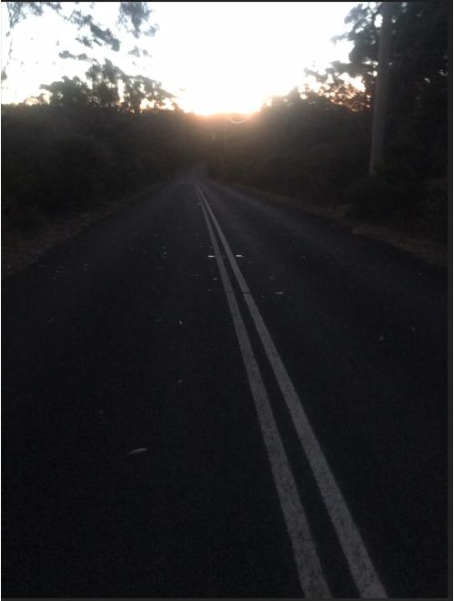
Whilst ground-truthing the area we took the follow photo of Sublime Point Road (looking northeast) between Orchard Lane and West Street, which is where Gary walked/ran just after midnight. [Photo taken by Nature Trail at sunrise 6:08 am Wednesday 7th May 2025 – hasn’t changed since 2013].
This impression would have been a reason for Gary to use it thinking it went somewhere prominent, like to a town centre and a railway station. Yet Gary was heading the opposite direction.
In any case, the Blue Mountains rail timetable showed that the last train to Sydney had departed Leura station that weekday night at 22:19 hrs (10:19 pm). He had missed the train by nearly two hours.
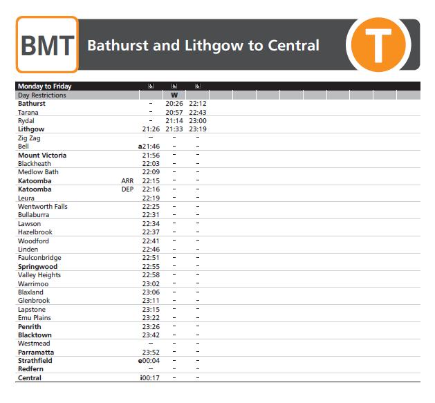
This shows that the last train departing from Leura to Sydney had been at 22:19 (10:19 pm), so two hours prior. [SOURCE: ^https://transportnsw.info/routes/details/intercity-trains-network/bmt/02bmt]
Sublime Point Road from the Fairmont Resort heading southward. It appears to be a major road given the double lines. But note no footpaths. At night road is pitch black with no street light at this section and there’s no directional signage. It is mostly residential. So this is what Gary faced thinking he was on a major road to Leura to get his imagined train to Sydney, though it was after midnight midweek on a Wednesday.
Calculating the likely location scenarios:
Upon further analysis, we revisit the three key pieces of known evidence at the time of Gary’s disappearance:
- Gary’s running departure from the Fairmont entrance captured on CCTV – it is ABOUT midnight, but we are not told the accurate time, and the electric clock on the CCTV computer may not have been accurately set (one knows this from personal experience with one’s own setup)
- The local car driver sighting Gary along Sublime Point Road at 12:15 am (but this timing may not be exact either, and we are not told where exactly the driver saw Gary “standing on the road” (or more likely him actually running given the fair distance he managed to travel in such short durations)
- Gary’s final words to his work colleagues on his mobile phone as he is heard running and jumping (in hindsight presumably in the scrub located off the end of West Street.
Also, recall the supplied evidence that Gary’s conversation with his colleagues lasted about “17 minutes”.
This would have been verifiable by Police investigation checking the call duration on that particular colleague’s mobile phone – so likely accurate.
Since Gary was sighted talking on his phone during this time, that would place him 17 minutes from his running and jumping through that dense scrub location at the end of West Street.
Given the time of night and the driver likely alone, it makes sense not to have stopped on that dark lonely isolated section of road for a young male stranger.
Gary was not talking on his mobile phone when he ran out of the Fairmont entrance, rather only after he had become lost. What along Sublime Point Road (which we know from hindsight that he was on) had triggered him to realise that he was lost and so call for navigation guidance to his colleagues?
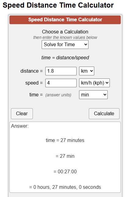
The overall road distance between the Fairmont entrance and the western end of West Street is 1.8 km. (See map below)
A steady walking pace along a footpath/road is about 4 kph, so at that pace if continuously maintained, to cover 1.8 km would take 27 minutes. [Algebra derived relationship for Speed = Distance / Time , which to solve for Time transposes to the formula:
Time = Distance / Speed
In this case, known are: S = 4kph, D = 1.8km
Calc: 4kph x 1.8km = 0.45 Hours, which converting that to more meaningful minutes is by 45/60 = 27 minutes. Basic algebra is taught in Australia from Year 7 (aged 13 years), but to readers, as adults you must use it or lose it.
Here’s a handy alternative tool for evidence analysis:
This is the lazy way to do the same maths. [^SOURCE]
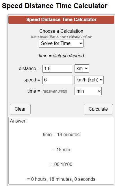 This indicates that overall, it took Gary about 18 minutes to get from the Fairmont entrance the cover the 1.8km mostly level road distance to the end of West Street before rummaging in through the scrub. This would seem to be a reasonable guesstimate, based on the supplied evidence in the media, our mapping and basic algebra.So, to then better calculate the location where Gary was sighted by the driver let’s backtrack (since that fact was not supplied by the police to the media). We’re allowing a nominal extra 5 minutes of him struggling in the bushes at the end of that 17 minute conversation just before his phone battery went dead. So, from the scrub at the end of West Street back to where the drive sighted Gary on Sublime Point Road: Time is 17 minutes less 5 minutes = 12 minutes.Algebra Distance = Speed x Time = 6 kph x 12 minutes, so Distance = 1.2 km
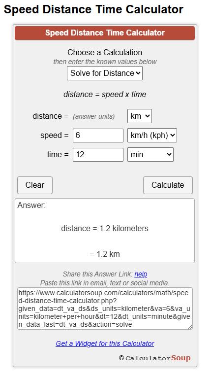 So, 1.2 km from the end of West Street would place Gary 2/3 the distance of the overall 1.8km back toward the Fairmont. Again, this is near the intersection of Orchard Lane as we had estimated.
Gary’s Fateful Decision at West Street:
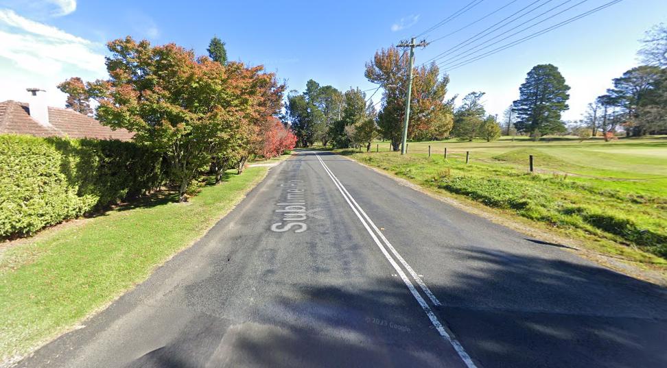
The following photo is a street view from Google Maps at the time of compiling this article. It is taken at the intersection of Sublime Point Road and West Street facing westerly (a rather imaginary Council name for this street).
This street is short at about 150 metres in length and is a ‘No Through Road’, which is consistent with Sublime Point and its short side streets off (dead-end) Sublime Point Road all being in a dead-end-cul-de sacs due to this small residential precinct being situated atop the surrounding cliff escarpment on a plateau peninsula above the Jamison Valley.
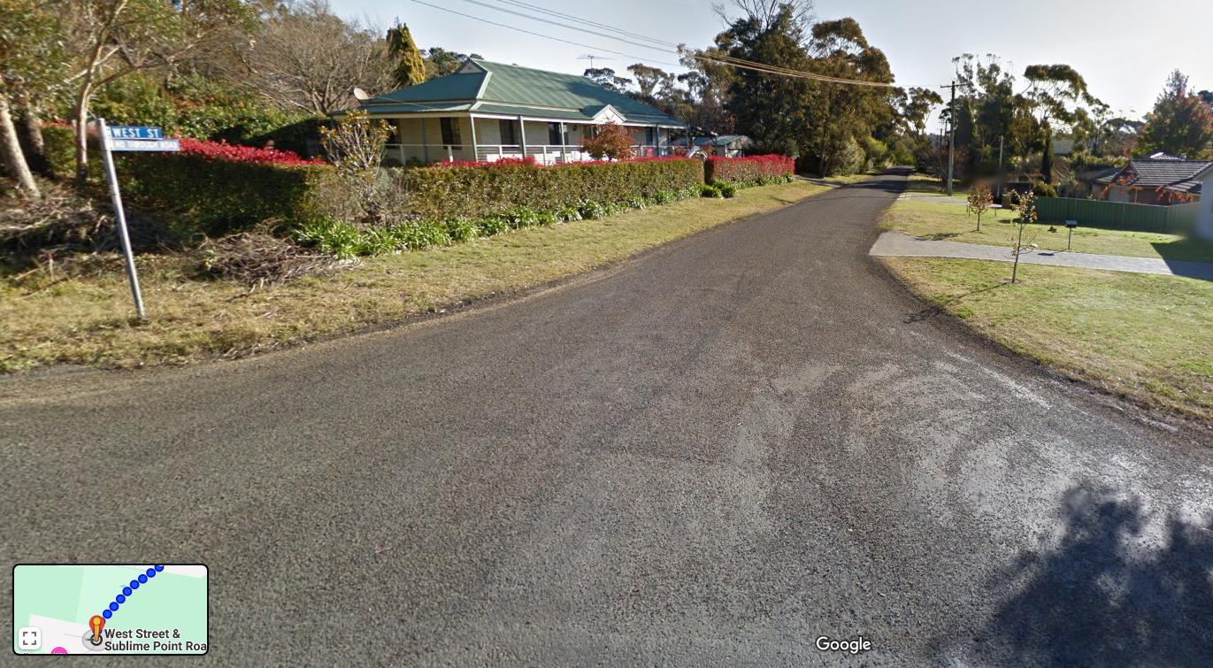
The junction of Sublime Point Road and West Street in 2025. However, back in 2013 this was a new street and the vegetation at the dead end was not present, so the lights of Katoomba in the distance would have been noticeable from this spot – providing an illusion of a continuation of this street toward town.
We note that one media photo of Gary (probably from his Facebook page or his girlfriend’s) prior, during an Oracle work function showed Gary in corporate office attire wearing glasses (photo reproduced below).
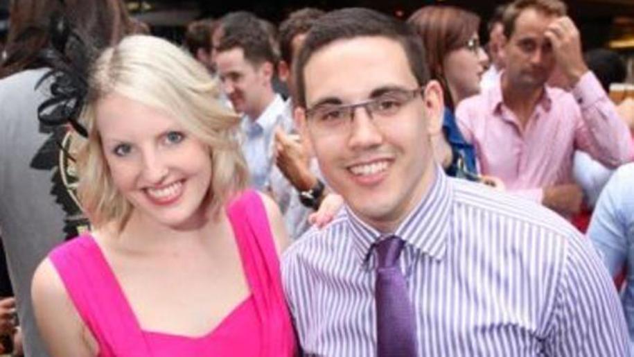
Gary wearing glasses for non-reading needs
Instead, this confirms that Gary had short-sightedness (myopia) which is a physical condition where distant objects appear blurry, while nearby objects are seen clearly. The glasses he is shown wearing here would have certainly been optometrist prescriptive glasses.
This is a significant factor in Gary’s disappearance, and we can’t find any publicised records that anyone in the police search investigation or the media picked up on this key evidence. It is significant in this case because it was reported later on in the media:
“Security footage captures Tweddle running out of the Fairmont without his jacket or glasses”
[Source]
This confirms that his glasses were NOT for reading since he is wearing them not for close reading but to see in normal conversation and over distances. His work colleagues for starters could have attested to this to Police on the morning of Day 1 BEFORE the search commenced. Without his glasses, Gary is sight handicapped and especially on foot in an area he has know familiarity with, alone, at midnight in almost pitch blackness.
Nature Trail, whilst ground-truthing the route of Gary’s disappearance, took this photo at dawn at the intersection of Sublime Point Road and West Street.
We aligned the direction of West Street, a short 150 metres long ‘No Through Road’ (due to a 650 metre drop chasm cliff edge located about 100 metres down slope through thick bushland further west.
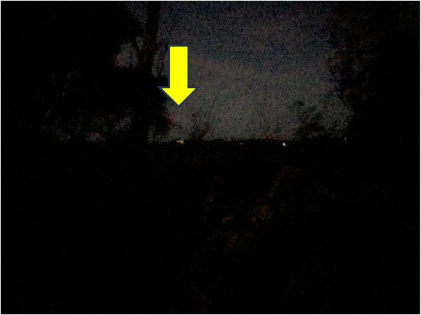
Using a Google Maps aerial photo, We orientate from what was Gary’s “light of the hill” obviously westward, since it was many metres down off the cliff at the end of West Street. [See our explanatory illustration below).
Subsequent field research conducted by the author confirms that the lights would be those of the Katoomba High School which is perched on a hill back from the escarpment cliff top on the other side of this chasm on the northern side of the Jamison Valley and which is lit up and back in 2013 would have been very distinguishable from this West Street junction with Sublime Point Road. The bushland at the western end of West Street has long since grown, so blocking the view.
We can categorically confirm this was Gary’s “light on the hill”, since six weeks after his comment of this on his mobile phone, Gary’s body was discovered slumped in a gum tree about 50 metres down a cliff face immediately below the western end of West Street.
He was walking towards the distant light through thick bushland with no more mobile phone torch light in total blackness unbeknownst of the chasm in between.
>Go Back To Top of This PART
>Go To Next PART
>Go To Previous PART
>Go to TABLE OF CONTENTS