Blue Mountains ‘Grand Cliff Top Walk’ – a misleading promotional article
This 19+km trek is officially promoted equivalent to a proverbial ‘walk in the park’ as being do-able in just 2-days… like ‘easy peasy’? Yet, from our on-ground hiking experience of this trail, it seriously is anything but!
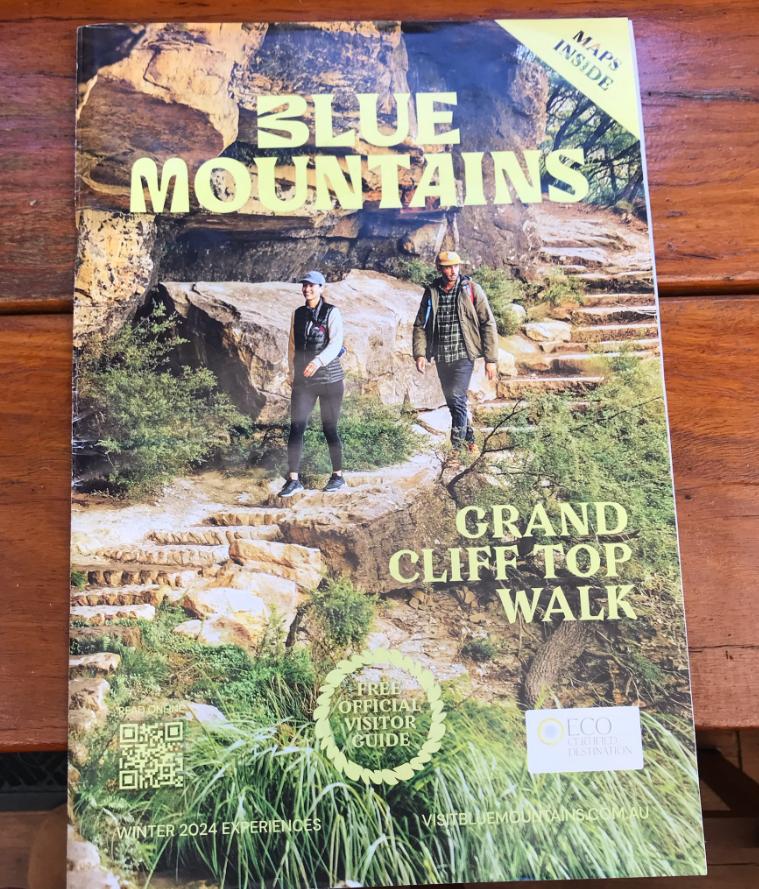
The Parks Service’s (NPWS) March 2024 public opening launch of its new concept ‘Grand Cliff Top Walk‘ in the Australian Blue Mountains, was promoted locally in Blue Mountains Tourism‘s freely distributed tourism magazine’s Winter 2024 edition at pages 11-12. (per magazine cover image above).
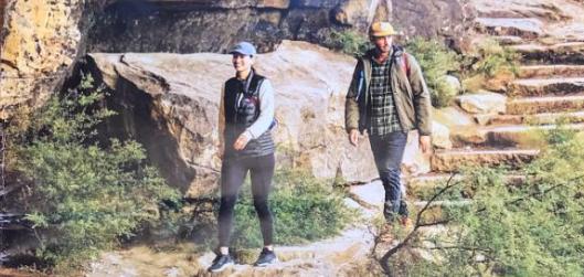
The Parks Service’s official promotion to Blue Mountains visitors of its new ‘Grand Cliff Top Walk’. But taking along toddlers on its 20 km trek is in our view grossly dangerously and culpably reckless tourism propaganda. [Photo and caption comment by Steven Ridd 7th July 2025].
The internal article is entitled ‘Grand Cliff Top Walk – Shorter walks‘ and is authored by local hiking expert Caro Ryan.
Well, frankly we agree with Ms Ryan’s sentiments and recommendations in her article. We acknowledge her as an experienced bushwalker and indeed a local expert in this field/craft.
In our reported on-ground research of this new trail thus far, we have stated in our previous critique article about this concept half marathon length trail, thus:
>https://naturetrail.com.au/blue-mountains-grand-cliff-top-walk-misleading-flyer-press-release/
However quite separately, we note within that article the editor of Blue Mountains Tourism has separately added a small high-level map of the trail and included a QR-code hyperlink. This would appear to be quite separate to what Caro wrote.
This is that map and embedded QR-code (top left):
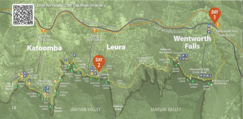
The New South Wales (state) Government’s recently named ‘Grand Cliff Top Walk’ (shown in yellow) in the Blue Mountains, Australia. It is mostly a hiking track that covers about 20 km above the World Heritage Jamison Valley, politically re-branding 19 interconnected historic tracks, some dating back to the late 1800s. [SOURCE: ‘Blue Mountains, Blue Mountains Tourism, Winter 2024 edition, pp. 11-12.]
So, we tried the original QR Code on the map above (top left), which is indistinct on this reproduced image above. However, when we scanned the original QR-code with a working smartphone QR Code app, it links to a tourism website VisitBlueMountains.com.au. This is the specific webpage hyperlink we found on that tourism website: ^https://www.visitbluemountains.com.au/travel/entry/grand-cliff-top-walk-itinerary
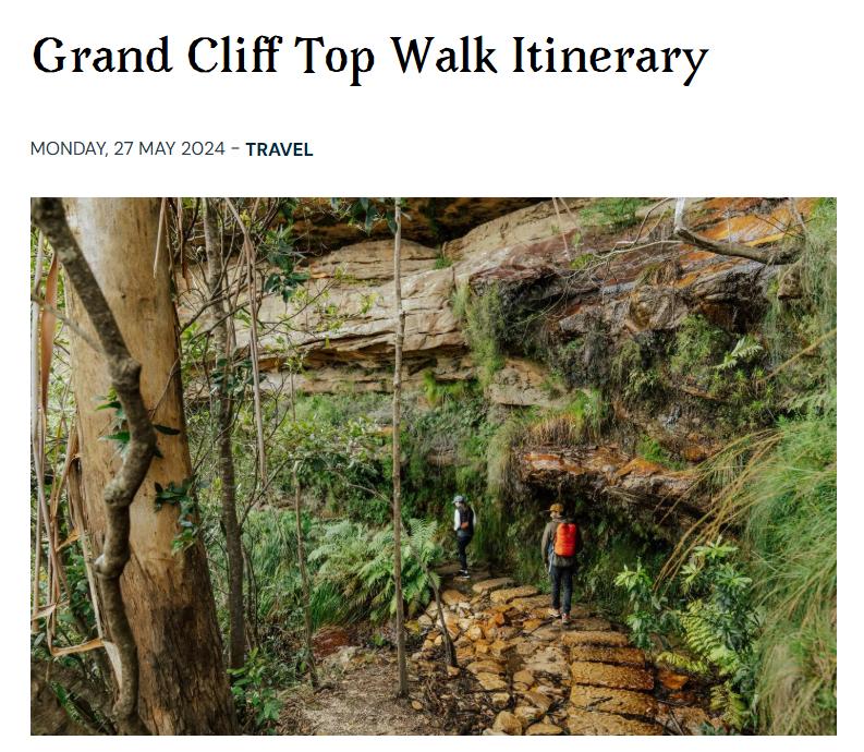
Now, this QR-code hyperlink goes to a quite different brief 400 word article entitled ‘Grand Cliff Top Walk Itinerary‘, written by regular travel writer Ellen Hill. The above hyperlink (in blue) to that article remains for anyone to read it. We presume it has nothing to do with the previous author Caro Ryan.
This then follows the QR-code is to the lead image to another article by Ellen Hill, thus:
Looks like a walk in the park? But Nature Trail’s current ground-truthing reconnoitres contradict this alluring perception. We have come to realise that this 20+km trail presents a serious athletic slog and to attempt it in just 2-days its akin to more than undertaking a half-marathon. This trail is not even a FLAT half marathon, instead it’s a hilly series of relentless dozens of staircases up and down and more than the official 19.7 km as we’ve researched.
We won’t reproduce the article out of copyright respect, but while we acknowledge that it is another piece of excellent travel writing by travel writer/content writer Ellen Hill clearly purposefully to attract visitation, we do however flag a number of questions and concerns with the content of that article.
All photos included in this article were taken by the author on a reconnoitre undertaken on Wednesday 18th June 2025, unless otherwise stated.
Nature Trail wishes to point out that it has no affiliations with the above website nor its owners, nor authors. Also, our critique herein seeks no financial nor promotional benefit to Nature Trail nor to this author.
Rather, this author’s motivation is to question the exaggerated sales pitch of this article which we consider considerably downplays the on-ground reality and risk of this trail to over-exertion:
(A) The steep terrain dominated by dozens of staircases
(B) The unstated required physical fitness and exertion
(C) The more than half-marathon pace demanded (to do 20+km in just 2-days)
(D) The trail’s safety risks – including a 1km section demanding dangerous walking on a tourist road
(E) The ongoing multiple track closures en route
(F) The misleading selling of Parks Service puffery, omitting sensible guidance to intending hikers.
We write this critique in a genuine honest effort to warn potential hikers of such as part of Nature Trail’s professional touring policy of encouraging a risk management approach.
We have decided to critique Ellen Hill’s article in this, a separate article of our own, following our professional current ‘ground-truthing’ reconnoitring of this ‘Grand Cliff Top Walk’ concept new trail.
Our Critique of Ellen Hill’s article of 27th May 2024:
(1) It entices an inappropriate target audience
The article is a very brief promotional piece of a travel writing style crafted succinctly to attract visitors to the Blue Mountains to ‘walk’ this new “19 km” concept trail between Wentworth Falls and Katoomba. It does make for entertaining travel reading. It reads like the Grand Cliff Top Walk is easily do-able for most as if a gentle ‘walk in the park’.
It up-sells the visual benefits of the walk with in some cases exaggeration and fantasy and adds recommended activities promoting specified tourist related services. But it is certainly not a hiker’s guide the likes of that by Veechi Stuart’s 2009 book ‘Blue Mountains Best Bushwalks‘, nor one of Jim Smith’s on-ground researched guidebooks, nor we recognise that Ms Hill’s promo intended to be.
But our main concern with Ellen Hill’s article is that it grossly understates this trail’s difficulty and promotes and entices it to the wrong demographic; that is to tourists (wealthy ones to be able afford Ms Hill’s “luxury” selections of off-trail extracurricular activities – all quite pricey. No mention is made of how the hikers could transfer from Day 1 trail end at Gordon Falls Picnic Reserve to those selections, which are located up to 2km away.
The promotional photos of sections of this trail show ordinary tourists walking on new stone stairs either on level ground else downhill. This is so misleading to the trail’s up and down dale reality – relentless staircases in many sections.
In addition, such a readership demographic is a quite a different animal to super fit seasoned long distance hikers/trekkers, to which this new understated “19 km” trail concept demands to slog over just 2-days. Think gentry v foot soldiers.
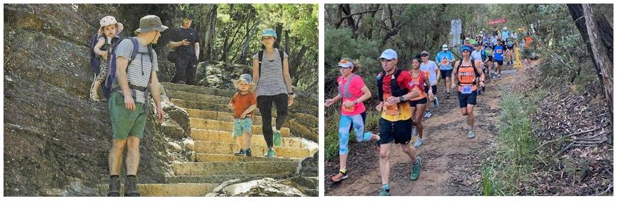
This new ‘Grand Cliff Top Walk’ concept – what is its target market? Is it fantasy (left) or Parks service intended reality (right)?
To be able for a hiker/hiking group to do all the wonderfully sounding “luxury” indulgences as specifically identified by Ms Hill (gourmet dining, massage, stay) will require a substantial budget. Seriously the 20+km trail in two days and such indulgences are incompatible?
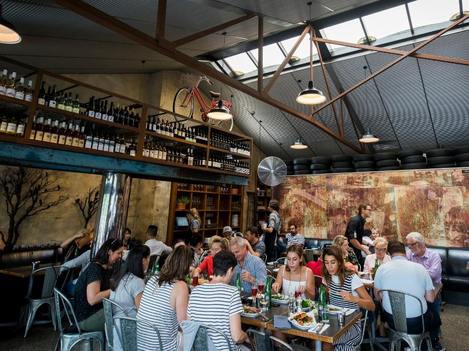
Blue Mountains visitation – the indulgent demographic is always very welcome and provide great custom to local tourism gourmet eateries, wellness centres and stays. But would any one here have just completed a 12 km hike of the Grand Cliff Top Walk and then taxied into Leura Mall for stay check-in and then dinner like this? Add the return taxi back to the stay, and there’ awaits another 12 km next day – according to the crazy official trail flyer.
For participating hikers to cope with the trail’s lack of convenient transport transfers, will instead most definitely require pre-booking a local private chauffeur with detailed local knowledge for all the many transfers.
It sounds like an opportunity for Nature Trail, if we do say so.
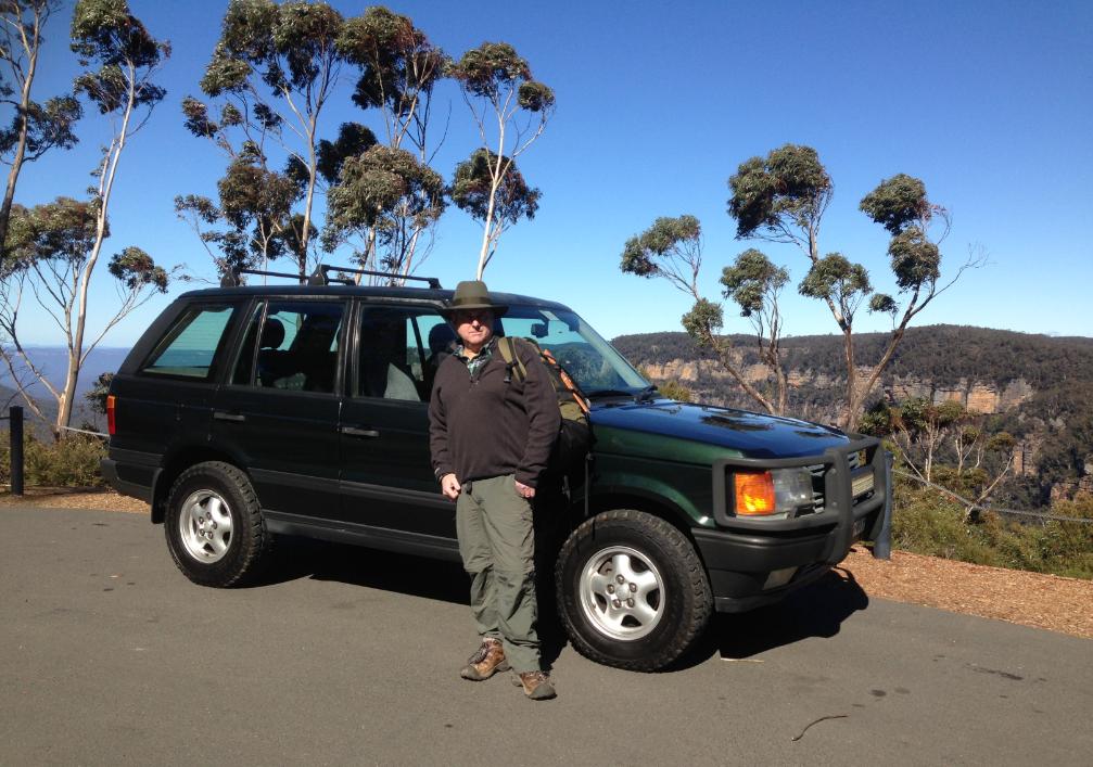
Nature Trail’s tour vehicle based at Katoomba (Cahill’s Lookout, 2018).
So, we consider it overall to be a misleading article and factually wrong and a piece of fictionally fantasy. A work of fiction comes to mind, but not to be taken seriously or as advice. Ellen Hill’s hype article is delusional fiction.
Anyone reading Ellen Hill’s article and then attempting the Grand Cliff Top Walk will get a shock of the trails’s reality – multiple track closures, detours, dangerous walking along roads, an absence of public transport, of public toilets, of drinking water points, and be considerably disappointed, if not require a trip to Katoomba Hospital.
(2) Overstates the “comfort” of this 20+km trek as recommended in just 2 days
Ellen Hill’s article opens:
“What if there was a way to experience the wildness of the big Blue – without sacrificing comfort?”
Well, we point out that in reality, this 20+ km trail recommended to be tackled in just 2-days is far from promoting walking “comfort” in our experienced opinion.
This we are learning currently while reconnoitring it – and mind you, during the cooler more comfortable cooler winter temperatures.
But in our book, a summertime attempt at times when it’s much hotter and humid, despite most of this trail’s aspect being on the south side away from direct sun, the relentless up and down hiking over many sections would be sacrificing anyone’s definition of “comfort”. We state this for pragmatic safety guidance to potential hikers considering this concept Grand Cliff Top Walk trail.
Our Tour Director has over the years, previously hiked all the sections of the trail on a number of occasions. But not all at once, rather in various segments and exploring and becoming on-ground familiar with the network of many interlinking tracks of unique and historic names, especially around Wentworth Falls escarpment area. So we know the route very well, but this is the first time we are tackling the Grand Cliff Top Walks since its conceptual renaming, because being up to date with upgraded and new tracks adds to our choice pool of delivering guided hiking options.
(3) No suggestion of Ms Hill having hiked this trail
We do ponder whether this local travel writer Ellen Hill has indeed actually hiked this new Grand Cliff Top Walk trail herself? And not necessarily completely, or ridiculously attempting the officially recommended 2-day (19.7 km – or more realistically the 24 km) marathon effort as per the official flyer, but if any section of it on foot at all?
But from an office desktop, using Google Maps Street View does not cut it really!
Anyway, Nature Trail is currently doing a ‘ground-truthing’ series of reconnoitres mid-winter in 2025 to get the facts. We’re doing this in manageable short segments over multiple days, taking detailed journal notes and photos. Nature Trail certainly does it in “comfort” – at a slow interpretative scouting pace, one segment at a time, spread over multiple days, utilising two-car shuffling to avoid backtrack hiking, and in the safe company of our ‘Friends of Nature Trail’ who help offer us insights and feedback.
We intend to fully reconnoitre its entire trail’s length from Wilson Park to Scenic World and report back to this website in due course.
We likewise recommend this too to Ellen (safely duly kitted and with experienced hiking companions with due local knowledge) and we invite her to then write a follow-up piece soon afterwards.
As public feedback herein, we are currently step-by-step writing a sort of travel guide and critique about this so-called Grand Cliff Top Walk ‘concept’ 20+km trail. We write it independently warts-and-all for a targeted audience – advanced hikers and trekkers.
We seek no support nor commission, but just realistic safety advice to anyone intending to hike it and follow the various reported guidance. This is part of Nature Trail’s pragmatic, ground-truthed evaluation feedback to the hiking fraternity in and visiting the Blue Mountains Region.
From the outset, we state that Nature Trail strongly disagrees with all the published guidance about this Grand Cliff Top Walk thus far, and seek to air a deal of reality checking.
(4) Paying lip service promo to the Parks Service’s unrealistic concept flyer?
The Grand Cliff Top Walk’s official governmental flyer ascribed by the Parks Service recommends starting this trail from the Wentworth Falls eastern end and heading westward.
On Day 1, its recommendation is to mid-trail finish at Gordon Falls Picnic Reserve so to stay overnight locally somewhere. How to or where is not offered. Then on Day-2 the official itinerary by the custodial Parks Service is for hikers to regain the trail from Gordon Falls Picnic Reserve and continue westward to finish at Scenic World. Such is the travel narrative also adopted by Ellen Hill in her promotion article for visitors to do this new concept trail re-branded ‘Grand Cliff Top Walk’ in March 2024.
However, pragmatically, we are rather inclined to instead suggest hikers start at the other end of this trail from Scenic World and head eastward to finish at the track head of Charles Darwin Walk track for public transport availability at either ends, morning and afternoon respectively. We explain this in more detail shortly.
We adopt this preferred direction from local expert hiker and author Caro Ryan’s suggestion also because the overall trail altitude is naturally down hill rather than uphill. Also, hikers need to consider the transport transfers at either end and the time of day for such service reliability. We offer this as a professional tour operator with due trip planning and risk mitigation in mind, also having been a local bus driver of this area with Blue Mountains Bus Company for nearly three years, so knowing all the bus routes .
Factually, Wentworth Falls Railway Station (with taxi rank option) is close by (350m) to the head of Charles Darwin Walk track to facilitate reliably transfer independent hikers back to Sydney or to their vital stay elsewhere.
Meanwhile, our research shows that at the alternative start of this trail from Scenic World there is a regular public bus service Route 686 that departs from outside The Carrington Hotel, Katoomba which is situated just 100 metres from Katoomba Railway Station – accessible from Sydney. (which this author has driven as a bus driver in past years). This bus route regularly services the other end of the trail at Scenic World, so making it a more flexible start option to tackle this trail. The bus leaves bus stop outside the front of The Carrington every 20 minutes.
 Loading...
However, note that the last daily bus from Scenic World is reliably at 3:55 pm.
This means that by taking the recommended direction per the Grand Cliff Top Walk flyer starting Day-2 at Gordon Falls Picnic Reserve, a hiker reliant upon public transport would need to do the 9.5 km trail and arrive at Scenic World before that time, else extend that another 2.5 km to walk uphill to Katoomba Railway Station.
We warn that hikers attempting to adhere to the arbitrary 2-day schedule of this trail will have to contend with a 12 km hike/walk on Day 1 and then a 12 km hike walk on Day 2 to finish at Katoomba Railway Station. So that would be then over (not 19.7 km but a more accurate 24 km) of hiking/walking in two days!
The official distance of the Grand Cliff Top Walk trail concept has been grossly understated by the government – the Parks Service, jointly with the Blue Mountains Council. It is not 19.7 km. We explain how we arrive at this total distance below shortly in this article. Back-to-back, tackling this on successive 2-days is akin to more than undertaking an exhausting Half Marathon.
(5) Hiking sustenance reliance on en route third party takeaways
Whilst, the recommended FED café currently is probably a top takeaway catering option at Wentworth Falls village, if a hiker is planning to start from that end and has failed to pre-pack sustenance beforehand.
This is presumably having caught a Blue Mountains train from Sydney hyper early (2-hours prior) to alight at the Wentworth Falls Railway Station directly across the street (Station Street).
We read from an extract of its website that takeaways at FED café are available from from 7:30 am:

SOURCE: ^https://www.fedbluemountains.com.au/
Bear in mind, the Parks Service official schedule for this trail is on Day 1 to hike from Wilson Park to Gordon Falls Picnic Reserve (supposedly 12 km on foot). This of course ignores transfer logistics pre-hiking such as:
- The initial super early 2-hour train transfer from Sydney to Wentworth Falls
- Ordering and waiting for takeaway food from FED cafe (available from 7:30am)
- The 350 metre walk from FED to the new eastern start of Grand Cliff Top Walk
- So say the hike starting at say more as early as 8:30am, if following Ellen Hill’s article
We estimate that for a hiker to achieve the official Day 1 itinerary from the track start at Wilson Parks Picnic Reserve to roughly mid-point at Conservation Hut, one should safely allow 3.5 hours, allowing for en route pauses (eg: vistas, photographs, minor delays and a few unpredicted contingencies).
Then add a minimum 4 hours from Conservation Hut to tackle a multiple staircase slog (up and down) to reach Day 1 hike finish at Gordon Falls Picnic Area arriving somewhere after about 4pm, also allowing for en route pauses and all presuming all hikers are suitably hiking fit.
This then translates to a Day 1 hiking duration of just under 8 hours. It is a big day; a continuous and energetic day’s extended hike in our opinion. Experienced hikers for such a long and rigorous distance, wisely pre-pack their own food and carry it in a day pack including added hiking necessities for safety. They sensibly operate independently for such a energetic challenge, rather than being reliant upon third party catering on the day of a hike.
(6) Misleading hype about this trail’s wonderful vistas
However, we disagree with Ellen Hill about her tempting invitation to visitors:
“the yawning view that draws your eye south – up to 80km on a clear day to Mittagong and the Southern Highlands”…
This is unfounded and false. From our current recce, nowhere along Charles Darwin’s Walk track is available such a view south to the horizon such as to see the Southern Highlands.
Charles Darwin Walk section runs perpendicular to the escarpment. The trail at this eastern end starts at Wilson Park Picnic Area at the track head of Charles Darwin’s Walk, which rails the trickling remnants of Jamison Creek (it was dammed upstream back in 1878). The track is in this creek’s gully and yes it heads southward but there is no view until one arrives at Wentworth Falls Lookout almost 3 km from the start. By the time one reaches Fletcher’s Lookout on the trail the view south is below Tablelands plateau.
It’s along no “cliff top”, so in one sense the trail naming of Grand Cliff Top Walk here is misleading. But expect as such throughout this misnamed trail.
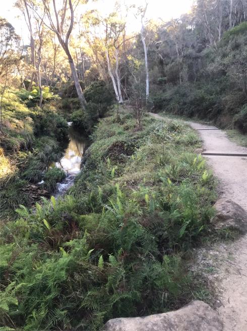
A typical section of Charles Darwin Walk track – but here no “yawning views 80 km to Mittagong and the Southern Highlands…”
(7) Omission of the trail’s multiple closures
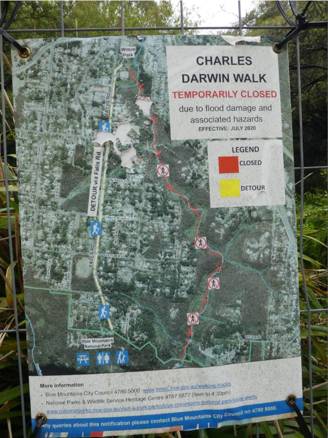
At the time of our ‘ground-truthing’ reconnoitring of this Segment 1 of this trail on 8th June 2025, we discovered that the lower portion of Charles Darwin Walk has been currently closed off to the public.
This closure is situated from two-thirds along the length of Charles Darwin Walk track between Fletcher Street and Weeping Pool, as one hikes in the official easterly direction overall. This is the closure sign, showing the red coloured section closed:
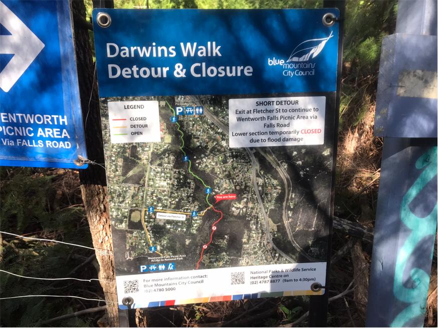
Charles Darwin Walk (track) closed for its southern 1/3 section.
The track’s closure sign currently reads that this track closure is “due to flood damage”.
However that flood damage occurred initially over five years ago during an unusually fierce storm that brought torrential rainfall concentrated in the upper central Blue Mountains area through Friday night 14th February 2020.
The rain caused flash flooding down the Jamison Creek, which was exacerbated mainly due to the creek’s upstream Wentworth Falls Lake dam spillway overflowing in a rush, causing a micro-tsunami downstream along the creek, and the creek’s gully where Darwin’s Walk has long been constructed. Repairs to the track had also been undertaken back in 1987.
This severe flooding basically destroyed Darwin’s Walk including boardwalks, track sections, and footbridges, as well as ripping through the riparian zone pushing tonnes of vegetation debris downstream.
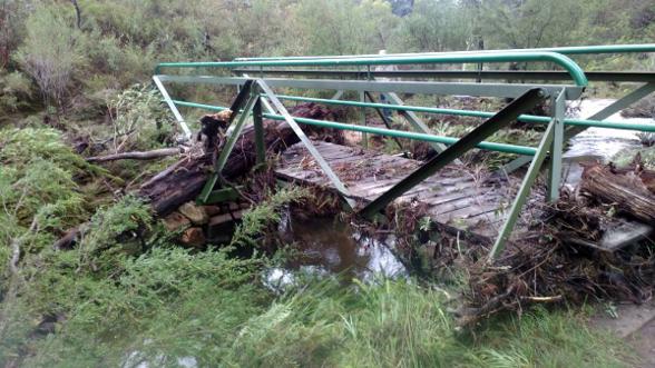
One of many footbridges impacted by the floodwater debris along Charles Darwin’s Walk five years prior. [Photo: Blue Mountains Gazette newspaper, 17th February 2020].
Then five months later, Blue Mountains Council finally decided to close Charles Darwin Walk “temporarily” from July 2020.
Blue Mountains Council July 2020 closure sign near the start of Charles Darwin’s Walk at Wilson Park, Wentworth Falls. [Photo by Steven Ridd over year later on Tuesday 30th November 2021].
Blue Mountains Council had hushed up the true human cause of the flooding damage being mainly by the man-made Wentworth Falls Lake spillway overflowing 500m upstream. For further reading read our ‘References and Further Reading‘ section at the bottom of this article.
That flooding event has thus far been over five years ago! Blue Mountains Council reported subsequent heavy rain events causing further minor landslides along this Charles Darwin Walk taking place during 2021 and 2022.
We then question why again this Grand Cliff Top Walk was officially declared open to the public by government on 25th March 2024, when currently in July 2025 the trail still has multiple closures like this one along a large portion of Charles Darwin Walk?
Also, this trail’s section remains closed off at Leura Cascades since 2020 in perpetuity it seems. So clearly this trail still ain’t open!
So, this means that hikers of the opened Grand Cliff Top Walk are currently detoured off track at this juncture, out of the Jamison Creek gully. Hikers must exit 100 metres uphill on an access side track to link up with a private road off the end of Fletcher Street.
We are now well off trail, not ‘hiking’ on track but ‘walking’ through ‘private property’ driveway where vehicles have right of way over pedestrians (aka hikers). So this takes away from the natural bushland and creek into and through residential Wentworth Falls.
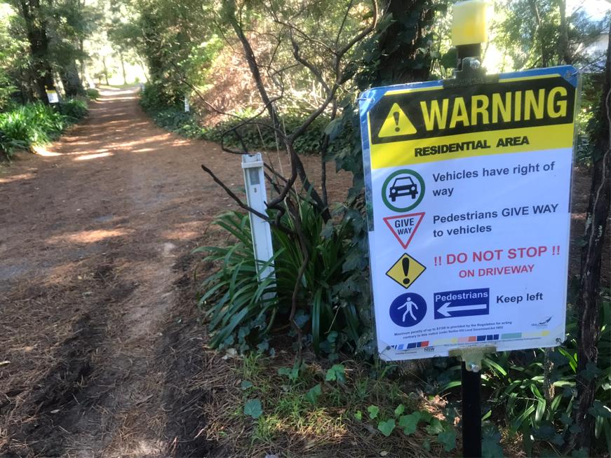
Grand Cliff Top Walk – “vehicles have right of way”. Nice one!
There are no footpaths along the detour of Fletcher Street for 500 metres. So whom then is culpable for negligence for any hiker/vehicle accident on the governmental route?
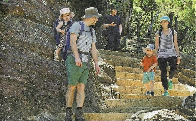
Recall this is the Parks Service recommended demographic of hikers with toddlers to use the Grand Cliff Top Walk on its official flyer:
So, the current official detour to walk along the road at Fletcher Street (with no footpath) and then again later along Sublime Point Road (no footpath) for a kilometre poses unacceptable pedestrian risks.
(8) Misleading trail naming
The Charles Darwin Walk section is not near any cliff top. Frankly, for hikers strictly keeping to the wayfinding signage of this trail, nothing but glimpses through trees of the magnificent Jamison Valley visible. And this This extends for the first half of the entire Grand Cliff Top Walk to Gordon Falls Lookout.
One should logically ask then what is the point of the naming?
Only by deviating to connecting side tracks to selected lookouts can splendid uninterrupted vistas of the Jamison Valley and beyond can be seen. But this is not mentioned let alone encouraged either onling the trakc signage itself nor in any of the promotional literatire we can find.
Surely, hikers should be informed as to which lookouts are the best, since there are dozens off side tracks and some not as good nor as accessible as others. Also as a caution, the network of tracks along the Wentworth Fall escarpment precinct is extensive and poorly signposted, so risking hikers getting lost and even benighted.
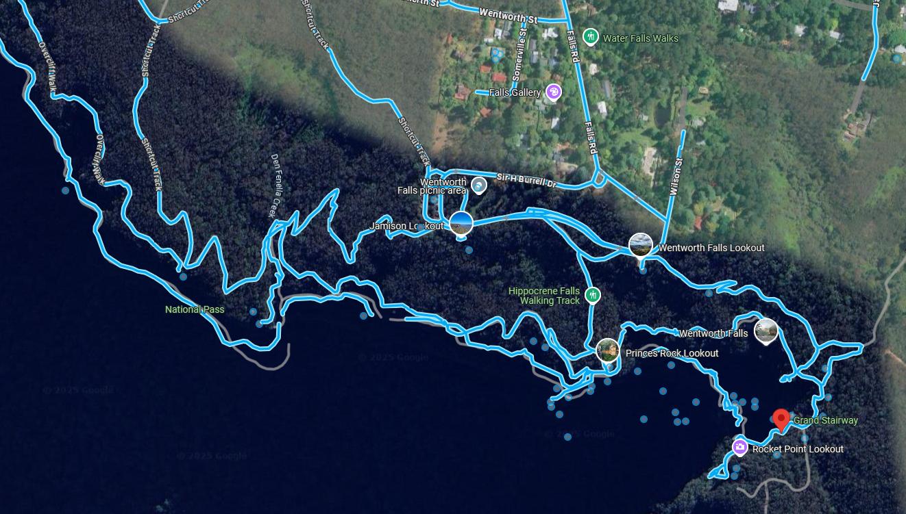
Beware: Wentworth Fall escarpment precinct’s extensive network of tracks that are poorly signposted, and many tracks are all but permanently closed. [SOURCE: Google Maps, satellite view showing in turquoise the tracks having ‘street/ground’ view continuous images and photo spots].
Nature Trail’s two preferred lookouts in this particular precinct are Wentworth Falls Lookout (see image below) and the top of Grand Stairway, but without local knowledge, having a qualified hiking guide is highly recommended to avoid becoming disorientated and lost.
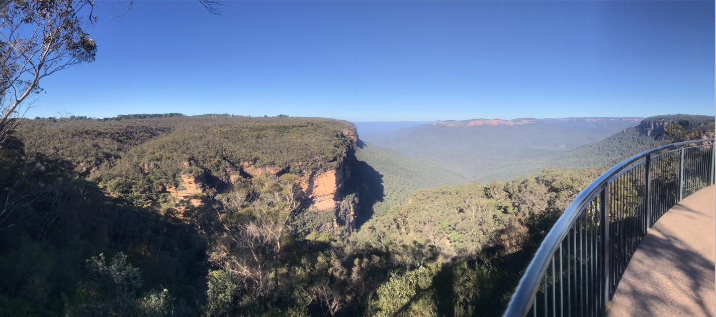
Nature Trail Lookout Rating (Wentworth Falls Lookout): Vista Spectacle: 5/5 | Panorama: 170 degrees | Safety: 5/5 | Sidetrack Accessibility: 5/5 | Visitor Capacity: 10+ pax | Vertigo Risk: 1/5 | NT Tour Plan Dwell: 15 minutes (with max 6 guests).
The “dripping rainforest gullies” and “call of the lyrebirds” don’t feature until one wends one’s way through the Undercliff Walk track section, situated nearly 1 km west of Wentworth Falls Lookout. During our recce, strolling quietly we happenchanced upon a female Lyrebird building her nest early morning, around the time Fed café would have opened for takeaways.
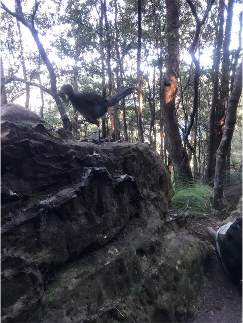
Superb Lyrebird (Menura novaehollandiae) – a female nest building. This species is native to cooler SE Australia mountain ranges.
In our opinion, from Wentworth Falls Railway Station to Conservation Hut café via this Grand Cliff Top Walk trail, the average fit hiker should allow 3.5 hours to hike at an average pace of 2 kph (allowing for pauses and breaks).
This pace also allows reasonably for a few selected side tracks to convenient lookout vistas en route. Bushwalking clubbers could probably rush it in 2 hours, but though see little except down at the track surface – at pace, pace, pace!!
Yes, we agree with Ellen that “The Conservation Hut seems to be a timely break for morning tea”. This timing is consistent with our hiking duration estimate of 3.5 hours from starting off at ‘Wenty’. But then if one has already bought takeaway from FED café, why need morning tea as well?
Also, there are public toilets adjacent (we rate them 3/5). The whole Conservation Hut precinct is owned by the Parks Service. On this occasion we didn’t try this cafe – it’s hours are 8am – 3pm (7 days a week) and their current prices seem competitive.
Hikers however should beware that the next track section from Conservation Hut to Gordon Falls Picnic Reserve is physically exerting in terms of tackling the dozens of staircases up and down that demand a high level of hiking fitness and a very light pack weight.
By choosing this westerly direction involves 3 descents and 3 climb outs of up to 100 metres altitude each and with multiple staircases, so it is important to allow for less fit hikers in one’s group – for such constant exertion it’s wise to pause to get one ‘s breath/heart rate back, plus to allow for relaxing sit down breaks.
Note that a convenient exit (safety and comfort) is at the Fairmont Resort en route, book a taxi to your pre-booked local stay. This then avoids the most taxing part between Carleton Road down-up-down-up to Gordon Falls Picnic Reserve. It’s wise to always have a Plan B and C to safely respect the weakest member of your hiking group.
In this section (Conservation Hut to Gordon Falls Picnic Reserve), in duration we would allow for a range of around 4 hours for the average fit hiker allowing for exertion pausing, breaks and vistas. Of course a picnic and dip at “the fairytale Pool of Siloam” would add additional duration to this.
So the recommended Day-1 hiking duration as per the Parks Service flyer’s route, direction, and waypoints, to us would be reasonably allow an average 7.5 hours. Be mindful also that unfavourable weather (such as rain, strong wind/gusts, high heat, and humidity) can make the hiking more difficult (less comfortable), so demanding more caution and thus take longer.
As for where to eat and stay, in Nature Trail’s touring operation, we provide our booked guests with a current list of convenient options grouped by type and pricing range. We the let them make their own direct arrangements respectively and communicate back to us for any specially extra transfers they seek from us.
(9) Omission of the lack of transfer logistics
Ellen Hill’s narrative for Day 2 of this trail:
“DAY TWO: Start the day fuelled from Sparrows Café, then grab takeaway lunch from The Bunker at the top of Leura Mall before stepping along the Prince Henry Cliff Walk, where the Grand Cliff Top Walk links together the maze of historical routes into one seamless journey.”
There is so much fiction with this first sentence.
First, the official Day 1 of this trail that Ms Hill follows, which finishes at Gordon Falls Picnic Reserve, is located 2km from Sparrows Cafe up across from Leura Railway Station. How are hikers to get there and back? The public transport is scarce, that public bus stops distant from Gordon Falls Picnic Reserve and is not readily publicised at the location.
Whereas the privately run Blue Mountains Explorer Bus, which offers a bus stop at Gordon Falls Picnic Area at the eastern end of Olympian Parade is currently priced at minimum $35 each per adult ride of up to one hour. See its website’s extract below.

So using this option, the price of a ticket for two parents with two children from Gordon Falls Picnic Reserve to Leura to Sparrow cafe and the Bunker (which has gone broke) would cost $90 ($35 x 2 adults + $10 x 2 children).
We wisely suggest more convenient reasonable price options.
Coffee $4.50
(10) Swayed promotion of member enterprises of Blue Mountains Tourism
Ellen Hills concludes her narrative with selected recommendations to specifically named local businesses which are all paid up members of the magazine’s operation, Blue Mountains Tourism, each we highlight in bold as follows:
“By the time you arrive at Echo Point and those famous Three Sisters you’ll need to take a moment to take in the view with a snack and a drink at The Lookout Echo Point before embarking on the last push to Scenic World.”
Arrive before 4pm (8pm Friday, Saturday and school holidays) and you can grab a well-earned drink at The Terrace Bar (Scenic World) before hopping on the big red Blue Mountains Explorer Bus (last bus at 4.17pm) to Katoomba to tip the bubbles at The Carrington Hotel’s Champagne Charlies and great pub food at the Old City Bank Brasserie (The Carrington Hotel) at the end of the driveway.
Historic guesthouse No. 14 Lovel Street is the perfect sanctuary to retreat overnight before grabbing an early (or leisurely) brekky at Tempus Up Early and heading back home.”
References and Further Reading:
[DISCLAIMER: Nature Trail researches its source information as part of this article, which we privately record for our own personal referencing. If any of the references below ever become ‘dead links’, that is, deleted from public access online; we always have retained a full documented copy of that original reference document and every other listed in this section below. This ensures our article stands up truthfully to having relied upon the factual record made public online which we have sourced at the time. So, if ever challenged later in law, we can reproduce that and any document in toto as evidence.]
[1] ‘Grand Cliff Top Walk unveiled in Blue Mountains‘, 2024-03-25, Blue Mountains Gazette (newspaper), ^https://www.bluemountainsgazette.com.au/story/8566633/grand-cliff-top-walk-opens-connecting-wentworth-falls-to-katoomba/
[2] ‘Blue Mountains ‘Grand Cliff Top Walk‘ – Misleading Flyer & Press Release’, 2025-07-05, Nature Trail, ^https://naturetrail.com.au/blue-mountains-grand-cliff-top-walk-misleading-flyer-press-release/
[3] ‘Grand Cliff Top Walk – Blue Mountains‘, printed colour brochure, by National Parks and Wildlife Service of NSW (NPWS), (undated), DCCEEW, 2 pages. Also available on its website: ^https://www.nationalparks.nsw.gov.au/things-to-do/experiences/grand-cliff-top-walk
[4] ‘Darwin walk smashed during storms‘, 2020-02-17, Blue Mountains Gazette newspaper, ^https://www.bluemountainsgazette.com.au/story/6634371/darwin-walk-smashed-during-storms/
[5] ‘Without funds Charles Darwin walking track at Wentworth Falls “could be closed for some time”‘, 2021-03-25, by B.C Lewis, Blue Mountains Gazette, ^https://www.bluemountainsgazette.com.au/story/7173676/darwin-walked-there-but-we-cant-heritage-walk-needs-1-million-repairs/
[6] ‘Darwins Walk Project‘, (undated), Blue Mountains Council, (website), ^https://www.bmcc.nsw.gov.au/ward-1-projects/darwins-walk-project
[7] ‘CHARLES DARWIN WALK RE-OPENS ~ Stage One of Darwins Walk revealed as part of Grand Cliff Top‘, 2024-03-24, by Ask Roz Blue Mountains (Facebook website), ^https://www.facebook.com/AskRozBlueMountains/posts/charles-darwin-walk-re-opens-stage-one-of-darwins-walk-revealed-as-part-of-grand/834008015419963/
[8] ‘Major upgrades open at Wentworth Falls Lake‘, 2025-06-21, by Blue Mountains City Council, ^https://www.bluemts.com.au/news/major-upgrades-open-at-wentworth-falls-lake/