The Hiking Demise of Lily Hooper – her situation? scenario? questions of why? how? on a solo hike? of her 2026 tragic death in our Blue Mountains Nattai National Park

[A] Introduction to another Blue Mountains outdoor tragedy
Not another one! Our Blue Mountains World Heritage Area in Australia has yet again tragically lost another hiker in our midst.
One Lily Hooper (18) (or was she aged 19 according to some media?) of nearby Oakdale (a regional village in public consumption the Wollondilly Shire southwest of Greater Sydney ws found deceased just yesterday after her previously being reported missing on a hike immediately by her family.
Oakdale is situated about 20km by road north of the township of Picton.
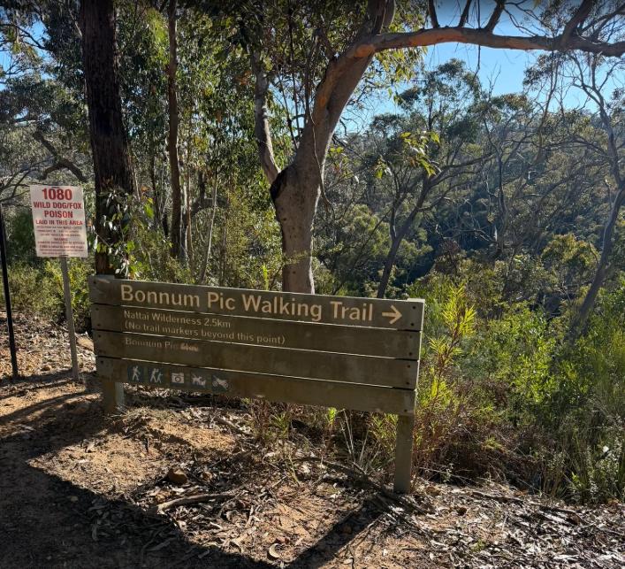
A “Walking Trail”? Seriously misleading or what? Try more ‘Bushbash Scramble GPS Mandatory!’ It’s boulder trekking at cliff edge and no bloody trail to speak of! Only wee stone cairns and pink tape markers on tree branches generously positioned by previous well-meaning hikers. Go! the Parks Service (NPWS) [ We note the Parks Service 1080 Dingo poison warning sign – nice about wildlife?]
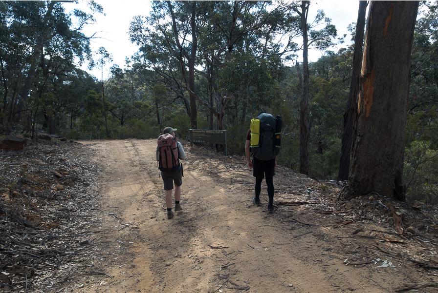
Bonnum Pic Trail is within Nattai National Park and presents here on a different trip as some ‘walk in the park’. Note the same official NPWS endorsing signage ahead of these two hikers. [SOURCE: ^https://ozultimate.com/tom/bushwalking/2019/20190727_bonnum_pic/photos.htm]
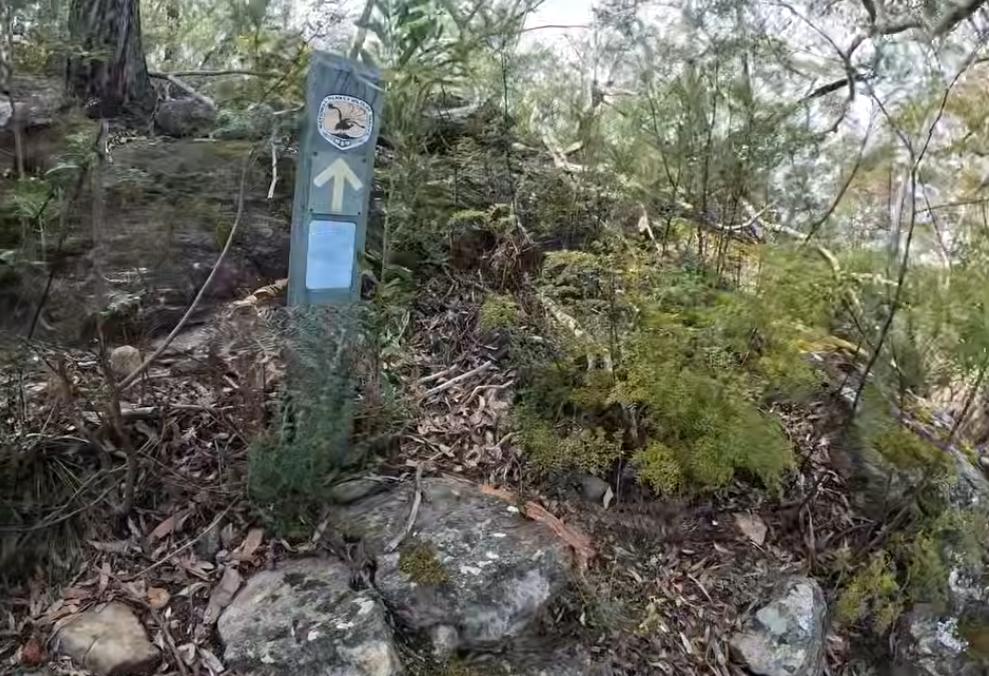
Bonnum Pic Trail – shown here officially signposted by NPWS, the New South Wales state government’s delegated custodial authority. But like, spot the “trail” here? Mmm? [SOURCE: ‘Bonnum Pic – Nattai National Park’, by Project Fit Trekker, (YouTube video), ^https://www.youtube.com/watch?v=WULk-HZMmO4 [Accessed 2026-09-11]
Yeah but, as hikers approach the destination of Bonnum Pic, NPWS is nowhere to be seen, so all that is left at sporadic spaced out intervals are donated small stone cairns placed by well-meaning hikers for guidance of trail direction for future hikers. They ought to send invoices to NPWS for services so rendered…
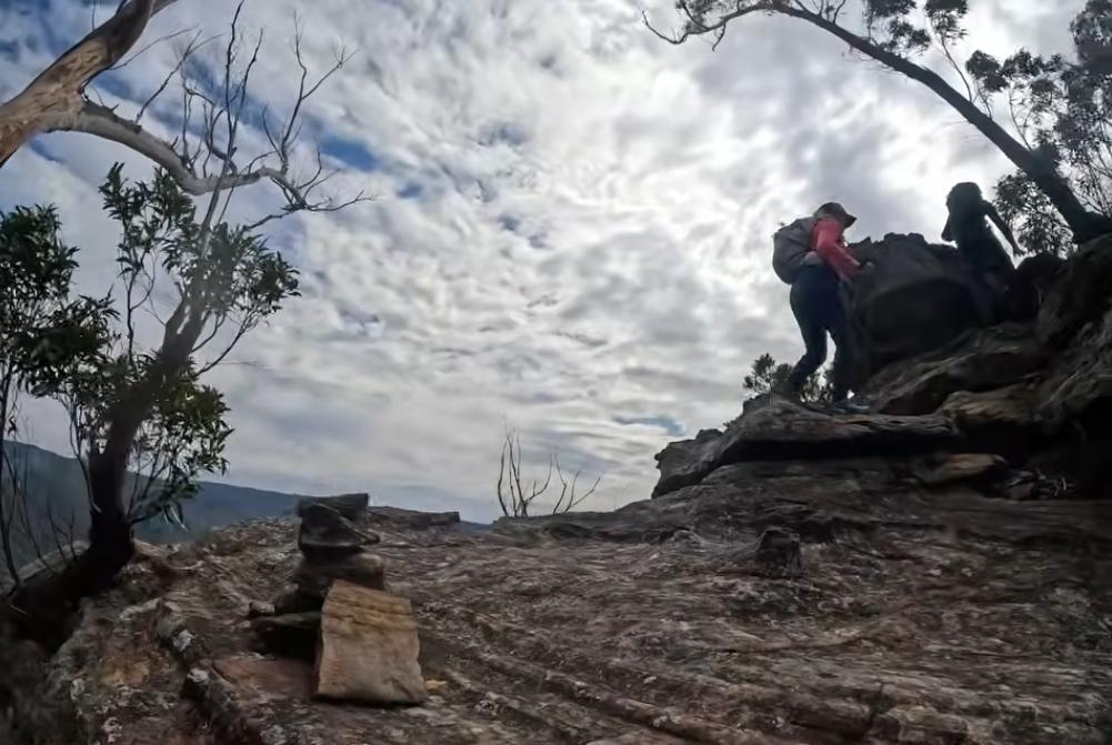
Left: an unofficial kind trail marking stone cairn, but not by the custodial Parks Service in its distant Parramatta corporate tower.
[SOURCE: ‘Bonnum Pic – Nattai National Park‘, by Project Fit Trekker, (YouTube video), ^https://www.youtube.com/watch?v=WULk-HZMmO4 [Accessed 2026-09-11]

Parks Service flash urbane-remote from wilderness steel HQ tower
Meanwhile…NSW National Parks and Wildlife Service’s flash new eco-pass headquarters in downtown Parramatta Square – clearly out there and hands-on in the National Park environment, NOT! The bureaucrats certainly got their upgraded digs from Hurstville and Whitton Street in Katoomba, plus announced in June 2026 a bonus $130 million extra by the Minns Labor Government “to keep NSW national parks safe, accessible and ready for record numbers of families to enjoy the great outdoors.”
Yet where out there at Nattai, Wollondilly, et al. with a free Personal Locator Beacon (PLB’s) on loan?
Now that’s a good question.
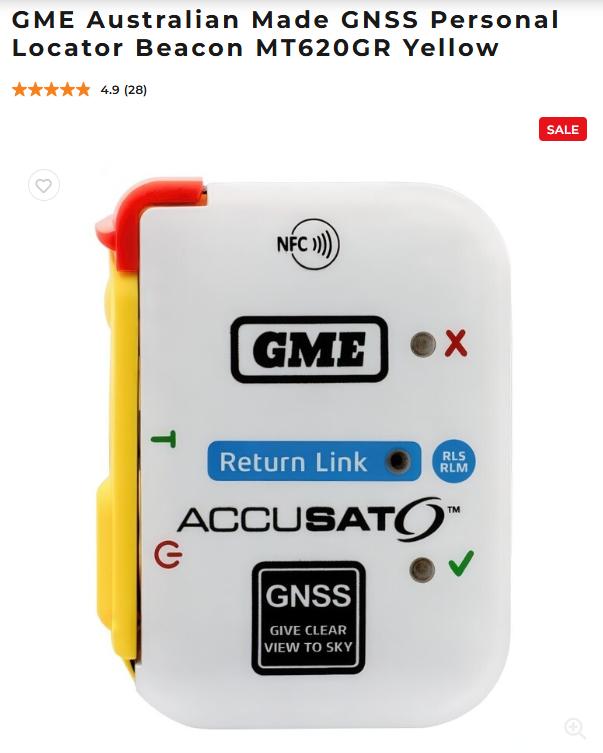
This ‘PLB‘ device retails for an affordable AUD$500. It’s philosophically affordable if your life depends upon it.
Yeah but Katoomba Police Station seems to have given up on loaning hikers such PLBs – dismissing enquiries from would-be hikers off to a NPWS-installed digital ‘kiosk’ stand in its foyer.
Yet when a hiker goes missing in a national park within the state of New South Wales, such as Nattai NP (within the Greater Blue Mountains (world heritage) Area, the delegated authority charged with the governmental duty of co-ordinating a Search and Rescue operation is themselves – the NSW Police – in particular its New South Wales Police Rescue Squad.
Well, this was its former name from 1942, until recently (2022?). It’s latest name is the NSW Police Rescue & Bomb Disposal Unit. So they’re multi-tasking these days it seems, yet no longer Blue Mountains based, but headquartered in inner Sydney in the suburb of Zetland, near Sydney Airport. More on this later.
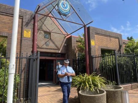
Katoomba Police Station, replete with counter terrorism preventative ramming pots and bollards – clearly they’ve not many friends around.
…Lilly Hooper…
Lilly’s body was discovered in the Blue Mountains Nattai National Park by Search and Rescue accumulated volunteer teams over a week later (8 days since day hiking on Wednesday 12th August 2026) located way below the cliff-line escarpment of Bonnum Pic in dense scrub on Thursday 20th August 2026.
She (her body) was inaccessible by emergency helicopter retrieval, so unpaid volunteers were despatched to the sad task.
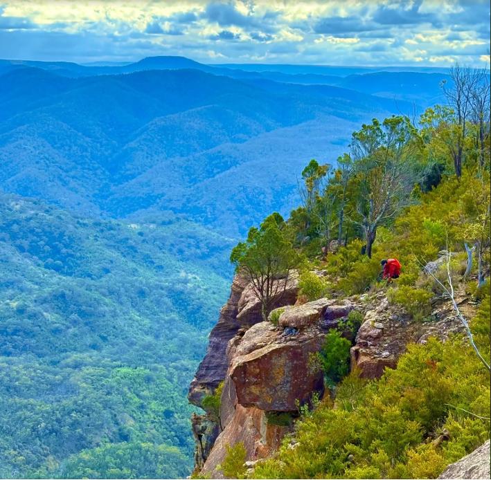
Bonnum Pic “Walking Trail” – the rather ‘upper’ section (Photo: All Trails, by hiker Lisa Li, 2025)
This human tragic loss is so very sad. Any human life lost is very sad, particularly one that could have been preventable, and one that involves a very young person.
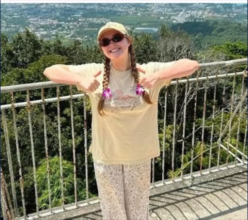
A youthful happy outdoorsy Lily Hooper previously shown here at Hawkesbury Lookout above the eastern escarpment of our Blue Mountains. We note the lookout’s safety fence (except during lightning, but).
We highlight the chronic recurring episodes of outdoor recreational pursuits that end in tragedy. Why can’t our Blue Mountains outdoor recreational activities in this, our celebrated world heritage area, live the hope of becoming renowned for being the safest wild place to experience the great outdoors?
This criticism is not about any ‘unwilding’ notion of the Blue Mountains with Echo Point style wheelchair access Grade ‘0’ concrete tracks everywhere. It is about best practice safety in natural wild places – education, training, knowledge, kit, preparedness, experience gradings, and managing the expectations of visitors so they all come back alive and safe EVERY TIME from our great World Heritage!
Australian Made GME Personal Locator Beacon – designed and made by GME in Sydney. It retails for under AUD $500. [Check GME website] When free for outdoor hire at all 8 reserve parks locations throughout our Blue Mountains World Heritage? How about it Parramatta Square long-lunch Parks Service?
Why should we be content with the legacy premise that Outdoor Recreation has inherent risks and that participants are presumed to just accept this that it goes hand-in-hand with the quest for fun and adventure?
This is 2026 and we are surely better than such yesteryear fatalist mindsets. But not it seems obvious, having due responsible leadership by those in charge who get paid without accountability. We are better than that mindset these days.
The Blue Mountains Outdoor Recreation tragic scorecard – time and time again!
We recommend, all Outdoor Recreation participants read Christopher Webber’s non-fiction instructive book, ‘Mountains Mishaps…‘.
We continue to do so ourselves and have purchased both his first and second editions. Christopher is a Blue Mountains local and he has garnered decades of experience and knowledge in Search and Rescue volunteering, such to share the losses and the lessons with all others.
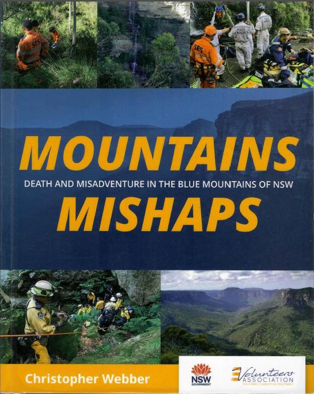
Website: ^https://mountainsmishaps.com.au/
Despite our experience and training in a variety of outdoorsy skills, we respect Nature and know our frailties sufficient to know we are as vulnerable as the next person. We are not 22 years old and at peak health and fitness when training in the Infantry, like 30km overnight route marches with kit.
Concerning this latest tragedy in Nattai National Park, we have only garnered the initial story of what has happened from various media reports since the day after the search discovery of Lily, plus subsequently over the days since. This article is following the incoming news as it is released to the general public.
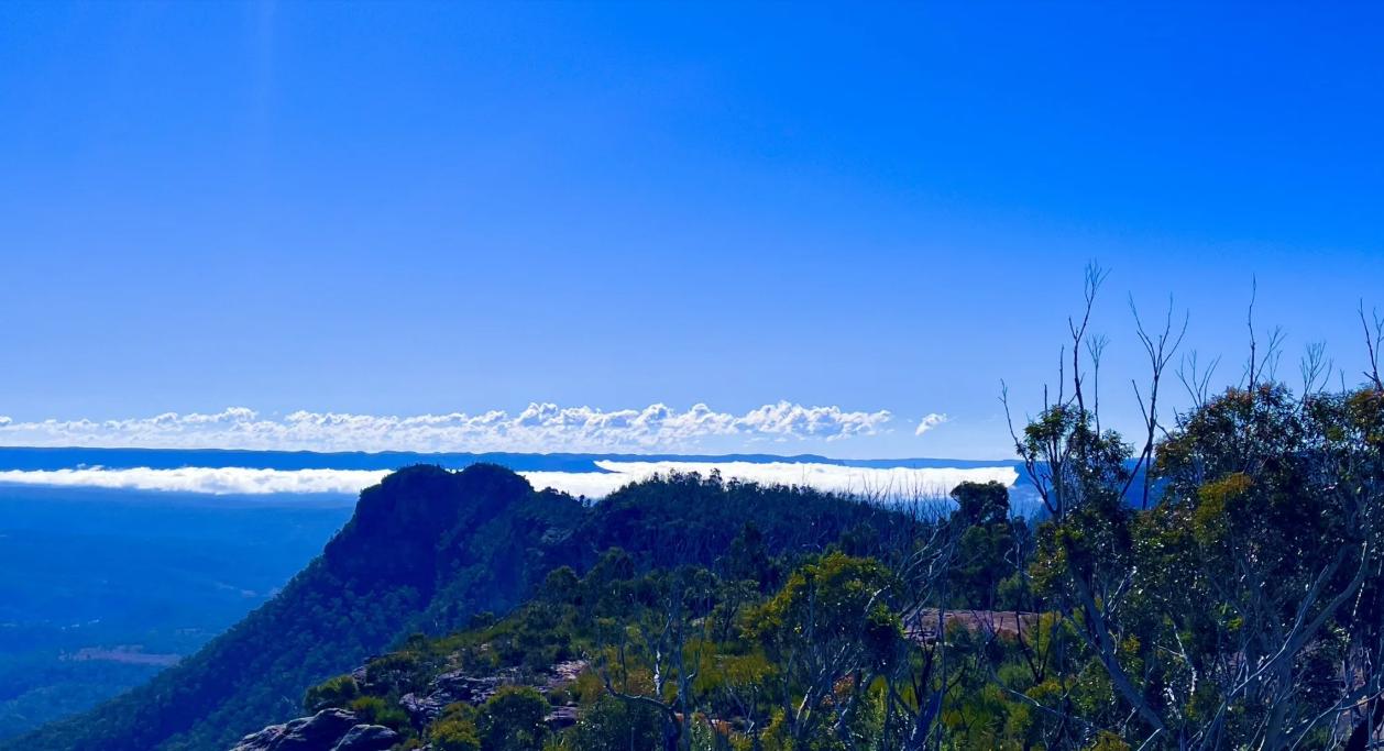
Bonnum Pic (being the twin Bactrian camel humps) – by All Trails, contributing hiker Lisa Li in 2025 – nice day!)
We are not Search and Rescue experienced nor intend to be, unless commercially trained and commercially paid, both by government and that ain’t likely. Nor are we likely to accept with top life insurance cover $2M nor likely to sign any indemnity waivers. Like if I fall of a cliff whilst serving voluntarily in S&R and die as a result, my family gets zilch compensation from life insurance. The volunteering expectation system promulgated by government is so archaic and exploitative in its abusive culture of ordinary citizens. The Hell with volunteerism for governmental ‘working bee’ emergencies!
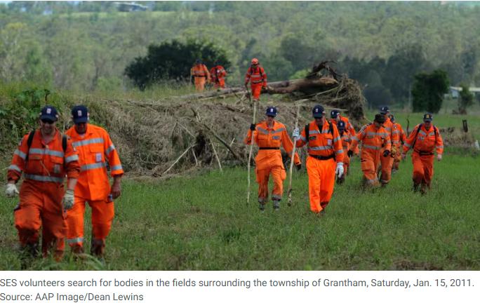

The starting loaded salary for a standard NSW Police Force officer is $88,169 per year as a Probationary Constable, plus applicable shift allowances and specialized duty additions. Then add Specialist Rescue Salaries & Structure range upwards of $100,541+ depending on the specific tier and increment level. Whereas volunteers get issued an orange hi-vis uniform, a B&E roll on field duty, a plaque at depot, and a political mention timely in the media at call outs.
Community volunteers suck it up for politicians’ taxpayer funding of their self-interested pet projects.
Government continues to rort the unpaid selflessness of dedicated community volunteers, yet manages to find spare taxpayer billions for its own political ends. (Such as its Little Hartley Bypass of 2025 that no-one wanted costing taxpayers $232 million).
Frankly, we don’t monitor the media and so early reports of missing adventurers don’t feature. That means that our knowledge of Lily’s ‘missing hiker’ status from 12th August 2026 was not known to us, despite being in our Blue Mountains region. We also have long not received the local Blue Mountains Gazette newspaper which used to be weekly thrown on our driveway for free, for more than 6 years! So we’re oft in the dark about local and regional goings on. Apparently now one has to pay a subscription, even locals.
The first we heard about Lily was the political aspect, which was not about Lily, but about the politics of some miscommunication – that’s the media for you, scandal focused.

Anyway, we shall continue to read the media reporting about Lily and update this article, as appropriate as we have done with other such events.
Over time, we shall contribute updates by way of our ‘Postscript‘ writing method. We are not the normal media who tend to move on. Instead, we take an interest in learning and sharing that learning so that we hope other lives can be safe in the great outdoors. This is one example of our previous analysis articles:
OUR PREVIOUS ARTICLE 1 (it became ended up becoming a webbook):
OUR PREVIOUS ARTICLE 2:
Heat Stroke Death down Lockley Track in full summer western sun
Back to Lily in this case…
We have no association nor knowledge of poor Lily. Those media reports so far are coming in are quite sketchy, apparently factually incorrect, and NSW Police have even been implicated in false reporting. WTF?
- The police reporting got it wrong?
- The media reporting also got it wrong? It was not in the Southern Highlands dudes!
So we reckon at this early stage that something’s fishy (aka substandard) about what’s happened to Lily and about the search, rescue and the police reporting process.
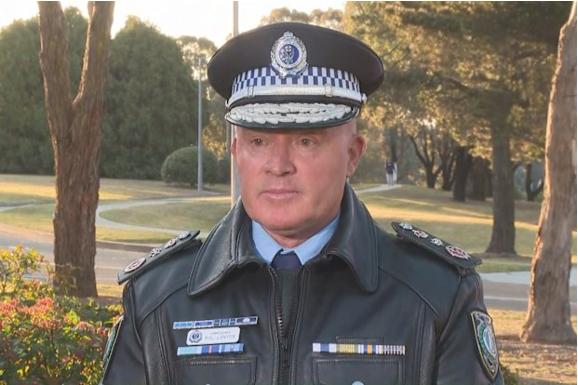
How in 2026 after 150 years of Search and Rescue in the Blue Mountains since 1936 and Paddy Pallin’s fraternal bushwalker S&R initiative of vitally assisting Police Rescue in remote-area rescue, we ask can such miscommunication to the awaiting family and public still perpetuate?
The facts of Lily’s circumstances are yet to emerge it seems. Such as:
- What was her situation for her day hiking trip of the 12th August 2026?
- What was her scenario (plan/intention/predicaments/distractions perhaps)?
- Did Lily slip/fall?
- Did she become benighted?
- Did Lily then become lost/disorientated?
- Was Lily medically ill or traumatised?
- Was there foul play?
- Some other contributing factor(s) for her demise?
- Why did she hike solo on a known very difficult trail in a remote area?
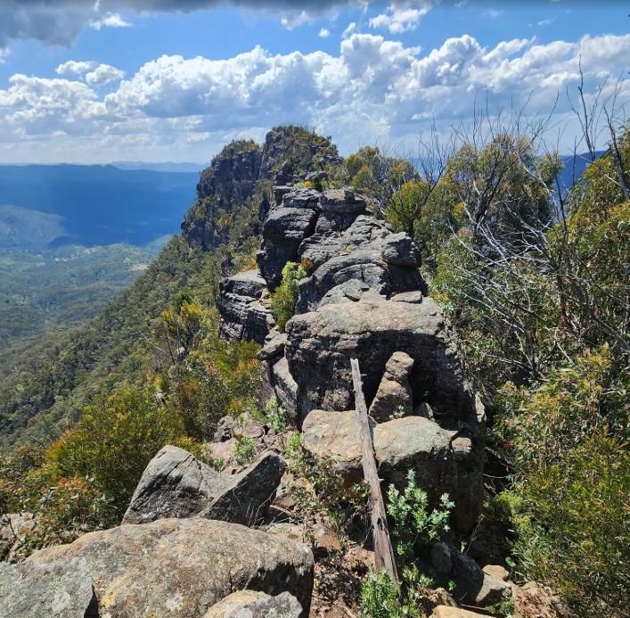
“Definitely don’t recommend going beyond the ‘slide of death’”…Bonnum Pic peak is not exactly a walk in the park. (All Trails – Iveta Valentova, 28 Sep 2025)
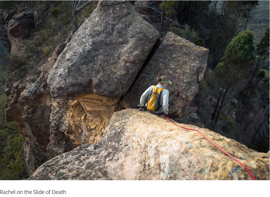
[SOURCE: Bonnum Pic, ^https://ozultimate.com/tom/bushwalking/2019/20190727_bonnum_pic/photos.htm]
This is all conjecture in the public domain. We simply don’t know yet of the what, why or how. The NSW Police reporting and media reporting are still vague to the public discourse as we write.
We hope the family at least has been informed by the rescue co-ordination (Blue Mountains Police Rescue leadership). Maybe the family considers what actually happened to Lily (and the location) inappropriate for public consumption – such would be their right always.
At this time of writing it is very early days, so we don’t yet know what happened to Lily or why. Questions and answers are morally due first to her family. Yet eventually, we the public including the outdoor recreation fraternity do deserve and await appropriate updates of the facts subject to the family’s consent. The media’s proverbial “a report will be prepared for the coroner” regurgitated spiel is but systemic highfalutin bureaucratic crap sure to deliver the public zilch explanation, outcome, closure; just nothing.
Nothing again and again. So more Lily’s again and again and over and over? Is that the governmental message? Like governmental custodianship and responsibility doesn’t give a tuppeny damn?
Just more training for Police Rescue?
Next!
NSW Police Assistant Commissioner Joseph Cassar and SES Commander Colin Malone provided a media update on Thursday afternoon after a body believed to be hiker Lily Hooper was located near a ridgetop summit of Bonnum Pic in the Nattai National Park.
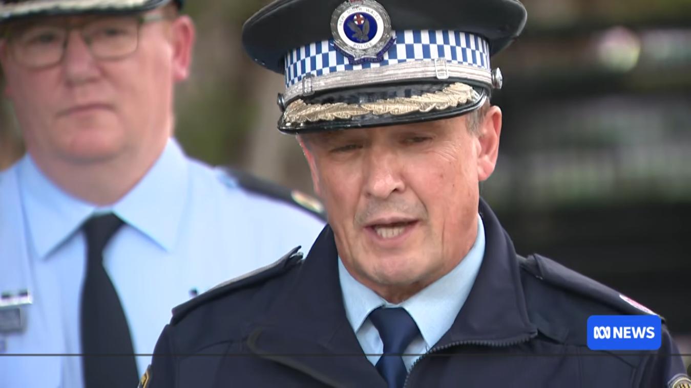
Frankly, these two dudes don’t come across as seasoned hikers/trekkers. Their suitability for remote Search and Rescue leadership? Perhaps more suited to traffic patrol oversight.
…the 18-year-old left her home on Wednesday 12th August 2026 for a dedicated day hike.
Apparently, regular contact from Lily to her family later that day into the night was lost. Her family logically initiated an emergency concern call out to emergency police rescue. (Blue Mountains Police Rescue?)
Lily’s car was then found by ‘searchers’ at the regular starting car park of the Bonnum Pic Hiking Trail. The search for Lily commenced from that location with an almost 400-person search for her – mostly unpaid volunteers (VRA NSW and others) supporting the fully paid NSW Police Rescue.
The initial police media release is here from Thursday 20th August 2026. This was that 20-minute video of the press conference by NSW Police to the media. It was taken in early days since reported by family as missing late on the night 12th August 2026 from the Search and Rescue police operation to find Lily ASAP…
Given communications problems, we suspect that this video may well soon be deleted from current transparent public access by NSW Police for perceived legal reasons. Whatever! Been there.
We’ll soon get to regurgitate the media initial reporting, but what smells in this case is that according to the media, the NSW Police initially mislead Lily’s family about notifying them that they had found her, instead of in fact finding her dead body. Police then soon corrected their mistake, but that’s was shameful.
So what happened to Lily? It seemed to have been just a day trip hike and in good weather.
[B] Media Reporting..”everyday the paper boy brings more“:
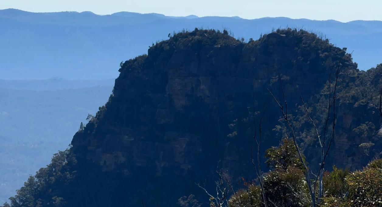
Bonnum Pic (peak) (SOURCE: All Trails, Photo by Zee Chehade)
[Author’s Note: For the benefit of readers we regurgitate the media reporting by identifying each media article below by an article number ID. This article was initially drafted the day after the news of the finding of Lily Hopper’s body being Thursday 20th August 2026.
Media text layout has been modified from one-sentence-per-paragraph ‘sound-bite’ journo style to an improved narrative style, with the same textual content.
Our drafting and updates continue thus far as information is publicly reported].
MEDIA ARTICLE #1: What Happened To Lily Hooper? Everything We Know About The Tragic Search For The Teen.
Our hearts go out to the family.
2026-08-21, by Writer Caitlin Napier, Marie Claire, ^https://www.marieclaire.com.au/news/lily-hooper-bushwalker-body-found/
What Happened To Lily Hooper? Everything We Know About The Tragic Search For The Teen
‘Eight days ago, 18-year-old Lily Hooper was reported missing after telling her family she was going hiking at Nattai National Park. The experienced hiker left her Oakdale home in Sydney’s south-west at approximately 8am, intending to spend the day walking in the national park.
When she failed to return home by about 10pm, her family raised the alarm. Her disappearance prompted a major search operation involving hundreds of personnel, including 100 Australian Defence Force officers, PolAir, the dog unit, Rural Fire Service, Fire and Rescue NSW, National Parks and Wildlife Service, NSW Ambulance, the Westpac Lifesaver Rescue Helicopter and 240 NSW SES volunteers.
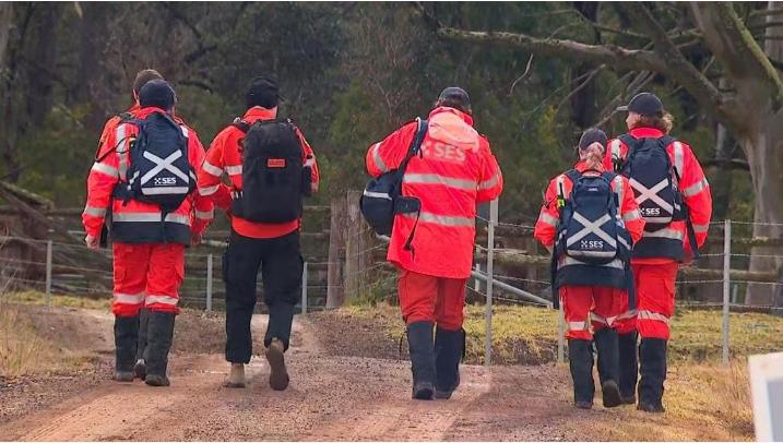
[This Author’s note: try more like 1000 and not just SES, but “multi-agency” so including specialist VRA NSW, NSW SES Bush Search and Rescue, plus the NSW Rural Fire Service volunteers, bushwalking volunteers, club hiking volunteers, etc. – all unpaid! Plus presumably the search effort co-ordinated by NSW Government’s fully paid to six figure salaries and perks the NSW Police Rescue].
Go figure!
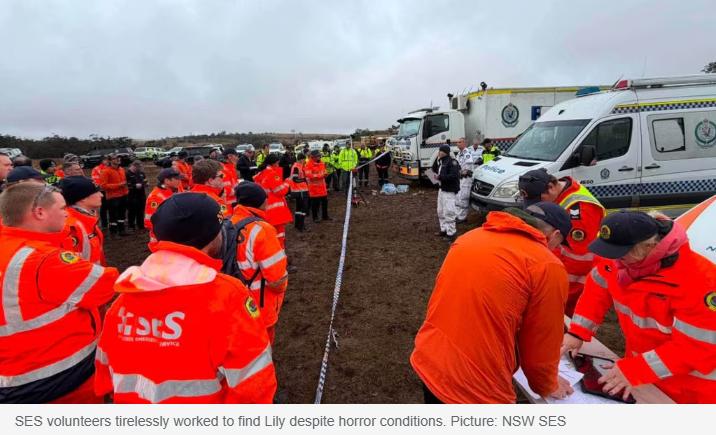
[Author’s Note: Why does the NSW Government continue to rely on the selfless generosity of time, effort and risk of unpaid volunteers to do its dirty work of remote Search and Rescue? It is an abuse of community by government. Had these lot been properly paid like to the standard of NSW Police Rescue, how many hundreds of millions of dollars would Lily’s SAR have cost?
Answer? Well, the Parks Service annual budget in 2024 was $141 million in spending. In 2025 the NSW Minns Labor Government wasted $232 million bypassing the colonial historic village of Little Hartley (Blue Mountains region) with a M7 style motorway of 2.4km, that no-one wanted.
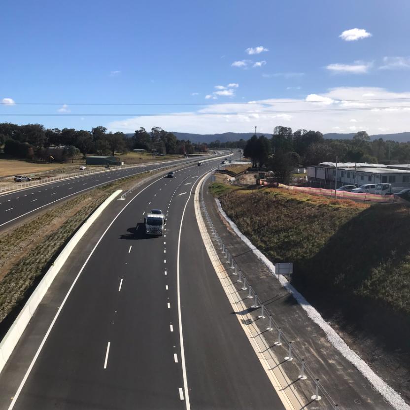
“The lunatics are in my hall“: A WTF waste of taxpayers’ money, bypassing and buggering adjacent Little Hartley’s colonial heritage! Some 2.4km micro-M7 that no-one wanted and $232 million later.
[Back to search for lost Lily…]
(Volunteer) Search crews spent eight days scouring the challenging terrain, with the walking trail reportedly following a sandstone ridgeline through dense shrubbery. The track has been described as challenging and strenuous and is recommended for experienced hikers.
Detective Inspector Benjamin Carey said Lily was familiar with difficult bushwalks. “She does regularly engage in bushwalks, some quite challenging and it is one of her favourite recreational pastimes,” he said.
But today, the search ended in tragedy, with the body of a woman believed to be Lily Hooper found in bushland in the NSW Southern Highlands. NSW Police confirmed the body was discovered by an SES searcher in “thick dense terrain” at about 11:30am.
While formal identification is yet to take place, police believe it is sadly that of the 18-year-old.
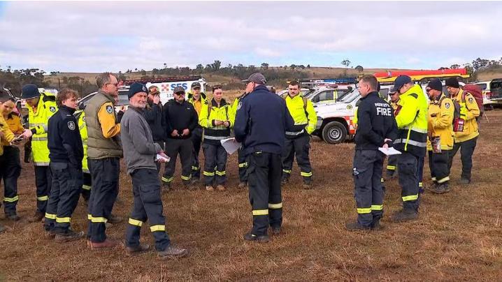
How many in this photo got paid by the reckless NSW Government, except for the hi-vis clothing and budget B&E ‘sangas’ to tokenly sustain field morale?
NSW Police Assistant Commissioner Joseph Cassar said there was sadly an “eight-to 10-minute” period when the family believed Lily had been found alive. “Unfortunately, it did take that small period of time for us to give them an update,” he said. NSW Premier Chris Minns was incorrectly advised that Ms Hooper had been found alive before receiving confirmation that a body had been located.
He initially told a televised parliamentary hearing: “Lily Hooper has been found alive. Found in the bush with half a bottle of water with her.” Mr Minns later retracted the statement following the miscommunication.
“I’ve got some terrible news,” he said. “I apologise to the committee, but it seems as if the early advice was wrong.” In a later statement, Mr Minns said he “genuinely believed” he was “sharing good news” and apologised for potentially adding to the family’s heartbreak.
Prime Minister Anthony Albanese led a moment of silence in federal parliament, with Mr Albanese describing Lily Hooper’s death as “an unspeakable tragedy”.
Lily’s parents, Jim and Kirrily, had been stationed at the search command point since she went missing.’
MEDIA ARTICLE #2: ‘From ‘elation’ to ‘terrible news’ in 10 minutes: how the confusion over missing bushwalker Lily Hooper unfolded’
Thursday 20 Aug 2026, by Luca Ittimani, The Guardian media, ^https://www.theguardian.com/australia-news/2026/aug/20/lily-hooper-missing-hiker-found-dead-nsw-national-park
Police have “blamed” dense bushland and radio confusion for wrongly reporting to 18-year-old Lily Hooper’s parents, the New South Wales premier and the media that the missing bushwalker had been found alive.
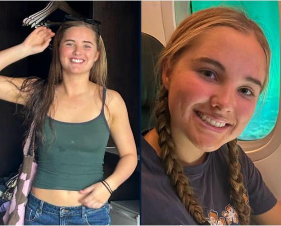
The body of Lily Hooper has been found in Nattai National Park “in the NSW southern highlands”? [Photograph: NSW Police].
[This author’s correction: NO! The Nattai National Park is within the Greater Blue Mountains World Heritage Area, not within the Southern Highlands region, but instead adjacent to the north. What is the point of having a Blue Mountains World Heritage Area if the media don’t know where it is or what’s in it?]
‘Lily had last been seen on 12th August 2026 after leaving home (Oakdale) for a hike in the rugged bushland of Nattai national park, 90km south-west of Sydney. She was reported missing that night, triggering a multi-agency search involving nearly 1,000 people, including hundreds of volunteers.
Eight days later, on Thursday morning, police media told reporters a “hiker” had been found.
At around midday, the premier, Chris Minns, was handed a piece of paper while addressing a parliamentary committee. He asked if it was accurate, to which the secretary of the cabinet office, Kate Boyd, said: “Yes.”
The premier, reading the paper, said he had “fantastic news” that Hooper was “found in the bush with half a bottle of water with her”.
His remarks were published across media outlets. Less than 30 minutes later, Minns told the committee: “I’ve got some terrible news. I apologise … Lily’s body has been found.”
Minns had not realised his own initial statement may have contained a clue to the error.
On Friday morning, the SES commissioner, Mike Wassing, suggested the “half a bottle of water” phrase may have been a code used by search crews to convey sensitive information without alerting others potentially listening to official radio transmissions.
“It’s very common that code words are given to search and rescue crews,” Wassing told ABC radio. “My understanding is that that’s what has occurred in this situation.”
SES search volunteers had told police they believed they had found Hooper alive at 11.30am, the police assistant commissioner Joseph Cassar told reporters in Moss Vale on Thursday afternoon.
Recounting the sequence of communication, he said officers soon shared that message with Hooper’s parents, who had spent a “great deal” of time at the search command post near the head of the Bonnum Pic walking trail, where the teenager’s car had been found.
Vehicles drive along road near NSW national park where Lily Hooper’s body was discovered
Cassar said the hundreds of searchers, carrying handheld radios, faced communication challenges in the “thick, dense terrain”. They had “clear instructions” to report when they found anything, even an item of clothing, he said.
The SES assistant commissioner Colin Malone said the SES volunteers were from the “highly trained” bush search and rescue team.
“It’s very rugged and rough terrain up there and radio communication, like mobile phone communication, as we all experience, when you’re in black spots or tricky areas, the information does get broken up a little bit,” Malone said.
Wassing said on Friday this, plus confusion over any code, was likely a factor.
“We’re working through with police in terms of [the explanation],” he said. “[Was it] actually the aspects of the codes? Or is it the fact that [it was] really difficult terrain, some of the communication was very patchy as well, and so that may have also contributed.”
Within 10 minutes of the first message, the same SES volunteers made a second “more accurate” report, Cassar said. He said they would probably have been “very close” to Hooper’s body.
By then, the incorrect message had already begun to circulate publicly. The police commissioner, Mal Lanyon, told reporters on Thursday afternoon that police had hurried to share the initial report after searching for Hooper for eight days.
“We sought to communicate, obviously, with the family and the media at the first opportunity,” Lanyon said. “Elation,” he said, soon turned to “deflation – and obviously we know now, an impact on her family”. [I] apologise for any additional trauma that may have caused Lily’s family, but certainly for the embarrassment and confusion that caused.”
Minns later said in a statement that he received incorrect advice and “genuinely believed” he was sharing good news.
“My deepest condolences are with Lily’s family,” the premier said. “I am profoundly sorry to think that anything I said may have added to their heartbreak at an already devastating time.”
Angus Taylor, the opposition leader, had reportedly published and then deleted a social media post indicating she had been found alive. He addressed the miscommunication while paying tribute to Hooper in parliament.
“Initial reports that she had been found alive proved to be wrong and that makes the blow even worse,” Taylor said.
Lanyon said police would have reported the finding to the office of the police minister, Yasmin Catley, and then to the premier’s office.
“I can’t explain why it was so quick but what I can say to you is this search has been high profile,” he said.
Lanyon said he had called Minns to apologise for the “misinformation” he had received.
Asked on Friday who had been in contact with his office, the premier said he wouldn’t single out an individual.
“Ultimately, this is my responsibility and Mal’s responsibility, and we’re going to fix it,” he said.
Minns’ reference to a water bottle prompted speculation that search crews had used a code word in their initial report.
Asked how the “water bottle” phrase had been referenced, Cassar said on Thursday: “I can’t tell you because I don’t know exactly what was said.”
Lanyon said he could not explain the reference but communications would be reviewed and improved.
“This is not a circumstance I would like to see repeated,” Lanyon said. “We will look at the relationship between police and the SES and we’ll work with other agencies to make sure communication failures don’t occur.”
The public breakdown in communications came a week after NSW police separately reported finding a “body” inside a suitcase which was determined the next day to have been a sex doll.
Lanyon denied the two incidents would impact public perceptions or trust in police.
“The police took exactly the right precautions [when] what we now know was a doll was found in a suitcase,” he said. “I accept later on it was [determined] not a body, but I think the community would expect the police to treat crime scenes seriously and preserve evidence, and that’s what was done.”
MEDIA ARTICLE #3: ‘Body believed to be missing hiker Lily Hooper found in NSW Southern Highlands after eight-day search’
Thursday, 20 August 2026, ABC Illawarra, ^https://www.abc.net.au/news/2026-08-20/missing-18-year-old-bushwalker-lily-hooper-found/107045898
In short:
The body of a woman believed to be missing bushwalker Lily Hooper has been found in bushland in the NSW Southern Highlands.
The NSW premier has apologised for initially telling parliament the 18-year-old had been found alive, before confirming the “terrible news”.
What’s next?
A report will be prepared for the coroner. [Author’s note: This media cliché means nothing]
NSW Police have apologised “unreservedly” after the family of missing bushwalker Lily Hooper were told she had been found alive after an eight-day search in the NSW Southern Highlands.
A body believed to be that of Ms Hooper was located in bushland about 11:30am today.
Police said that while the body was yet to be formally identified, it was believed to be that of the missing 18-year-old.
Ms Hooper left her home south-west of Sydney on the morning of Wednesday, August 12, to go hiking in the Nattai National Park.
Her car was later found near the Bonnum Pic Walking Trail, sparking a large-scale multi-agency search involving almost 100 Australian Defence Force personnel and 280 NSW SES volunteers.
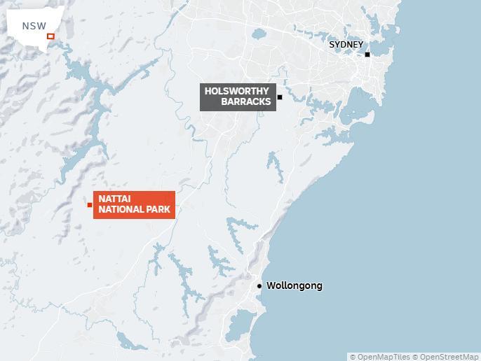
[Author’s Note: Nattai National Park is not part of the Southern Highlands region of New South Wales as incorrectly reported by the media. Instead, Nattai NP forms one of the UNESCO inscribed eight national parks of the Greater Blue Mountains World Heritage Area since 2000.
[Search and Rescue] Crews scoured steep drops, dense undergrowth and complex cliff lines. NSW Police used a thermal-imaging helicopter and examined telecommunications data in an effort to trace Ms Hooper’s last movements.
Ms Hooper’s family have been stationed at the search command point since she went missing.
Police Commissioner Mal Lanyon said the next step was for police to recover the body.
“We attempted to use a helicopter to retrieve her body. Due to the nature of the terrain, the canopy, we weren’t able to do that,” he said. “So we’ll now work through a process, whether it’s manual or on foot, to retrieve her body … to bring her back to be with her family and go through the investigative process.”
Family believed she was alive (for up to 10 minutes)
How missing hiker Lily Hooper was mistakenly reported alive.
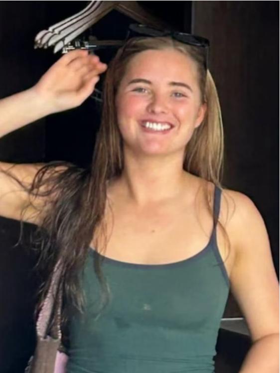
NSW Police Assistant Commissioner Joseph Cassar this afternoon said the body was found by an SES searcher in “thick dense terrain” and that there was an “eight- to 10-minute” period when Ms Hooper’s family believed she was found alive.
Cassar:
“Unfortunately, it did take that small period of time for us to give them an update. I can tell you the police that were in charge at the time that spoke to Lily’s mum and dad certainly hoped for a more positive outcome. If we were able to provide them more detailed information on that first report, I can tell you that would have been the case.”
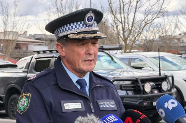
Assistant Commissioner Joseph Cassar offered his sincere condolences and defended the search process. (ABC News: Brooke Chandler)
Commissioner Lanyon;
Commissioner Lanyon said he “unreservedly” apologised for the “miscommunication” and “any additional trauma” to Ms Hooper’s family…
“The miscommunication obviously was born out of elation that Lily had been found, and her condition at that time was such that searchers were relieved. Tragically that miscommunication then led to a deflation and obviously we know now, an impact on her family.” Commissioner Lanyon said it was a “tragic day”. Our focus had been clear, find Lily and bring her safely back to her family,” he said. Sadly, that has not been the case.”
He said just shy of 1,000 searchers (mostly volunteers) helped look for Ms Hooper and communications “may have passed through a number of hands” given the location where Ms Hooper was found was remote.
“I think it’s appropriate we review the matter … we’ll look at the communication obviously with a view to improving that.”
Assistant Commissioner Cassar denied suggestions police had “jumped the gun” as far as providing information to the family was concerned.
Assistant Commissioner Cassar:
“It’s an eight-day coordinated search, we’re talking about hundreds of volunteer people that are trained in searching, we’re talking about think dense terrain, we’re talking about processes that we’ve adopted to engage family members to keep them informed throughout every step of the way.
So when we talk about a very short window in information being provided, no I don’t believe we’ve jumped the gun. If I could turn the clock back I certainly would. I can’t provide a comment in regards to that because I don’t know the exact wording of what was said [to her family].
I think the all the searchers involved in this operation have done an exceptional job coming together,” he said. “This is not the outcome that we’d hoped but my sincere appreciation goes out to every one of the searchers that were involved. “They’re putting themselves in harm’s way and they don’t even give two thoughts of it.”
Minns gives ‘terrible news’
Chris Minns seated in senate hearing, speaks into microphone while holding a note.
Chris Minns apologises after incorrectly relaying Lily Hooper’s condition.
NSW Premier Chris Minns was informed during budget estimates that Ms Hooper had been found, initially saying that she was alive.
This was widely reported by Australian media, including the ABC.
The premier later told a parliamentary hearing that a body had been found.
Minns:
“I’ve got some terrible news. I apologise to the committee, but it seems as if the early advice was wrong. Lily’s body’s been found and she’s been found deceased. I only raise that because I made the earlier advice and I’m very sorry for that. This is obviously devastating and I’m just profoundly sad for her family and all those concerned. And I apologise to the committee. This is terrible news.”
In a later statement, he said he “genuinely believed” he was “sharing good news”.
“I am profoundly sorry to think that anything I may have said may have added to their [Ms Hooper’s family] heartbreak at an already devastating time.”
Commissioner Lanyon said the information went through policing commands to the police minister and up to the premier’s office, and had been reported widely.
“It was something that was inadvertent, but as I said, was born out of looking to find Lily and bring her back to her family.”
He said he did not know what exactly was said to Ms Hooper’s parents at the time, “but obviously her condition when she was located, initial information … that was communicated was that she was alive”.
The commissioner said he called Mr Minns to apologise for the information the premier received.
Federal leaders pay tribute
Prime Minister Anthony Albanese and Opposition Leader Angus Taylor today led a moment of silence in federal parliament after expressing their condolences to Ms Hooper’s family.
Mr Taylor said Ms Hooper was from his electorate and her love of bushwalking “only compounds the tragedy of her death”.
“Any parent who reads this news will hug their children tighter tonight,” he said.
Mr Albanese described her passing as “an unspeakable tragedy”.
“Lily Hooper had so much more to offer the world,” he said.
“Her passing, I have no doubt, will be felt very deeply across Southern Highlands, among her family, her friends, and indeed right across the nation.”
Wollondilly shire mayor Matt Gould wrote on social media that he was “absolutely heartbroken” for Lily and thanked all the people who searched for her.
“For eight days our community held onto hope together,” he wrote.
“We watched every update, thought constantly of Lily and her family, and desperately wanted this beautiful young woman to be found safe.”
NSW Opposition Leader Kellie Sloane said in a statement the news of Ms Hooper’s death was “devastating”.
“So many people had been hoping for Lily’s safe return and today’s news will be difficult and deeply felt,” she said.
A report will be prepared for the coroner.’
MEDIA ARTICLE #4: ‘Family of lost hiker Lily Hooper urge ‘Lily’s Law’ after tragic death’
August 24, 2026, by Joanne Williamson and Andrew Hedgman, News Corp, ^https://www.news.com.au/travel/travel-updates/incidents/she-wanted-to-be-famous-heartbroken-father-of-lily-hooper-asks-for-tribute/news-story/1d22a28e494f6f4cc386f459caafffdc
‘Lily Hooper’s loved ones want her death to leave a meaningful legacy, with the family urging better education around bush safety and wider use of personal locator and tracking devices for young hikers.
At the same time, they are continuing their call for an official tribute to commemorate the 18-year-old.
The teenager headed into Nattai National Park on August 12 on a solo walk and did not return. Her body was located on Thursday in remote bushland in the park’s southwest Sydney region, bringing a major search operation involving police, army personnel, SES crews and other rescuers to a heartbreaking end.

Lily Hooper, 19, went missing in the remote Southern Highland wilderness while on a solo hike. Picture: Supplied [Author’s Note: aged 19 or 18, media? Get it right media dudes!]
Hiker Lily Hooper’s body was found in the Nattai National Park on Thursday. Her parents, Jim and Kirrily Hooper, hope “Lily’s Law” can become a lasting campaign centred on helping others better prepare before going into the bush.
“We think it’d be good if there was a legacy that was left like a Skye’s Law, Jack’s Law … Lily’s Law,” Mr Hooper told 7News. “And that’s about the awareness of going out in the bush with EPIRBs, tracker devices, Garmin, Navman type devices.”
After retracing the route Ms Hooper took, Mr Hooper believes she may have become lost after conditions changed late in the day.
“It’s a hectic track, I was surprised she took it on. I think it was on dark and she got disorientated and she headed in a direction that she didn’t walk in on,” he said. “Like I said the bush can swallow you up.”
[Author’s Note: “hectic” is Kiwi vernacular emphasis, is it not?]
Lily Hooper’s father Jim has paid tribute to his teenage daughter whose body was found on Thursday August 20 after she went missing while on a solo hike. He said he had previously tried to discuss bush safety with his daughter, but like many teenagers, she was confident in her abilities. “I locked horns with her about this sort of stuff which saddens me in a lot of ways because there was a lot of you know ‘what do you know dad’ stuff and you know kids think they know better,” Mr Hooper said.
Although they are grieving an unbearable loss, the family has taken some comfort from having Ms Hooper back.
“Out of the three scenarios of getting her back alive, getting her back (deceased) and then not getting her back we got the middle one,” Mr Hooper said. “Not ideal but at least we got her back.”
The family of hiker Lily Hooper, whose body was found in Nattai National Park on Thursday August 20, have paid tribute to her. Picture: Channel 7
The family is also pleading with Premier Chris Minns to honour Ms Hooper, who worked as a tour guide at BridgeClimb, by flying the flag at half-mast.
“If Chris Minns could organise probably to get the flag put at half-mast for her,” Mr Hooper told 7News.
“Oh, just as a tribute to Lily. You know, like I say, she’s an advocate for young women.”
The family now says other young people can learn from Lily.
“She will leave a legacy, I hope, for girls, young girls, you know, to get out and about and enjoy life like she did.”.
Lily’s family is planning a big farewell off for the girl who threw everything at life.
“She wanted to be famous as a movie star. She became famous, not for the right reason, but yeah, so she got that wish,” Me Hooper said.
He said the family was not angry over the heartbreaking communication breakdown following the discovery of her body.
Coded messages between emergency agencies led to Ms Hooper’s family believing for eight minutes that she had been found alive.
The miscommunication widely spread, even reaching NSW Premier Chris Minns, who announced it to parliament.
But elation soon turned to deflation after the code was relayed and it was made clear Ms Hooper had died.
“No, not at all. I’m not in any way angry at the police or the police commissioner or the Premier,” he told 7News.
NSW Police Commissioner Mal Lanyon and Mr Minns have since apologised for the miscommunication.
The search for missing 18-year-old hiker Lily Hooper who went missing in the remote Southern Highland wilderness. Picture: NSW SES
The search for missing teenager Lily Hooper, who has now been missing for 8 days, continues in the Nattai National Park. Picture: NewsWire Handout
Mr Hooper said he was grateful for the lengths that rescue parties, including NSW Police and volunteers from the SES, went to try and recover his daughter.
The tragedy has sparked an outpouring of grief across the nation and shattered the young woman’s local community.
“Beautiful Lily, may your soul rest peacefully … May your family find solace and comfort in knowing that you passed from this world doing what you loved to do and being with nature – you certainly touched the hearts of our Camden & Wollondilly communities,” one resident wrote on social media.
“Lily, you will always be remembered for the love and joy you brought to our community, your memory will live on in our hearts and minds,” another said.
Members of her community turned out to a candlelight vigil in Willis Park on Friday evening, barely 24 hours after learning of the devastating loss.
“A community coming together to support the Hooper family through this devastating time. Rest easy, fly high and shine bright Lily,” one commenter wrote on social media following the event.
The death of hiker Lily Hooper has led to an outpouring of grief in the community.
A community candlelight vigil was held on Friday to remember hiker Lily Hooper, who was found dead after a weeks long search. Picture: Facebook
A community candlelight vigil was held on Friday to remember hiker Lily Hooper, who was found dead after a weeks long search. Picture: Facebook
Ms Hooper’s alma mater Campbelltown Performing Arts High School shared a message to their community remembering the 18-year-old, who graduated less than 12 months ago.
‘Shine bright beautiful Lily’: 18yo mourned
‘Bottle of water’: Code word fail in Lily search
“Lily will be remembered by our school as a kind, humorous and respectful young woman who lit up every room with her infectious smile, positive energy and determination to live life to its fullest,” the school’s statement read. “She was, and will always remain, a deeply valued member of our school community. “May Lily’s light continue to live on in all of us who were fortunate enough to know her.”
MEDIA ARTICLE #5: ‘Search continues for missing bushwalker – Southern Highlands’
Saturday, 2026-08-15, NSW Police website, ^https://www.police.nsw.gov.au/news/news_article?sq_content_src=%2BdXJsPWh0dHBzJTNBJTJGJTJGZWJpenByZC5wb2xpY2UubnN3Lmdvdi5hdSUyRm1lZGlhJTJGMTI2OTk2Lmh0bWwmYWxsPTE%3D
‘A search is continuing in the Southern Highlands for a bushwalker missing since Wednesday. 18-year-old Lily Hooper left her home in Sydney’s south-west about 8am Wednesday (12 August 2026), to hike in the Nattai National Park about 60km north-west of Mittagong.
When she hadn’t returned by 10pm she was reported missing and inquiries to locate her began immediately by officers attached to The Hume Police District.
About 11pm, Lily’s car was found parked on Wanganderry Road, near the start of the Bunnum Pic Walking Trail at High Range, and a command post was established. Initial inquiries indicate Lily reached the summit of Bunnum Pic about mid-morning; however, there’s been no further contact since that time.
Local police were joined at the scene by regional Police Rescue, NSW Ambulance, Fire and Rescue NSW, SES and members of Lily’s family, and a search utilising drones and the Ambulance helicopter commenced.
The multi-agency search has been ongoing with additional support from the NSW Police airwing, PolAir, RFS and VRA members but there’s been no sign of the missing woman.
The search continued overnight and will continue with fresh teams from 7am today (Saturday 15 August 2026).
Lily is described as being of Caucasian appearance, about 175cm tall, of slim build, and long blonde hair and blue eyes. When last seen she was wearing a shirt and shorts but it’s not known what clothing or supplies she took for the hike. Police have been told she is an experienced hiker.
Anyone who may have seen Lily or has information about her whereabouts, or who walked the Bonnum Pic Walking Trail on Wednesday, is urged to contact Moss Vale Police Station 02 4869 7899 or Crime Stoppers on 1800 333 000.
Anyone with information about this incident is urged to contact Crime Stoppers: 1800 333 000 or https://nsw.crimestoppers.com.au. Information is managed on a confidential basis. The public is reminded not to report information via NSW Police social media pages.’
MEDIA ARTICLE #6: Lily Hooper’s mum reveals more details on tragic search
August 30, 2026, by Patrick Brischetto, Nine Entertainment, ^https://www.nine.com.au/australia-news/nsw/lily-hooper-mum-reveals-more-details-on-tragic-search-20260830-p60sro.html
The mother of a Sydney teenager who died while hiking in the NSW Southern Highlands has shared more details on the desperate search for her daughter.
Lily Hooper, 18, went missing on August 12 after going on a bushwalk in the Nattai National Park. (She) died on a bushwalk in the NSW Southern Highlands. She was found after an eight-day search, but Lily’s family was originally told she had been discovered alive before authorities confirmed she was dead.
In a new interview, the Hooper family say they hold no ill will towards authorities who “threw the kitchen sink” at finding Lily alive. They also shed light on what caused the teenager’s death. “Preliminary reports have said Lily had a fall, she had an accident that first afternoon… she died the day she went missing and was found lying peacefully in dense bushland,” Kirrily Hooper, Lily’s mother, told (media).
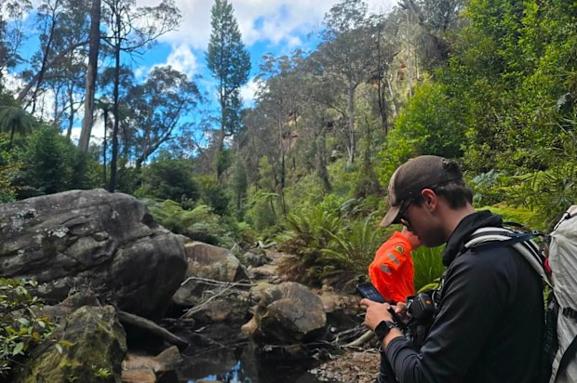
Hooper’s body was found in dense bushland. (Photo: SES Wingecarribee)
“In hindsight we now know she passed quickly and she didn’t suffer in the cold.”
Kirrily said she was taken aback by the natural beauty of the area Lily had been walking in.
“We went to the trail with a police officer when Lily was still missing, desperately looking for answers… we couldn’t take our eyes off it, it’s stunningly beautiful,” she said. “I could see why Lily wanted to do it”.
Her family were at the search site when Lily’s body was found on August 20.
Police are still investigating the circumstances that led to the family incorrectly being told Lily had been found alive. “It is a common practice to have a code for the circumstances of missing persons,” SES Commissioner Mike Wassing said, adding that police usually set up such code words.
Mal Lanyon said it was a regrettable situation that led to the miscommunication when Hooper was found. (Photo: 9News, Nine Entertainment)
NSW Police Commissioner Mal Lanyon had expressed regret to the Hooper family in the aftermath of the miscommunication.
Lanyon:
“The miscommunication was born out of elation that Lily had been found and her condition at that time was such that searchers were relieved. Tragically, that miscommunication then led to a deflation.”
The incorrect information reached NSW Premier Chris Minns, who interrupted budget estimates to share the news, though he later corrected himself and expressed his condolences to the Hooper family.
Minns (21st August 2026):
“I am absolutely devastated and profoundly sorry that anything I said may have added to the grief that [Lily’s] family has gone through. I know they’ve gone through hell over the last week. Lily was a fantastic person with a close family and this will be devastating for them.”
MEDIA ARTICLE #7: ‘Meant to come back alive’: Parents pay heartbreaking tribute to Lily Hooper after Nattai National Park death’
2026-09-03 by Andrew Hedgman and Jack Nivison, NewsWire, News Corps,
[One comment – but of unjustified contempt, so not worth repeating.]
‘The parents of Lily Hooper have shared heartbreaking tributes to their beloved daughter as hundreds bid farewell to the 18-year-old.
A large crowd of young people congregated at a chapel in Sydney’s southwest to bid farewell the “fearless” teenager after her death on a solo hike in rugged NSW bushland gripped Australia. Mourners gathered at the sprawling Macarthur Memorial Park in Varroville on Thursday to say goodbye to the beloved teen.
The park sits on more than 113 hectares of land in Sydney’s southwest, with Ms Hooper’s funeral being held at its centrepiece, the Sanctuary Chapel.
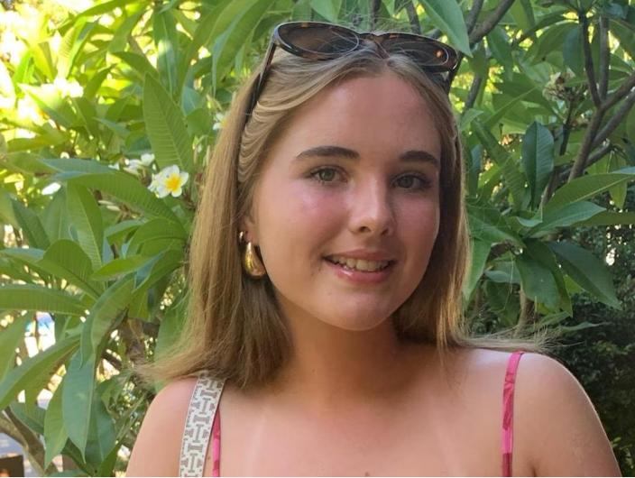
Lily Hooper is being farewelled by her family, friends and loved ones at a funeral on Thursday. Picture: Supplied
Sad detail as mourners farewell beloved teen
The carpark had nearly completely filled up by 10.30am, with many of the vehicles trickling in sporting red and green P plates.
A large number of mourners entering the building prior to the service were young adults and teenagers. The chapel was described by park operators as a “place of peace and reflection” which “offers a warm and welcoming setting for memorial services and quiet moments of remembrance.” Media were asked to refrain from taking photos as mourners entered the chapel, dressed in bright colours to pay tribute to the beloved teen.
Before the service began, hundreds of mourners gathered for the casket, adorned with an array of pink and white flowers, to be walked into the chapel. The crowd was so large that mourners were forced to spill out of the front doors of the chapel.
‘She was fearless’: Parents’ tribute
Speaking inside, Ms Hooper’s parents Kirrily and Jim held their composure as they shared fond memories about their beloved daughter.
Kirrily said the teenager was an authentic and fearless young woman, describing her daughter as someone who “didn’t worry about what other people thought”.
Kirrily Hooper:
“She didn’t hold herself back through fear or worrying about whether she was doing too much. When we think about Lily’s achievements, we actually took all these great things for granted – because that was just her.”
She said Lily’s determined and driven nature “captivated so many people in these last few weeks”. “She took life by the horns and did what she enjoyed, what she wanted to do, and is teaching us all about the important things in life.”
Kirrily said the teenager managed to “pack a lot into 18 years”. She was authentic and had a style all of her own. Lily expressed her opinions, had a hilarious sense of humour. One of Lily’s greatest qualities was that she was fearless.
Kirrily said Lily was “meant to come out of all this ordeal alive to learn her lessons and also teach other young people about taking safety seriously. Unfortunately, we will all have to do this without her and on her behalf.”

Tributes have been shared to the teen in her home town. Picture: Thomas Lisson
Through tears, Mr Hooper said Lily was always outside ready for the next adventure.
Jim Hooper:
“(Lily) really loved the outdoors. She loved bushwalking behind our property … she loved going to the beach, and especially when she got her (P plates), she drove to the beaches of Wollongong whenever she could. She loved fishing, hunting, camping and spending days in the boat.
Mr Hooper said Lily had always been a fun-loving and energetic girl who excelled in sports, maths and the arts.
Lily was a happy, funny and confident child. Lily had a wide range of interests and she had a beautiful combination of strengths.
Best friend Stevie said Lily was the “most vibrant and courageous girl I’ve ever met”, who encouraged others to “chase dreams”.
Ms Stevie told the gathered crowd:
“(She was) extremely passionate about the people she loved. She made me brave enough to chase dreams I never knew I had. Lily wanted to experience as many things as she could … she did this with confidence, bravery and talent. Exploring places, laughing together and crying together, supporting each other through all the good and bad choices. She was my favourite person and forever best friend.”
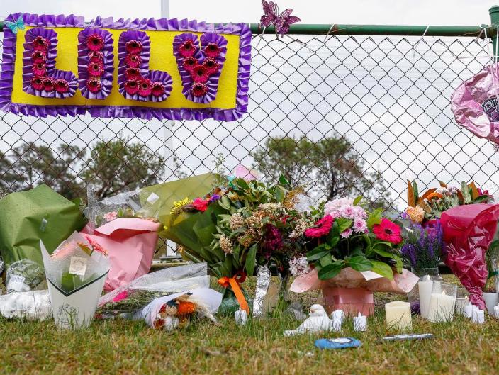
Flowers and candles were placed shortly after the teen’s body was found. Picture: Thomas Lisson
The teenager was “strong, steady and full of spirit”, her kickboxing coach Janine said.
Janine:
“She would have been a formidable black belt … I called her Lethal Lily. Off the mat she was gentle, sweet and full of light. She made people feel safe, supported, inspired and seen.”
Among the tributes, her little brother Charlie shared a heartbreaking poem to Lily.
Brother Charlie:
“Eighteen years – far too few. Yet Lily filled them through and through. With courage, strength and fearless heart, she lived each day and played her part.”

Lily was described as filled with courage and a fearless heart. Picture: Supplied by family.
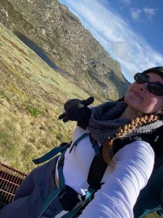
Her family recalled Lily’s cherished love of the outdoors. Picture: supplied by family
Brother Charlie:
Charlie spoke of Lily’s love for playing guitar, Tim Tams and being outdoors, and said she was a wonderful role model for other young girls.
“So when we walk a mountain trail, hear guitar strings upon the air. Step onto the mats, or share a Tim Tam too, There’ll always be a little reminder of you.”
Following the service, Lily’s casket was slowly carried from the chapel to the back of a white hearse, accompanied by a convoy of white sedans from White Lady Funerals. The White Ladies, known for their velvet red hats and all-white attire, were seen comforting mourners before and during the service.
She disappeared on August 12 after setting out alone on a hike in rugged bushland. Picture: 7News
Devastating details reveal Lily’s final moments
Lily disappeared after setting out alone on a walk in Nattai National Park on 12th August 2026. Her car was later found near the trailhead, sparking a major search involving police, the SES, volunteers and specialist crews working through dense and difficult terrain. Eight days later, her body was located in bushland – ending a desperate search that had drawn widespread public attention and left her family clinging to hope.
The teen from Oakdale will be remembered not only for the heartbreaking circumstances of her death, but for the warmth, energy and fearless spirit that family and friends have described in the days since she was found.
In an update after her death, Kirrily told The Daily Telegraph preliminary reports indicated Lily had suffered a fall on the first afternoon.
“She died the day she went missing and was found lying peacefully in dense bushland,” Kirrily said. “In hindsight we now know she passed quickly and she didn’t suffer in the cold.”
Those closest to Lily have painted a picture of a young woman who lived boldly and left a lasting mark on the people around her. Her mother described her as “a headstrong, independent, fearless girl”, qualities that made her who she was, but also, she believed, “left her vulnerable to misadventure”.
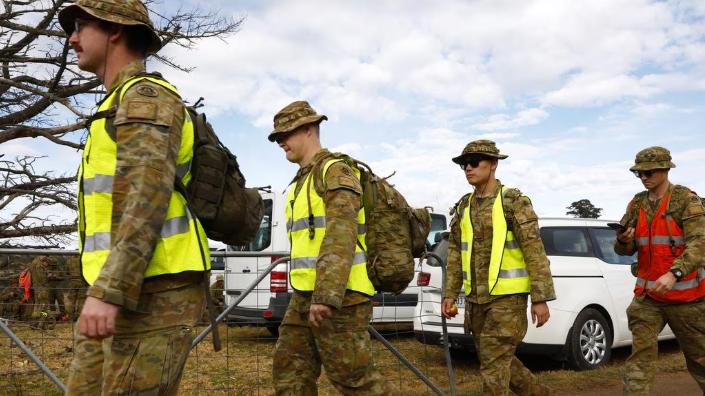
A major search was launched after Lily’s car was found. (Picture: Jonathan Ng) [Authors Note: Yeah but..the politicians’ propaganda spin to call in the Army to complement a proper Search and Rescue effort for missing Lily is just media pantomine. Army are not trained for Search and Rescue skills. This author was in the regular Army.]
Tributes have flowed from across the Wollondilly region and beyond.
Lily had worked as a Sydney BridgeClimb guide, where she was remembered as “an absolute delight” who “lit up every space with her smile and enthusiasm”.
Last month, a community memorial in Oakdale drew hundreds of people, with candles, flowers and purple lights honouring a teenager many described as bright, kind and full of promise.
Lily’s death has also sparked fresh discussion about bush safety, with her parents hoping her legacy will encourage young hikers to think carefully before heading into remote areas alone. Mr Hooper has also spoken of turning that grief into something lasting, floating the idea of “Lily’s Law” to build awareness around safety devices and preparation in the bush.’
[C] Our Uninformed Presumptions:
Ok, so our initial take garnered only from media reporting, is that this ridge top was apparently Lily’s day hiking trip target, presumed to achieve a wild scenic vista out there and back. AKA a day’s wild remote adventure – outdoor recreational ‘fun’.
The trail and destination are wilderness remote and situated as part of a wild and rugged natural forested area of the Nattai wilderness with no track and no support facilities. It is pretty much bushbashing, rock scrambling atop a rock boulder (“dome formations” – regionally geological ironstone) narrow ridge and precariously along a wild cliff-line and above a precarious cliff edge escarpment with no protection from falling hundreds of metres to the densely thick wilderness of the valley below.
Mmm.
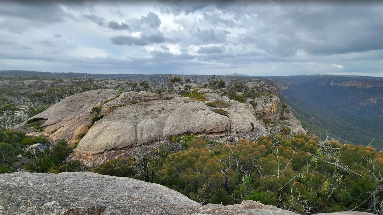
Bonnum Pic peak’s wild rocky approach (All Trails – Iveta Valentova)
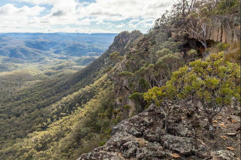
Lily’s planned destination (and return): ‘Bonnum Pic‘ – a very scenic vista ridgetop rocky outcrop (centre of photo) in Nattai National Park, a southern wild part of the Greater Blue Mountains (world heritage) Area. Clearly, a full day’s hiking adventure.
- Trip Location: Nattai National Park (Blue Mountains), NSW, Australia
- Trail Title(s): ‘Bonnum Pic Trail’ (a recognised one-way hiking trail)
- Trip Research: Prior reccie? Group prior hike? Unofficial social media reliance? From where do budding hikers obtain their trip research? All unknown. Question: Did Lily use All Trails website for guidance, else some other online agency promoting it?
- Trip Plan (actual): Day/Date/Duration: Wednesday 19 Aug 2026? – unknown to this author
- Road Transport: (to hiking start/finish): Personal car from home (Oakdale to hike start (Wanganderry Rd Cattle Yards and gate?)
- Hiking Route: chosen hike trail to Bonnum Pic (and backtrack), Nattai National Park
- Hiking Duration: (1 day trip – 7 hours according to some Internet sources). Timing of the trip start, time of last light, buffer time before last light (dusk)? It is 6pm in August. There are no ‘civilisation’ lights in Nattai NP, so at night it is pitch black.
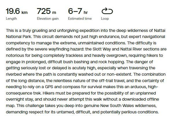
- Hiking Grade/Navigation: Grade 5 = Difficult so experienced hikers only, involves bush-bashing off-track in parts, rock scrambling, even rock climbing, the trail route is vague, it is not maintained by NPWS so overgrown and so making hiking navigation problematic.
- Safety Risks: a 562 metre (1843 foot) ascent/return descent, along an unfenced escarpment cliffline with high exposure hazard (to slip/fall), rough track mostly, trail maintained/overgrown? – unknown, route drinking water access at altitude likely little, benighted camping sites – unknown
- Hiking Route Hazards: Whilst Nature Trail has not previously heard of nor attempted Bonnum Pic Trail, and also that the official governmental custodian of Nattai National Park (so-called NPWS) is silent on this trail on its website, our online research (from over 200km away in Katoomba) reveals many inherent hazards of this trail. Here we again refer to the popular ‘All Trails’ website and especially its review and the many reviews submitted by independent ‘trailgoers’ who mention the plethora of trail hazards, summarised as follows:
- No track – quote: “No trail at all. If you like bush bashing do it. Otherwise choose somewhere else.”
- Overgrown paths
- “Takes longer than expected as no real track in places.”
- Difficult wayfinding
- Bushbashing
- Navigation difficulties
- Steep rock scrambling
- No trail drinking water
- A very difficult track, strenuous
- Rock climbing
- The trail gets hard after the third viewing point – “the ridge gets more narrow and a wrong turn can put you at risk of falling.”
- “Definitely don’t recommend going beyond the ‘slide of death’”
- Obstructions
- Cliff exposure
- “Would not recommend to do solo as we had safety in numbers.”
- “definitely need offline GPS.”
- “Getting all the way to the end is very challenging and dangerous.”
-
- [Author’s Note: For more details please refer to our section at the end ‘References and Further Reading‘ Item [18] ‘Published reviews of Bonnum Pic Trail by hikers‘.
- Hiking Distance: approximately 17km (return by backtracking)
- Hiking Group Factors: solo?, young female – other factors as yet unknown to this author. A group requires at least two people interacting. Solo hiking does not comprise the general definition of a ‘group’.
- Group Hiking Experience: at age 18, presume she had a few years hiking experience, any prior/regular bushwalking club hiking experience is unknown to this author. This author’s first hiking exerience was at age 14 – Cradle Mountain (Tassie) school group 3 days. [Quote: Police Detective Inspector Benjamin Carey said Lily was familiar with difficult bushwalks. “She does regularly engage in bushwalks, some quite challenging and it is one of her favourite recreational pastimes,” he said.]
- Group Fitness: This trip did not involve a group. It was a personal hiking solo trip. Lily was aged 18 years and reportedly a regular hiker, so presumed ‘hiking fit’ (Author’s note: there are other types of fitness) and Lily was independently confident and competent in remote hiking.
- Group Leader Preparation: unknown to this author.
- Group Kits: Hiking attire (footwear/sun protection/thermals/rain gear/head torches)?, carried in drinking water?, carried in sustenance (food)?, hiking pack gear (tent/fly/sleeping bag)?, mobile reception?, navigation devices (topo map?, compass?, satnav?), benighted gear – all unknown to this author.
- Trail Conditions: this trail has poor track clarity/no maintenance – so likely overgrown and navigation problematic), this current season is winter time, yet no rain, actual temperatures that day were relatively mild (over 24 hrs: between 13 and 22 Celsius, with a slight breeze).
- Trip Contingency Backups: smart phone reception?, Personal Locator Beacon (PLB)?, trip notice details provided to authorities/next of kin?, emergency alternate access road ‘railing’ for emergency evacuation? – all such unknown at this time of writing.
Since the UNESCO-inscribed celebrated World Heritage Area of Year 2000, are government authorities over the years actually improving their wisdom and abilities in dealing with outdoor recreation training and emergency responses throughout the Blue Mountains?
Obviously not.
Government continues to rely upon unpaid volunteers and the Army which is untrained in Search and Rescue skills, knowledge and experience.
Is it keeping pace with the tourism visitation marketing of the NSW Government’s ‘Destination NSW’ on the Blue Mountains – its reach, spending budget, investment, etc?
No!
Fact Checks:
“Destination NSW allocated $834,600 in regional funding for the Blue Mountains region under specific state funding tracking.
Blue Mountains Tourism & Visitor Metrics Visitor Numbers: 2.6 million visitors.
Visitor Nights: 2.9 million nights.
Total Expenditure: $1.2 billion generated for the local economy. Broader Regional Investments
Statewide Grants: The broader visitor economy has benefited from periodic NSW Government grant injections (such as $5.5 million statewide for marketing, product development, and business events).
Infrastructure Context: Beyond direct tourism marketing allocations, major regional capital works in the area include significant state commitments like the $7.7 million Leura Cascades upgrade and planning investments for the Blue Mountains Hospital.”
SOURCES: ^https://www.destinationnsw.com.au/insights/regional-statistics/Regions/blue-mountains, ^https://www.nsw.gov.au/business-and-economy/nsw-budget/2025-26-budget-papers/our-plan-for-western-sydney/budget-highlights-western-sydney-lga/blue-mountains
So, besides the NSW Government’s tourism promotion spend of having fun in the great outdoors in its Blue Mountains World Heritage showcase…yeah but:
- What about emergency prevention strategies?
- What about learned knowledge from the many past tragedies of outdoor recreation in our Blue Mountains (and other natural wild places) ?
- Why a multi-agency Search and Rescue response yet again by mostly unpaid volunteers?
- What about sharing that knowledge of known risks with hikers and trekkers to help to prevent repeat ongoing recurrences?
- What about cracking down on the “fun” unofficial and unqualified social media promotions for visitors to take on difficult graded trails, and foolishly hiking solo? [Lincoln’s Rock is a classic risk lure, promoted by tourist coach companies and even by the local Blue Mountains Council’s tourism office at Echo Point.]
- Government care factor? QUESTION: Where is the nearest NPWS office to Bunnum Pic Trail in Nattai National Park by public road? ANSWER: Parramatta (148km), or Katoomba (200km) or Blackheath (211km), else just vague info on the Parks Service website: ^https://www.nationalparks.nsw.gov.au/visit-a-park/parks/nattai-national-park
Lily was hiking in the Greater Blue Mountains World Heritage Area and one presumes that at least this was a fact of her trip. Yet, there remain many questions that deserve answers for not just her family and friends, but for fellow hikers and trekkers so they may learn and avert repeating a similar tragedy. From one’s experience, truly human nature from loved ones conceding such loss is to ultimately message that such does not happen to anyone else. A Sarah Fraser precept?
“When things go wrong in the bush, I think one of the most valuable things we can do is learn as much as we can about what happened, to try and prevent it from happening again.
In the past, there’s been a well researched Australian online accident register, with balanced reports and links to coroners findings. However, due to the time and resources needed to put it together, it’s sadly no longer available.”
~ SOURCE: Caro Ryan OAM, (A Search Manager serving the NSW SES Bush Search & Rescue), Rescue from the K2K Kanangra to Katoomba route | Read More
Indeed within a day of the reported discovery, the media are probing, like for starters was Lily in fact hiking solo and if so, why not with an experienced hiking group?
There are no rules or standards in public access to remote areas. There is no encouragement of those participating in Outdoor Recreation activities to be trained to deal with the demands and risks.
Our Analysis:
We clause ‘our analysis’ of what might of happened herein with the following caveats:
[i] It is rare that a coronial enquiry is made public
Outdoor Recreation tragedies such as those reported missing, lost, injured or worst scenario dead, typically attract media attention. Police Rescue, searchers, rescuers and paramedics naturally get involved.
Yet from our research, it tends to be only when a death occurs that is there a coronial enquiry into what happened – such as investigating the cause of death, the circumstances and contributing factors.
Only if the death is considered by police to be suspicious is there ever then an escalation from a coronial enquiry to a coronial inquest. Such an inquest is not automatic standard procedure for such to be made public, but usually only to communicate the findings to the immediate family in confidence.
Actually, there was one prominent coronial inquest into the death of one hiker in the Blue Mountains that did become very public. It concerned that of the hiking death of school teenager David Iredale (17) back in 2009. In 2026, this being 17 years ago so when Lily was aged just one years old. We refer to this tragic event at the end of this article in our References and Further Information section (references #11, #12). As a community in the fun that is ‘outdoor recreation’ are we learning?
Yet typically when the media states their clichéd closing line on a news report of such an outdoor recreation tragedy thus…
“A report will be prepared for the coroner.” ?????
…such reporting is not made public, nor the coroner’s report. This phrase is empty and meaningless. So then we ask what is the point of this media one-liner? It is template copy-paste ‘numbnut’ reporting by Internet wannabe journo interns.
It is for this reason that we choose to offer some analytical insight for the benefit of the family, friends, the hiking/trekking franternity, tour operators, rescuers, locals and the general public. So don’t expect any outcome.
[ii] Recurring Tragedies
We undertake this analysis because no-one else is.
We do so due to our involvement in outdoor recreation in the Blue Mountains where we live and yet of our ongoing frustration and sadness of learning about tragedies occurring in this outdoor recreational pursuit around us. We seek to send a community message that what keeps happening is unacceptable.
We are mindful of and respect the sensitive family nature of what has tragically happened to a loved one. We wish it not to happen to anyone else.
[iii] Mostly Desktop Research in this case
We don’t know the victim and we know little of the event, trail or area, although we have some limited hiking experience with Nattai National Park’s terrain. It’s remote and rugged.
The Nattai National Park is forested rugged wilderness and has its own characteristics and peculiarities. Yet wise planning and safety principles of outdoor recreation such as day hiking apply irrespectively.
We don’t need to travel to Bunnum Pic per se to assess the causation factors of this day hiking tragedy. What would be more useful is the police and coroners reports being made public, else why not? Something to hide? PLB’s used to be free, convenient and simple to hire for instance NPWS!
The Parks Service website for its ‘managed’ Nattai (wilderness) National Park is silent on Bonnum Pic Trail. However, very prominent online we observe that private operator ‘All Trails‘ features Bonnum Pic Trail with considerable detail including contributor feedbck reviews and hundreds of photos. Question: Did Lily rely upon All Trails website’s overview of Bonnum Pic Trail for her hiking trip?
This is an extract:
[iv] Online Promoters of Bonnum Pic as a hiking trail
The list of online promoters of the bushbashing, rock scrambling ‘Bonnum Pic’ as some proper hiking trail is as follows:
[1] AllTrails
‘Nattai National Park, 10.7-mile out-and-back trail near High Range, New South Wales. Generally considered a highly challenging route, trail is great for hiking, Bonnum Pic is a …’
^https://www.alltrails.com/trail/australia/new-south-wales/bonnum-pic
[2] bushwalkingnsw.com
‘Bonnum Pic lies near the end of a spectacular knife-edge ridge that juts out into the Wollondilly Valley in Nattai NP.’
^https://bushwalkingnsw.com/walk.php?nid=826
[3] bushwalkingnsw.com
‘The park itself is nearly 50,000 ha, and lies 80 km south west from Sydney. It is relatively undeveloped, and much of the park is wilderness. The park abuts …’
^https://bushwalkingnsw.com/park.php?nid=137
[4] Project Fit Trekker
YouTube videos, ^https://www.youtube.com/watch?v=WULk-HZMmO4
[5] Blogger.com
‘3 June 2026 — It’s a short drive between Bonnum Pic and Mount Jellore, both in Nattai National Park, so why would you not do both bush-walks while you are …’
^https://theconspiracytimes.blogspot.com/2026/06/bonnum-pic.html
[6] Sydney Hiking Group
‘Challenging hike to Bonnum Pic in Nattai National …’
Facebook · Sydney Hiking Group, ^https://www.facebook.com/groups/379584096028052/posts/2059632524689859/
[7] Hiking Scenery
‘Bonnum Pic Route, Nattai National Park NSW’, 8 Aug 2026 — The walk to Bonnum Pic in Nattai National Park is a real classic, with attractive rocky terrain and valley and cliff views in all directions.
^https://hikingscenery.com/bonnum-pic-route-nattai-national-park/
[8] Sydney University Bushwalkers
‘4 Dec 2015 — Bonnum Pic is an unusual mountain with an unusual name. It’s a strange promontory of craggy rock … about 20m wide with (maybe) 150m high cliffs …’ ^https://www.subw.org.au/2015/12/04/bonnum-pic/
[9] Sydney University Bushwalkers
‘Bonnum Pic in Nattai National Park’, ^https://www.subw.org.au/2015/12/04/bonnum-pic/
[10] Rachel Grindlay
‘Bonnum Pic (overnight) 27-28 July 2019’, ^https://grindlay.org/2019/07/bonnum-pic-overnight/
[11] ssdavies.net
Bonnum Pic,^https://ssdavies.net/2018/06/18/bonnum-pic/
[12] Rexby
‘Generally considered a challenging route. This trail is great for hiking and walking, and it’s unlikely you’ll encounter many other people. Home to many…’
^https://www.rexby.com/Samuel.markham/ttd/scenic-lookout-55
[13] OZultimate
’31 July 2019 — Photos from Bonnum Pic, from 27-28/07/2019.’
^https://ozultimate.com/tom/bushwalking/2019/20190727_bonnum_pic/photos.htm
[14] Trail Hiking Australia
‘8 days ago — Bonnum Pic is a challenging 16km, grade 5 track in Nattai National Park, New South Wales that typically takes 7-8 hours to complete.
[15] Johnny Boy’s Walkabout Blog
’31 Aug 2010 — Tuesday 31 August – Bonnum Pic – M/M. This narrow neck with 160r sides is in Nattai National Park, overlooking the Wollondilly River….’
^https://www.johnevans.id.au/Pages/Walk%20Descriptions/2010_08_31.html
[16] peakvisor.com
Bonnum Pic (720m/2 362ft a.s.l.) is a mountain in the Great Dividing Range in Australia. The prominence is 46m/151ft. There’s a trail called Bonnum Pic …
^https://peakvisor.com/peak/bonnum-pic.html
[17] BeyondTracks
Bonnum Pic. Nattai National Park. 15.7km. Distance. 6hr 30min. Duration. 694m. Ascent. 694m. Descent. Return. car. Summit. Hazard Reduction.
^https://www.beyondtracks.com/walks/nattai-national-park/bonnum-pic/
[18] actelan.com
’21 Feb 2014 — Historic Background. Francis Barrallier (1773-1853) is believed to be the first European to see Bonnum Pic. In November 1802 he was directed by …’
^https://actelan.com/oldsite/walks/pages/2014-02-21%20Bonnum%20Pic.html
[19] wanderings.au
’16 May 2026 — Wanderings · Bonnum Pic · Discover more from Wanderings.
^https://wanderings.au/2026/05/16/wanganderry/
[20] Canberra Bushwalking Club
‘9 June 2024 — Bonnum Pic is a rocky outcrop in Nattai National park near Mittagong. It is roughly an 8km walk to the Pic from the cars . After Bonnum Pic, we’ …’
^https://canberrabushwalkingclub.mybilby.com/activities/2802
[21] Zenfolio
‘20190901 Bonnum Pic, Nattai NP, NSW’, ^https://gavinkellett.zenfolio.com/p89720069
[22] Wild Treks
‘Wild bivvy Camp in Thunderstorm on Exposed Ridge, Bonnum Pic, Nattai NP
^https://www.youtube.com/watch?v=7aWdwFoFfM4&t=64s
EVEN promoted from the UK…
[23] guim.co.uk
‘Bonnum Pic trail, Nattai national park. Showing elevation and trail route. Bonnum Pic. Trail start. Wanganderry Rd. N. Bonnum Pic. Trail start. Wanganderry Rd…’
^https://interactive.guim.co.uk/embed/2026/08/nattai-park-trail_ai2html_output/
[Author comments: So with dozens of online promoters for hikers to undertake the wild ‘trail’ to Bonnum Pic – mainly for the vistas, it is no wonder that Lily Hooper discovered it’s lure from nearby Oakdale. So many private independent travellers have chosen to undertake, document and the promote this ‘trail’ online.
Yet the governmental custodial authority, NPWS, is silent of this trail on its official website for Nattai National Park. All care and no responsibility seems ‘par for the course’. The Parks Service culture that mismanages ‘national’ parks across New South Wales is hands-off, aloof and blind to any responsibility and accountability for the stewardship and safety of visitors.
In our experience, this same bureaucratic culture applies to its authoritarian red tape coercion of commercial tour operators like Nature Trail (despite us being qualified, experienced, familar and responsible for delivering professional trips that are dedicated to ensure they bring visitors back home safely. The alternative is that individuals try their luck by themselves without guidance and don’t come back. Government knows best.]
[iv] ‘Bonnum Pic’ Etymology
The word ‘bonnum‘ is apparently derived from Old French words ‘bon’ (good) and ‘homme’ (man). This composite phrase traces back to the Latin phrase ‘bonus homo’, translating to “good man”. Over time, the term evolved from its literal meaning to also describe a simple, honest person or a peasant farmer.
The word ‘pic‘ is apparently derived from the old French word ‘un pic’ meaning mountain peak/summit, and also vertically / steeply (“à pic”) used to describe a sheer cliff or dropping straight down)
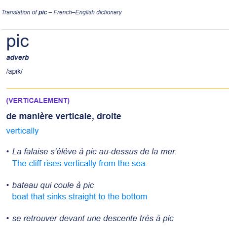
[SOURCE: Cambridge Dictionary, Cambridge University Press & Assessment 2026 , ^https://dictionary.cambridge.org/dictionary/french-english/pic]
So, meaning… ‘good summit‘ en français? Voilà…!
That French Connection?
“Louis Francis Barrallier (1773-1853) is believed to be the first European to see Bonnum Pic. He had been a Brevet Lieutenant-Colonel in the French Army who then escaped the French Revolution of 1789 and the subsequent ten-month Reign of Terror of mass public executions (September 1793 to July 1794). He was trained by his father in engineering and surveying. Having acquired the patronage of the politician Charles Francis Greville, Francis arrived in New South Wales in November 1799 with hopes of employment
In November 1802 he was directed by Governor King to find a way over the Blue Mountains to the west of Sydney.
As a colonial explorer, Francis Barrallier set up a base camp and supply Nattai Depot on the Nattai River (located possibly just west of historic village of Oakdale), situated northwest of Picton) in October 1802 during his expedition to find a crossing across the Blue Mountains. The depot was built as a secure staging post and resupply depot on the eastern side of the Burragorang/Nattai region to store provisions before pushing further toward the Wollondilly River and the peaks beyond.
Barrallier on his expeditions was accompanied by four soldiers and five convicts, plus local Aboriginal trackers. Barrallier used the depot twice to replenish supplies and make excursions down to the junction of the Nattai and Wollondilly rivers, officially documenting and naming features of the Nattai landscape.
Barrallier made three attempts to cross the mountains from his depot in Nattai.
The first two (attempts) were west across the Wollondilly near Yerranderie and up Christy’s Creek off the Kowmung. The actual route is disputed. However experts agree that his finishing point was “towards the head of Christy’s Creek, about 15 or 16 miles in a direct line southerly from Jenolan Caves”. On the 3rd journey, commenced in Dec 15, he went up the Wollondilly to a point not far up past Bonnum Pic which he described as “a mountain very remarkable on account of its pyramidal form” and which his map exaggerated as a “Peak about one and a quarter mile high”.
SOURCES:
‘Bonnum Pic‘, ^https://actelan.com/oldsite/walks/pages/2014-02-21%20Bonnum%20Pic.html
‘Barrallier’s Journal‘, ^https://gutenberg.net.au/ebooks12/1203731h.html
‘Francis Barallier & the Bindook route, 1802‘, in book ‘Crossing the Blue Mountains’, ^https://infobluemountains.net.au/history/crossing_bar.htm
‘Oakdale, New South Wales (history)‘, ^https://camdenhistorynotes.com/category/oakdale/
‘Ensign Francis Barrallier, an-engineer and explorer‘, Australian Dictionary of Biography, Australian National Library, ^https://adb.anu.edu.au/biography/barrallier-francis-louis-1745
[v] The generic benefit and wisdom of Analysis
We have an unpaid career interest in Outdoor Recreation including Tour Operating, now benevolent due to government unaffordable red tape imposts. We also have varied academic qualifications and a lifetime career experience in the Analysis profession.
This website is a benevolent venture and one does not seek, nor accept, any financial gain. All content herein this article (and this website) is subjective, so readers can take it or leave it, and indeed start up their own alternative blog if they hold differing views; indeed, more the merrier!
[D] So What Happened to Lily?
[D1] It is still early days as we write and we still don’t yet know. Reportedly the search crew(s) found Lily deceased in dense bushland (presumably below the cliffline escarpment of Bonnum Pic Trail) eight days after her family had immediately reported her missing on the hiking trip to the Emergency Triple Zero authorities.
[D2] Lily’s cause of death, circumstances and details have not yet been officially confirmed legally/publicly. Acknowledged, the family is presumable still in shock and grieving her loss.
[D3] Sketchy and conflicting media accounts (including misinformation – not disinformation) publicly reported has been of the presumption that Lily likely became disoriented as darkness set it and accidently fell off one of the rugged cliff escarpment edges with a series of perilous unfenced drops. Yet such factual evidence has not yet been publicly confirmed as investigated by NSW Police (being the NSW Government authority in charge of and ultimately responsible this search and rescue effort).
[D4] Recent media reports since have stated that Lily accidently fell off a cliff during her return hike from Bonnum Pic to the trail starting point at the car park at Wanganderry Pass Trail.
Her exact fall location has not been reported. However, based upon the trail section towards the summit of Bonnum Pic which skirts the cliffline escarpment edge, it would seem probable that this precarious upper section would have been likely from where she fell over the western edge. The “slide of death”? See image below.
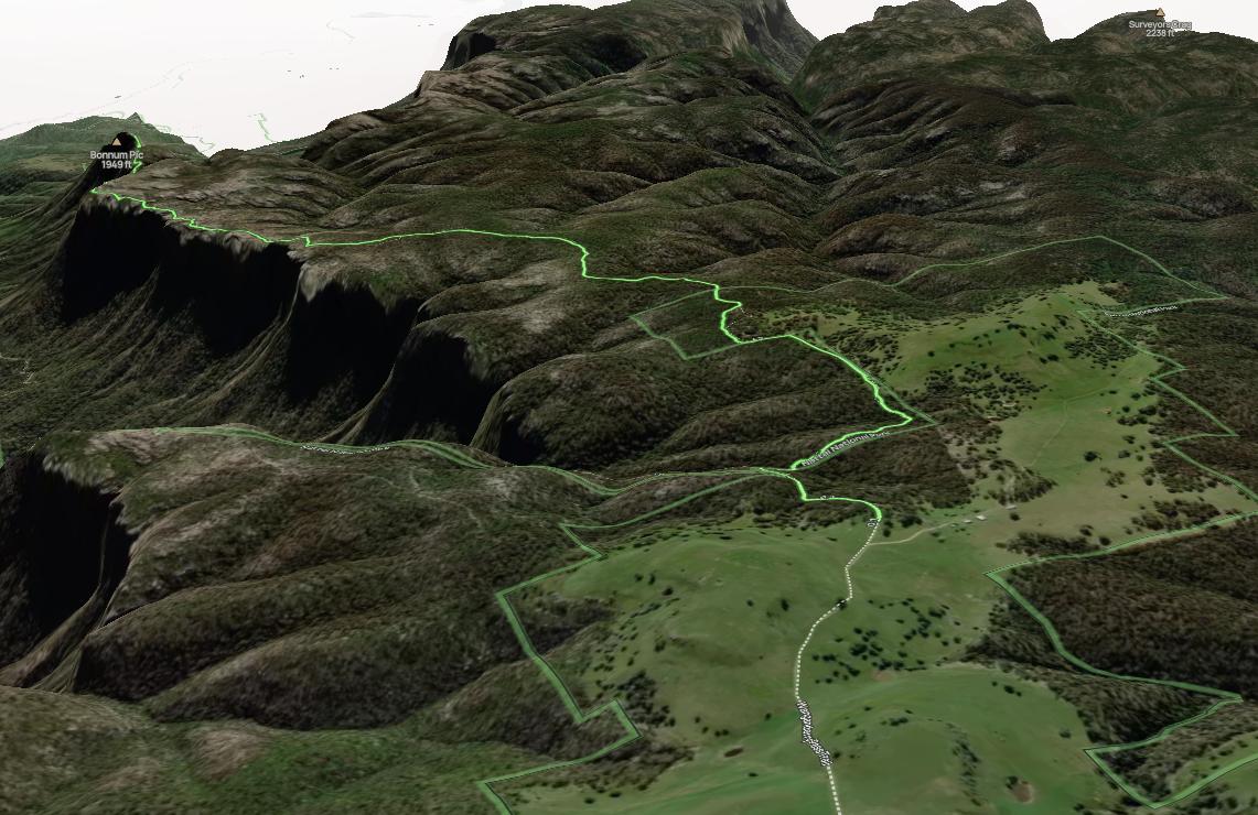
[D5] So then, presuming that Lily did fall off a cliff, we posit a few pertinent questions.
- Is the Parks’ Service “Bonnum Pic Trail” actually a hiking trail or in reality being rated Grade 5 Difficault by All Trails indeed a rock scrambling trail, so bordering on bush bashing and rock climbing, so demanding comensurate experience and rope gear?
- Bonnum Pic Trail has a NPWS sign so suggesting it is a hiking trail, yet the official NPWS website does not include it as a suggested activity in the Nattai National Park. Check: ^https://www.nationalparks.nsw.gov.au/visit-a-park/parks/nattai-national-park
Of the two walking options are promoted as follows:
Bonnum Pic Trail is not mentioned, so effectively it is officially ‘off-grid’, so wild bushbashing and free for all rock scrambling into wilderness.
- Given the media reports that Lily had fallen off a cliff into dense scrub below, we don’t know from which trail location nor how far she fell. Yet given the steep and deep terrain would any gear have protected her from such a fall? It is not publicly known at this time of writing. The facts may never be publicly known. Why not given the plethora of visitors continuing to hike Bonnum Pic Trail? [See our section below in References and Further Reading, item [18] ‘Published reviews of Bonnum Pic Trail by hikers.’]
[D6] Media reports confirm that Lily had made it to Bonnum Pic because she had phoned family to confirm mid-morning that she had done so.
The problem is with her then return hiking route from ‘the summit’ in the reverse direction. Reverse hiking the same outbound trail always looks quite different when inbound. A skill learned by advanced hikers and trekkers is to at key trail junctions, look backward to the trail you just came to try to recognise the way back.
GPS navigation technology to identify and digitally capture the waypoints and routes whilst outbound is incredibly useful/vital even if you have such advanced GPS devices, knowledge and ecperinec of using them and the ready funds to pay for the fancy expensive devices in the first place!
Also, time passed from prior trips of the same route previously taken can fog memory. This is especially as a participant of a trip leader with whom a follower participant hiker relies upon to trunch on subservient there and back, yet at the time such reliance does not focus on the “what then in future should I have to navigate and lead this trail there and back?”
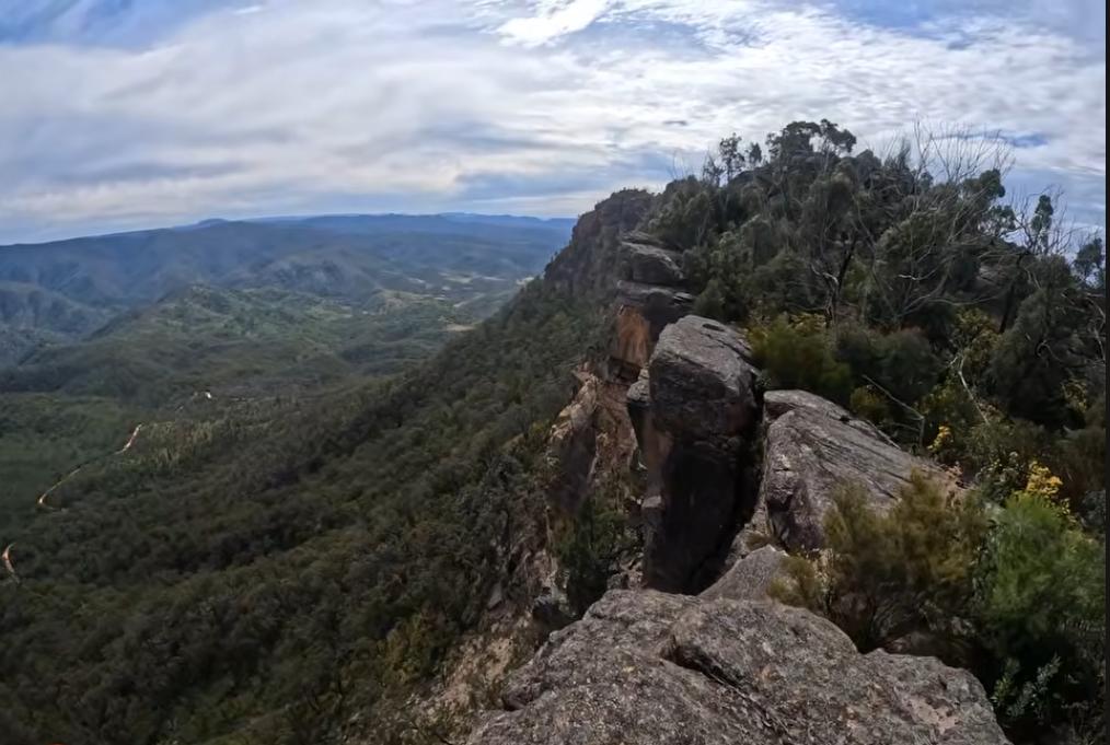
Bonnum Pic – extreme exposure approach…and return
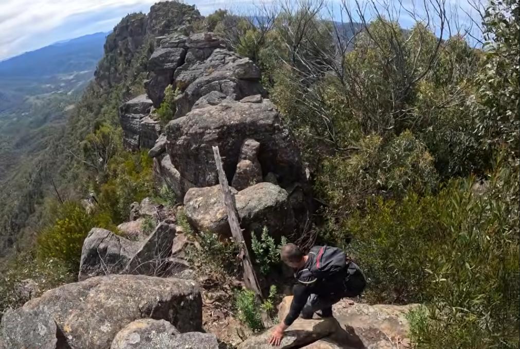
Gets worse
[E] Type of this Hiking Trip?
[E1] Why choose Bonnum Pic Trail? This is not publicly reported so the reason is unknown to this author.
Presumptive logic would suggest perhaps:
- Ready proximity to Oakdale
- Previous familiarity (attempted this trail previously?) – this is not confirmed
- A manageable day hike (hiking 7 hours return – reportedly)
- A challenge
- Wilderness experience
- Nattai (wilderness) National Park is geographically adjacent west of Lily’s family Oakdale semi-rural old (1870s) village, so to an outdoor enthusiast Nattai would be a regular trip lure.
- The Bonnum Pic Trail offers wild natural panoramic scenery from a ridgetop.
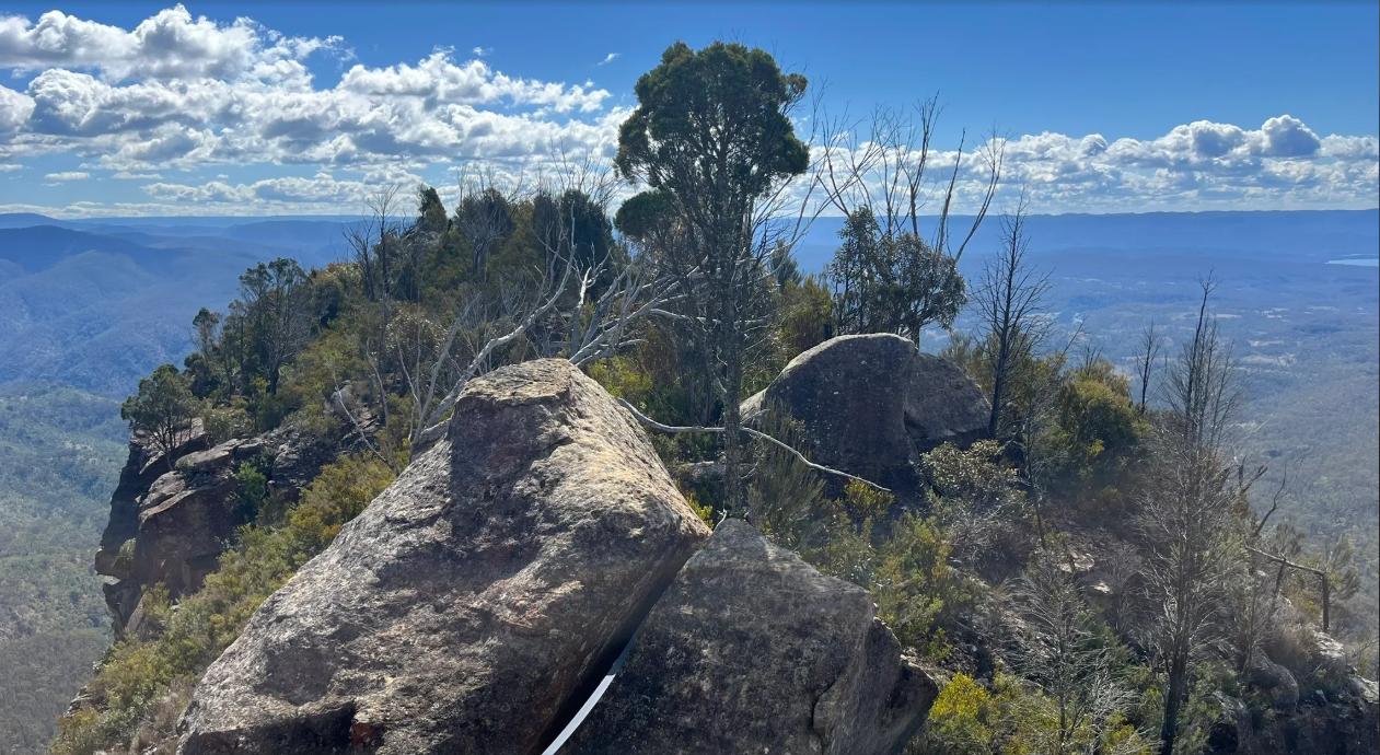
Bonnum Pic peak (All Trails, Photo by hiker Lynette Said)
[E2] The Area of this Hiking Trip
The area is in the Nattai National Park of the Blue Mountains region in Australia.
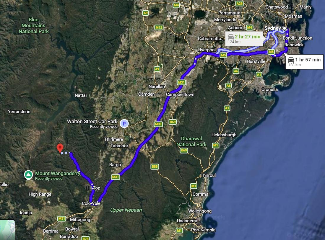
Nattai National Park aerial location map from Sydney – see red Google Location Pin on map above.

We note that a backroad network between Lily’s home at Oakdale comprises what has been recently amlgamated into a tourism ‘Greater Blue Mountains Drive’, like mostly the road she drive to her Hiking Trip Start car parking location.
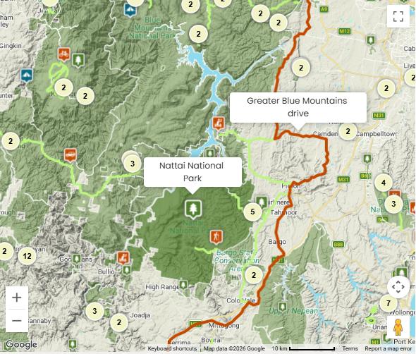
[E3] The transport route to the start/end of Bonnum Pic Trail
This aerial map shows the most direct road route between Oakdale and the car park start/finish approachng Mount Wanganderry.
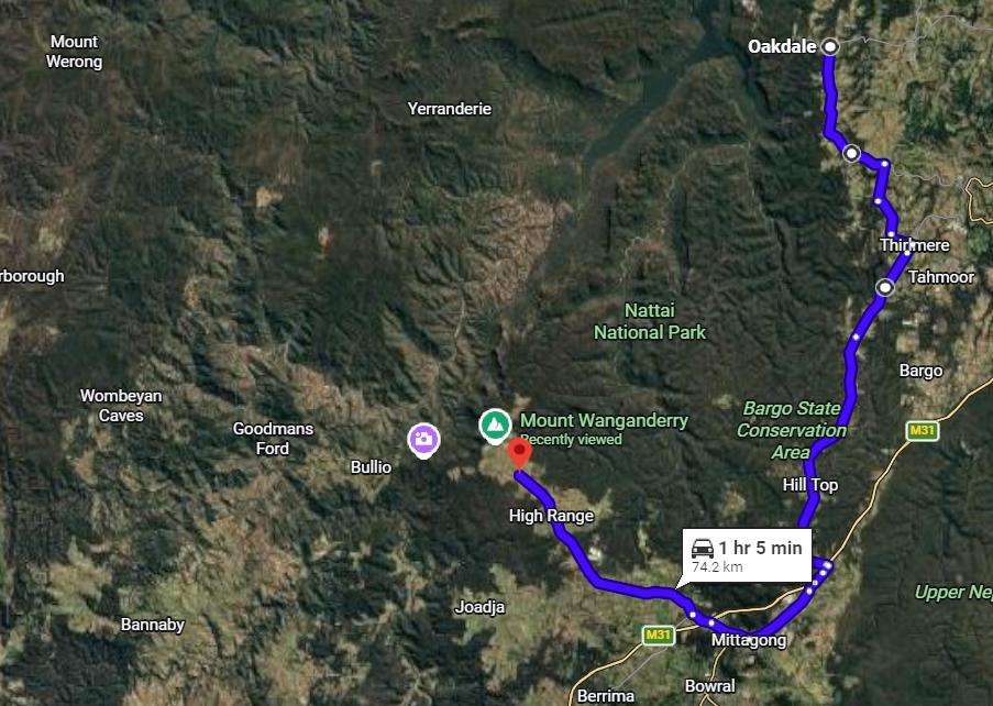
The transport access to Bonnum Pic Trail is via Wombeyan Caves Road, then northward along Wanganderry Pass Trail to a locked gate (courtesy NPWS) termed ‘Wanganderry Road Car Park’, where there is a road base gravel car parking small area (but no facilities, except a sign). This is effectively the trails start and finish (being a one-way hiking trail, not a loop.)
The local route from Oakdale to this car park avoids joining the busy Hume Motorway (M31) using counrty roads instead and the road distance each way is a reasonable 74km.
The AllTrails website provides useful guidance and mapping of the trail itself. The website is accessed by subscription.
[E4] The particular trail is referred to as Bonnum Pic Trail. This hiking ‘trail’ is remote and rough and mostly ascends up along a clifftop escarpment line. Actually by all accounts, it is not a trail at all, but rather a bushbashing direction atop a cliffline, so good luck!
[E5] This trail is generally rated ‘Grade 5’ meaning ‘Difficult’ so suitable only for experienced hikers with suitable mapping or GPS technology kit with advanced usage knowledge.
[F] Characteristics of this Hiking Route?
[F1]: Nattai National Park?
“The NSW National Parks and Wildlife Service manages the 8 adjacent conservation reserves that make up the Greater Blue Mountains Area:
- Blue Mountains National Park
- Gardens of Stone National Park
- Jenolan Karst Conservation Reserve
- Kanangra–Boyd National Park
- Nattai National Park **
- Thirlmere Lakes National Park
- Wollemi National Park
- Yengo National Park.”
Nattai National Park?
The NSW Goverment’s official website of its ‘Parks Service’ (NPWS), as delegated governmental custodian of the Greater Blue Mountains World Heritage Area, represents the Australian Government as being responsible (and accountable) to UNESCO’s listing in 2000.
^https://www.nationalparks.nsw.gov.au/visit-a-park/parks/nattai-national-park
Of note, the Bonnum Pic Trail does not get a mention on the website. Yet there is a Bonnum Pic Trail hiking sign of the Parks Service in situ.
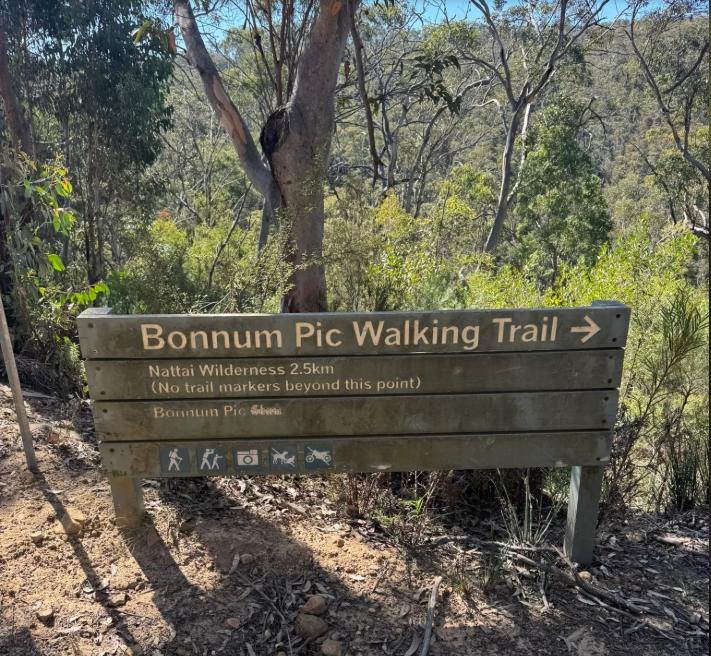
Bonnum Pic Trail hiking sign of the Parks Service. [Photo: All Trails, by hiking contributor Ben McAleer 27th April, 2026].
So Parks Service here is hypocritically inviting hiking visitation of Bonnum Pic so-called ‘trail’ to go somewhere in this direction with “no trail markers beyond this point”. The distance of 2.5km indicated suggests this is close to the final destination of the peak itself along the clifftop edge. It’s akin to a Lincoln Rock or Lindeman Pass cliff fall exposure hazard on steroids! Go figure!
So how is the NSW Government not liable for Lily’s demise given that she attempted this official trail and fell off a cliff to her death along the way?
F2: Bonnum Pic Trail – an overview
The location of the so-called ‘Bonnum Pic‘ is an isolated ridgepoint tip peak situated in the remote Nattai National Park (within the Blue Mountains world heritage Area) and is about 25km (as the crow flies) northwest of the township of Mittagong in the Southern Highlands region of New South Wales.
The following topographical map index extract from NSW TOPOGRAPHIC MAPS (former Lands Department NSW, now called ‘Spatial Services’); shows the general location of the Bonnum Pic geographical feature on the HILL TOP 8929-2N topographical map, published in 2006 in 1:25,000 scale – that being 4cm on the map = 1km on the ground. See yellow circle below.
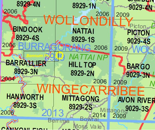
Relevant extract of ‘Index NSW Topographic Key Map‘. [SOURCE: ^https://www.maptopia.com.au/topographic-maps/new-south-wales-topographic-maps-NSW-buy-topo-maps-NSW]. Nature Trail possesses every printed topographical map (1:25,000) covering the Blue Mountains World Heritage Area – for each map we have double-sided laminated in Contact adhesive.
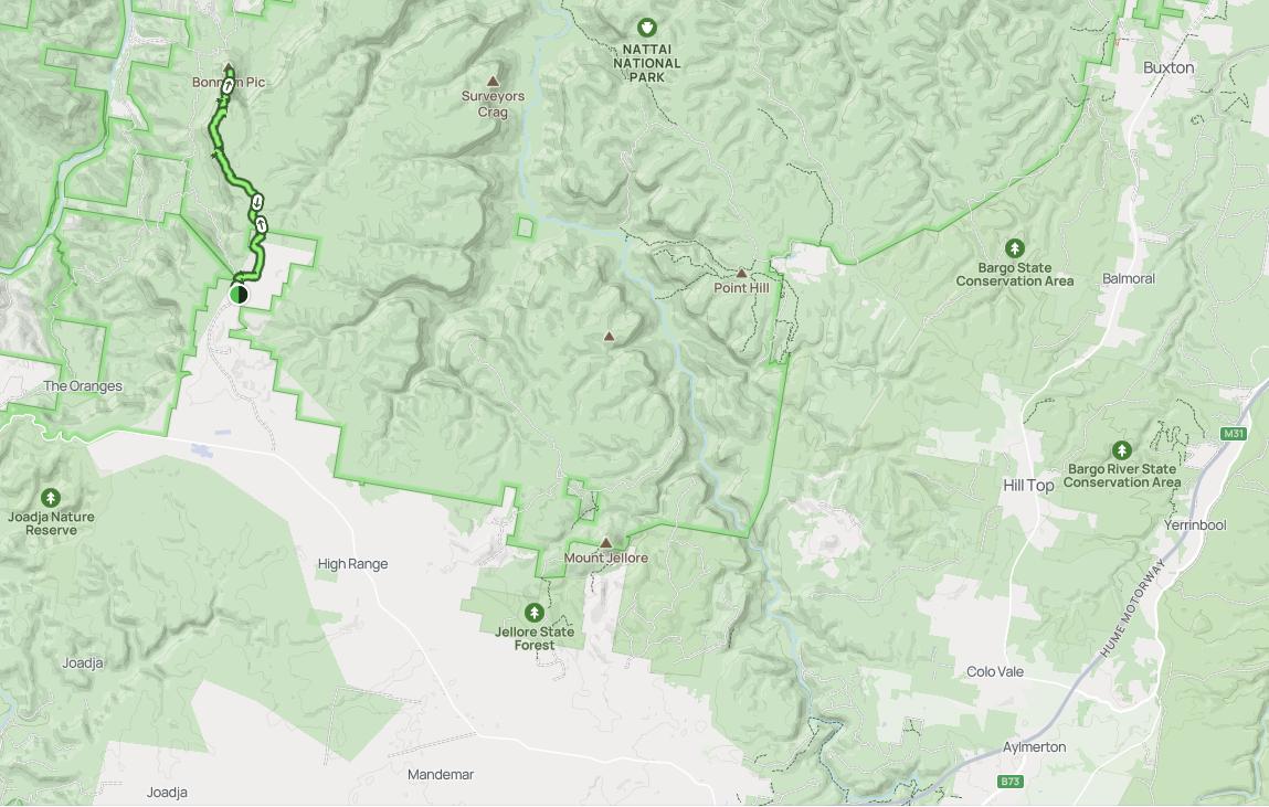
Bonnum Pic Trail (small scale/high level mud map view – left side of above image). [SOURCE: All Trails website]
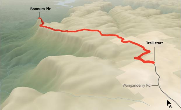
The geographic coordinate system (GCS) co-ordinated for Bonnum Pic are: -34.254823, 150.260366 (being latitude, longitude order, with accuracy down to a square metre)
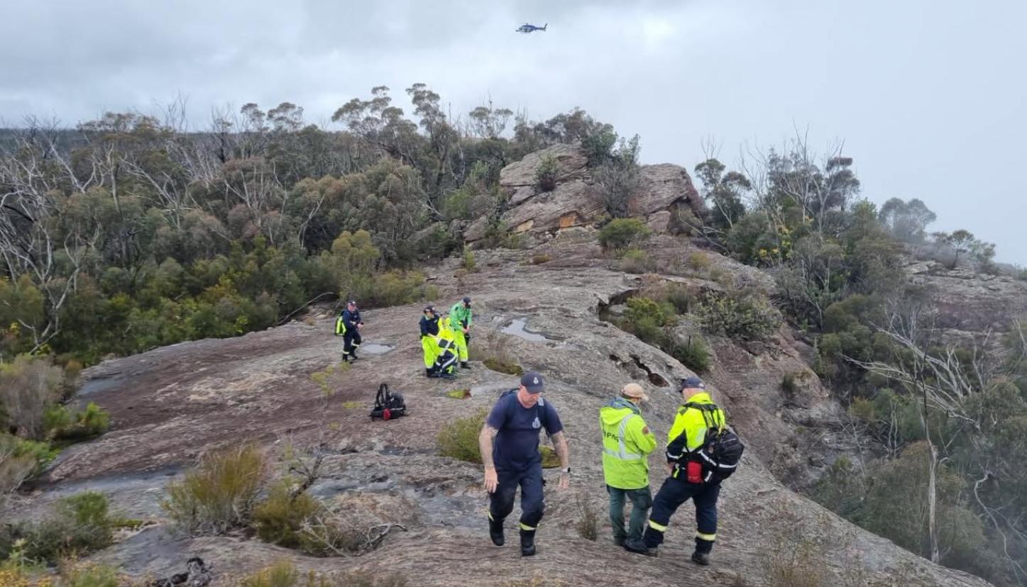
[F3]: It’s a renowned difficult hiking (bush-bashing trail with exposure)
A popular Internet source about the characteristics of the Bonnum Pic Trail is the All Trails’ website’s webpage, which states:
“Experienced bushwalkers seeking a rugged wilderness test in Nattai National Park will find a formidable challenge on the track to Bonnum Pic. The route follows a dramatic sandstone ridgeline but requires significant self-reliance, as post-fire regrowth has made the trail overgrown and difficult to identify, often necessitating heavy bush bashing through prickly scrub.
Navigation skills and a GPS are essential, as the path frequently disappears.
The final approach to the peak involves hazardous rock scrambling with significant exposure, and some hikers recommend carrying a rope to safely negotiate the steep, exposed sections.
Those who manage the technical terrain are rewarded with commanding views over the Nattai Gorge and surrounding cliffs.”
[SOURCE: ^https://www.alltrails.com/trail/australia/new-south-wales/bonnum-pic]

A graphical 3D software animated hybrid aerial view of the Bonnum Pic Trail looking northward from the approach up the cliff escarpment ridgeline climb toward the peak edge (left of image) of Bonnum Pic itself. [SOURCE: ^https://www.alltrails.com/trail/australia/new-south-wales/bonnum-pic]
The above image representation shows a high-level view of a difficult, if ot treacherous non-track trail route along a perilous cliff edge towards the final ascent. Lily made it to the summit, but not back.
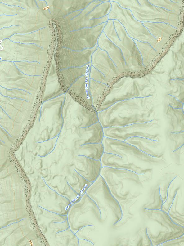
This topographic map shows to the top (north) the steep contour cliff edge either side of the razor back characteristics of the ‘deadend’ ithsmus-type approach to the tip that is Bonnum Pic. [Source: All Trails, map obtained from NSW Topographical Maps website].
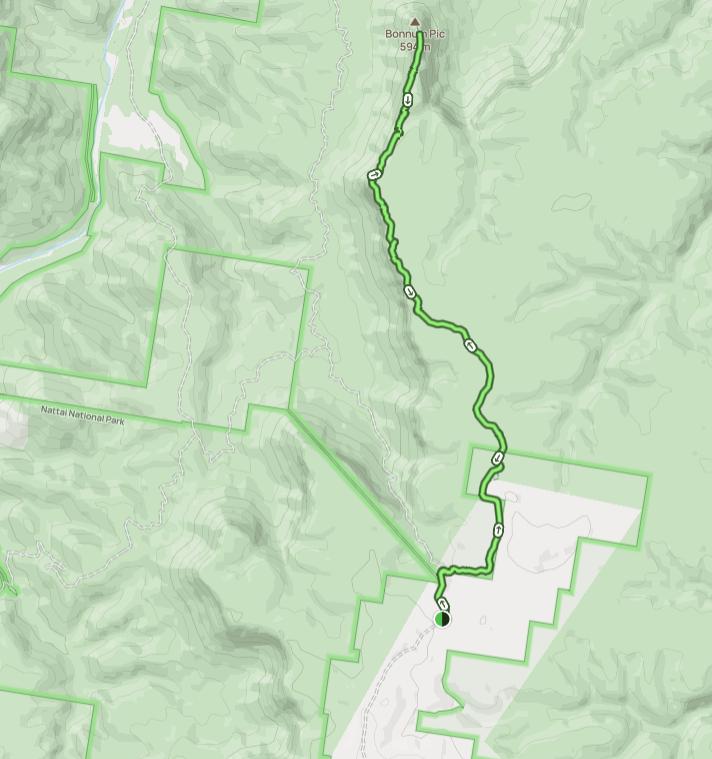
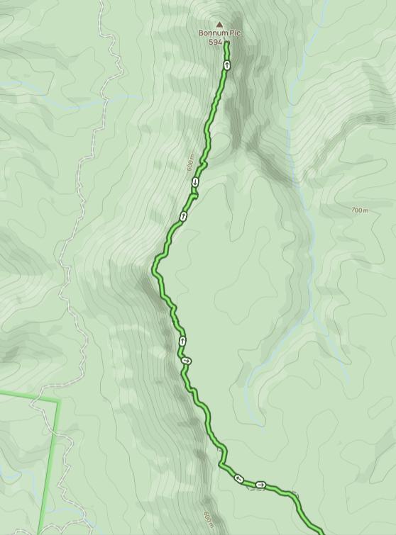
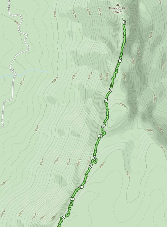
We note the mention above of the following cautions to prospective hikers about the precarious condition of the trail:
- Post-fire regrowth has made the trail overgrown
- (This trail being) difficult to identify
- (This trail) often necessitating heavy bush bashing through prickly scrub
- Navigation skills and a GPS are essential, as the path frequently disappears.
- The final approach to the peak involves hazardous rock scrambling with significant exposure (to cliff falls)
- Some hikers recommend carrying a rope to safely negotiate the steep, exposed sections.
F4: Bonnum Pic Trail is pure rock scrambling
- Rocky exposed ridgeline, no lookout fencing
- Wild and remote
- Grade 5 ‘Difficult’
All Trails’ website:
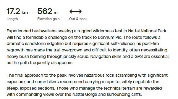
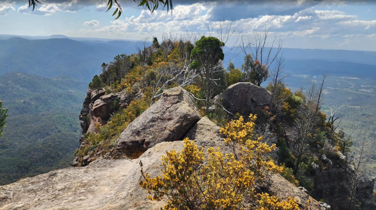
Bonnum Pic peak (All Trails – Photo by Iveta Valentova, Sep 2025)
[G] Trip ‘Group’s’ Experience and Knowledge?
- It appears that there was no ‘group’ on Lily’s hiking trip, instead this was a solo hiking trip by Lily only.
- It is not known to this author about Lily’s hiking background, experience, or outdoor recreation training, or qualifications if any.
- Lily’ previous knowledge of this trail is not confirmed, however media reports (Facebook) suggest she had undertaken this trail once previously.
- Not known was Lily’s situation – fitness, health, motivation, expectations, guidance, footwear, hiking attiure, day hiking kit, carried in drinking water, sustenance head space, pressures/deadlines, choice framework, risk tolerance, etc? Such knowledge may be with family, search and rescuers, NSW Police Rescue recovery crew, the NSW coroner (there are many in the NSW Coroners role by the way). At the time of writing, Her Honour Magistrate Teresa O’Sullivan is the New South Wales State Coroner.
[H] Trip Research and Preparation?
- This is not known to this author at the time of writing.
- However, for many young hikers, the Internet tends to be the ‘go to’ popular reference source for enquiring and researching potential hiking trails.
- Such privately operated website are of course not official (ie: not government run in the case of visiting/hiking national parks in Australia. So such websites are private and at the behest of the website owner(s) to choose to publish what they wish. Such websites may not be updated for some months, nor provide professional trip guidance, evaluation, nor planning information. They are usually brief and yet include feedback from actual hikers who have hiked the trail, which should be beneficial but treated with a grain of salt.
- One such privately operated website focusing on hiking trail information specifications, mapping and feedback is All Trails, whihc has an Australian dedicated subdomain – check: ^https://www.alltrails.com/trail/australia/new-south-wales/bonnum-pic. We note that this website charges a subscription for all its trails information at a current rate of just AUD $36/year.
- Mind you, if you take a peak at the official government website for Nattai (wilderness) National Park, one gets little useful information
- Then, if you take a peak at the official government website for bonnum Pic Trail inside Nattai (wilderness) National Park, one gets zilch. Government authority, responsibility, accountability – the three management core roles when this author undertook a Monash Univerity degree in business management, some years back now.
- The governmental custodian for Nattai National Park and the Greater Blue Mountains World Heritage Area has, since 2000 UNESCO’s enlisting, been delegated by the Australian Government downstream to the state government of New South Wales utterly! In turn, that delegation has similarly been sub-delegated by the NSW Government to its department ‘NPWS’ (NSW Parks and Wildlife Service). Such is a misnomer with a disgraceful reputation for ecological custodiannship and chrionicially lacks adequate funding from both the NSW Govrenment and the Australia Government to do jack shit about compliance with its World Heritage ‘authority, responsibility and accountability’. The NPWS is a parks service akin to mowing and leaf-blowing urban parks, no more. The NPWS deserves to be discredited for its decades of chronic neglect, mismanagemen, ecological harm, misappropriation of public funding from its environmetal conservation charter to some ongoing political tourism mindset (which smells corrupt) and so disgraced and wound up ASAP.
[I] Trip Hiking Conditions?
[I1] Trail conditions?
Reportedly overgrown (by All Trails website and its feedback hiking contributors who have hiked this trail). [See our section below in References and Further Reading, item [18] ‘Published reviews of Bonnum Pic Trail by hikers.’]
“Conditions: Bugs, Rocky, Scramble, Unmarked”
[SOURCE: Daniel Wood, Jan 10, 2021, a ‘trailgoer’ review comment on All Trails website.]
We note that this area was decimated by the summer 2019 widespread wildfires throughout the Greater Blue Mountains World Heritage Area. Such fires were deliberately abandoned by the government custodian, the NSW National Parks and Wildlife Service, which treated the devastating incineration as a defacto ‘hazard reduction‘.
Of course, subsequently by 2026 the trail had been overgrown, if not recognisable, unmaintained, and so extremely difficult to navigate by hikers like Lily.
Government negligent culpability or what?
Our Questions:
- Was the exacerbated regrowth due to NPWS recent hazard reduction/ habitat destruction?
- Was such hazard reduction contributory to Lily’s track finding disorientation and to ultimately her demise?
- Was such hazardous rock scrambling and bushbashing contributory to Lily’s demise?
- Were the NPWS trail signs and markers an act of official deceptiveness that contributed to Lily’s heightened positive expectations and to her tragic demise?
- The coroner of course won’t conclude that, but more likely claim accidental death.
- Next Blue Mountains outdoor recreational victim?
[I2] Weather conditions?
A nearby weather station to Bonnum Pic is at Yerranderie which is located just 10km northward (see map below).
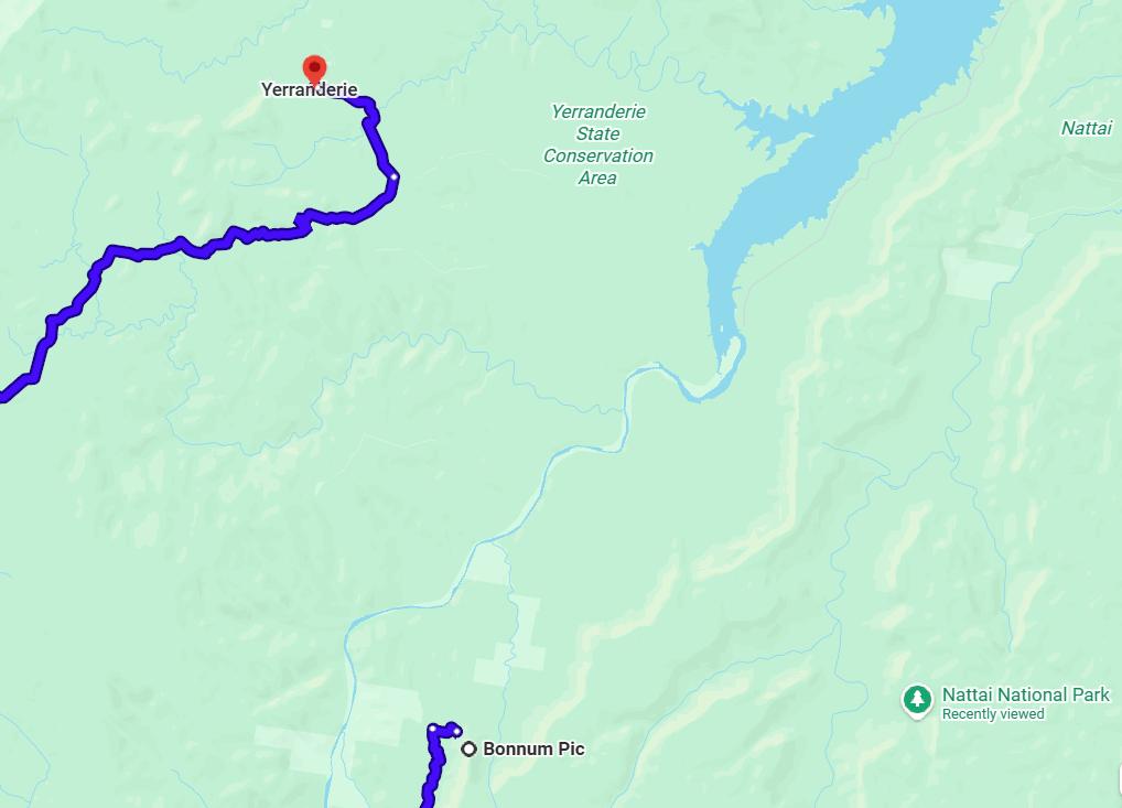
Yerranderie (historic ghost village run by NPWS) is situated about 10km north of Bonnum Pic as the crow flies, but the public access road and trail between Yerranderie and Bonnum Pic is a 283km loop each way.
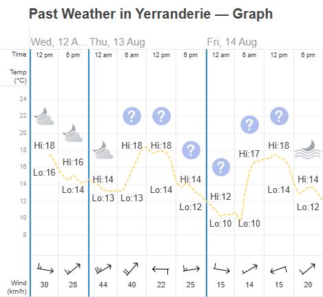
The actual weather at Yerranderie (594 metres elevation) on the day Lily was hiking at Bonnum Pic (12th August 2026) was rather mild and benign for winter in the Blue Mountains. [SOURCE: ^https://www.timeanddate.com/weather/@2142303/historic ]
A closer weather station to Bonnum Pic is at ‘High Range’ located about 300m east of Mount Wanganderry’s summit, which is itself located just 7km southward of Bonnum Pic. (see map below).
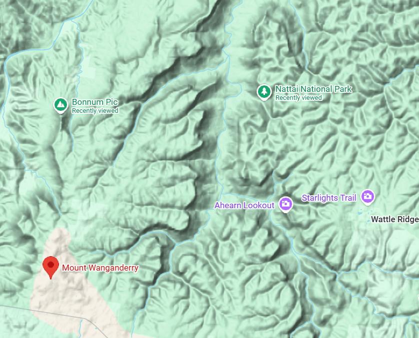
The following actual weather records at High Range (Mount Wanganderry) from the Bureau of Meteorology (BOM) are as shown below. Note: 12th August 2026 being the day Lily was hiking. The temperatures are much lower, especially overnight down to 5o Celsius. The elevation of Bonnum Pic is 594m being 237m below the elevation of Mount Wanganderry at 831m, or in comparative terms Bonnum Pic is 30% lower in elevation than Mount Wanganderry. Plus note the actual recorded wind gust speed approaching 60kph (see below).
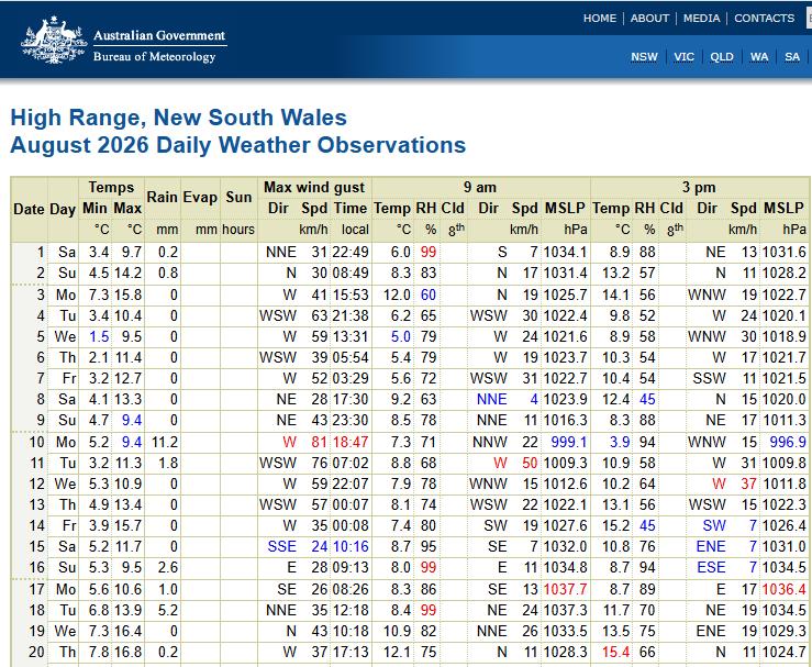
[SOURCE: ^https://www.bom.gov.au/climate/dwo/IDCJDW2164.latest.shtml], [Accessed 2026-08-28]
Now, the combination of low temperatures with high wind gusts contribute to a wind chill factor. So consider the following calculation:
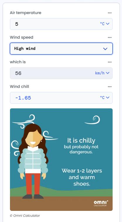
Wind Chilll Calculator [SOURCE: ^https://www.omnicalculator.com/other/wind-chill ]
Whilst Bonnum Pic is not as high as High Range, this does indicate that the cold weather could have probably been one causal factor contributing to Lily’s hiking demise, depending upon the thermals she was wearing, and how the cold may have affected her state of mind at the time.
Details are not known.
[I3] ‘Last Light’ at Bonnum Pic?
Darkness in remote areas is typically pitch black. Outdoor Recreation trip planning necessitates allowance for last light, plus professionally allowing a few hours buffer in reserve beforehand for contingencies (unexpected delays) so as to safely time the end location of a remote trip, such as hiking.
The actual Last Light schedule at the BOM’s nearby ‘High Range’ weather station on 12th August 2026 was approaching 6pm, being in mid-winter, so featuring shorter daylight hours than during summer. See simple table extract below.
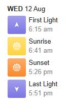
‘High Range ‘Sunrise / Sunset Times [SOURCE: ^https://sunrisesunset.willyweather.com.au/nsw/greater-western-sydney/high-range.html [Accessed 2026-08-28]
Media Report Extract:
“When she (Lily) hadn’t returned by 10pm she was reported missing and inquiries to locate her began immediately by officers attached to The Hume Police District.
About 11pm, Lily’s car was found parked on Wanganderry Road, near the start of the Bunnum Pic Walking Trail at High Range, and a command post was established. Initial inquiries indicate Lily reached the summit of Bunnum Pic about mid-morning; however, there’s been no further contact since that time.”
SOURCE: See above ARTICLE #5: ‘Search continues for missing bushwalker – Southern Highlands’ (Saturday, 2026-08-15, NSW Police media website).
Our presumptions, questions and comments in hindsight about this unexpected scenario are as follows:
- Day Trip: Lily’s hiking trip was presumably intended as a day trip duration, not to be an overnight trek involving camping.
- Trip Plan: It is not known whether Lily prepared a hiking trip plan for this activity in advance. Lily wisely should have made a Trip Plan, which necessitates trip research (route, hazards, risks, closure alerts, fitness and skills required, etc), plus trip preparation – a realistic transport route/schedule, hiking route/schedule, conditions forecast, carrying a full day hiking kit, kit required, trail and weather conditions, plus packed allowances for contingencies – 2+ litres of drinking water, food sustenance, thermals, full body raingear, head torches x 3 (with batteries), a benighted kit. Such is profesional outddor recreational protocol, which may not have been known to Llly. (Not her fault)
- Backup Emergency Coms – a current and tested Personal Locator Beacon (PLB) is invaluable. PLB’s however cost around AUD$500 each yet only have a now 14-year life span, given battery replacement. Check out the Sydney-based GME current version model ‘MT620GR‘ (^https://www.gme.net.au/au/plb/). Professional tour operators also take a satphone (for remote voice coms), yet the purchase cost and annual connection plan are prohibitive. (For instance Telstra’s current satphone offering is:
[1] SatPhone hardware device purchase: AUD$2400; plus..
[2] An annual connection plan: AUD $600-1300 p.a.
So, all up AUD $3700 just to be initially set up with a reliable satphone voice communication in remote areas using Iridium (global satellite communication network) and Telstra’s satphone device and satphone plan).

[SOURCE: Satellite Voice (Powered by Starlink)]
An affordable bargain for 18 year old outdoor wilderness adventurers? Not quite, but what’s the alternative?
- Trip Notification: This is not known, but a 10pm non-return deadline is unsafely too late to trigger contacting Emergency Triple Zero – Police (Rescue). We recommend handing a backup family member/trusted reliable buddy a copy of your full final Trip Plan, to agree to monitoring your schedule throughout the trip, to agree to maintain communications and especially deadline communications. This is a professional standard backup part of trip planning for any Outdoors Recreation trip, such as a hiking trip. Such is a recommended in Outdoor Recreational circles as for instance part of TAFE Outdoor Recreation training, compulsory in bushwalking clubs, mandatory with commercial tour operators, similarly with any private solo individuals/groups to have a Plan B contingency for incidents and emergency scenarios. It’s just part of sensible prepared risk management when venturing into the wild.
- “Initial inquiries indicate Lily reached the summit of Bunnum Pic about mid-morning; however, there’s been no further contact since that time.” This reported mid-morning coms timing (say 9am-10am) from Lily on the day of her hiking trip would have been encouraging. For Lily to have “reached the summit” she must have started early by transport and hiking to achieve that milestone destination.
- But something then afterwards (10am-10pm) happened to Lily. That is a 12 hour duration. What happened, where and when is not known to this author. Once media report (likely from NSW Police media) was that Lily had:
- Parked her vehicle at the Bonum Pic standard car park reached her outbound destinationOne still posits possible foul play.
- The 10pm time of calling Emergency to report Lily missing was tragically likely too late. It had been 4 hours after dark with no coms received from Lily.
A scenario emergency contingency scenario Coms Deadline Triggers:
-
- ‘I shall phone you by not later than 3pm that I have safely arrived back at my car at Wanganderry Car Park Start/End of Bonnum Pic Trail’
- ‘If you have not heard from me or been able to contyat and speak to me by 3:30pm, please consider an incident may have occurred to me’
- If you have not been able to contact me by 4pm then phone Emergency Triple Zero for Police to initiate a missing person search.
“When she (Lily) hadn’t returned by 10pm she was reported missing (presumably by her family) and inquiries to locate her began immediately by (police) officers attached to The Hume Police District.”
(To the credit of despatched police at) “About 11pm, Lily’s car was found parked on Wanganderry Road, near the start of the Bunnum Pic Walking Trail at High Range, and a command post was established. Initial inquiries indicate Lily reached the summit of Bunnum Pic about mid-morning; however, there’s been no further contact since that time.”
[J] Hiking Decision Making?
[J1] Before the hiking trip
- As yet unknown by this author from media reports, authorities, or may be others closer to Lily
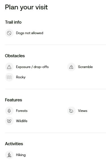
[J2] During this hiking trip
- As yet unknown by this author from media reports, authorities, or may others closer to Lily who received communications
[J3] Changed circumstances enroute?
- As yet unknown by this author from media reports, authorities, or others closer to Lily
- Media reports also indicate that Lily had contacted her parent’s mid-morning on the day of her hiking trip (12th August 2026) to inform them that she had successfully reached her destination of Bonnum Pic.
- Media reports indicate that Lily’s parked car had been found by police at the expected start/finish car park to Bonnum Pic Trail (Wananderry Pass Trail car park) at 11pm that night on the day of her hiking trip (12th August 2026)
- So, what happened to lily after that is unknown to this author from public media reporting, yet others may know more – particularly of search and rescue crews.
Questions/Presumptions Posed:
[J3.1] What type and model of smartphone did Lily have with her on this hiking trip?
[J3.2] Was Lily’s smartphone be a recent model that included GPS navigation/ emergency 000 coms with her on this hiking trip?
“Your iPhone uses GPS and built-in satellite hardware (on iPhone 14 or later) to connect with emergency services when you are completely off the grid without cellular or Wi-Fi coverage.” [SOURCE: ‘Use Emergency SOS via satellite on your iPhone‘, Apple, ^https://support.apple.com/en-au/101573 ]
[J3.3] What smartphone telecommunications network had Lily subscribed to? Reportedly she phoned home upon reaching Bonnum Pic, so that indicated that her smartphone reception was working to be abel to achiev that vital communication in hindsight.
But then why could Lily not be contacted subsequently?
But then why could despatched emergency NSW Police Rescue (co-ordinating the official search and rescue operation) not then quickly locate her via her phone GPS signal?. This given that they had successfully discovered her parked car at the standard Wanganderry Pass Trail car park within a hour of the family’s Triple 000 call.
[J3.4] What was the smartphone network range and functional communication access along the Bonnum Pic Trail, and specifically during the duration of Lily’s hiking trip?
So many critical search and rescue questions still remain unanswered at this time of writing.
[K] Posited Scenarios/Alternates?
Well, it depends upon a number of factors associated with the participants – such as their available time (dates, number of days), preferred interests, trip expectations, their trekking experiences (recently), their self-sustaining trekking kit and their trekking abilities, trekking fitness and health condition.
- Hiking timing?
- Alternative trails?
- Hiking group participation?
- Overnight camp options due to transport distance from Oakdale?
Often, there are alteratives that are superior in meeting the expectation of participants, rather than the particular suggested initial option, such as not Bonnum Pic Trail.
[L] Any Lessons Learned?
[L1] Nothing will bring back Lily. Her memory must be a solace. There is no more here to say about Lily specifcally on this very personal tragedy.
[L2] So, what take-home insights may be relevant and apt for others, all with the benefit of hindsight of course? That is for each of us. Yet can we not turn hindsight into wisdom so to save another? It’s not about in any way to even try to seek to turn a negative into a positive out of tragedy, like some ‘case’. As previously mentioned, from one’s experience, truly human nature from loved ones conceding deep personal loss is to ultimately message others that such does not happen to anyone else.
[L3] The definition of wisdom:
“According to the Oxford Advanced Learner’s Dictionary, wisdom refers to the capacity to make sound judgments and decisions, often derived from accumulated experience and knowledge. It encompasses not only intellectual understanding but also practical insight into life and human behavior. For example, someone may be described as a person of great wisdom if they provide thoughtful guidance or advice in complex situations.”
That’s a good start, generically. At Nature Trail, specific to learning from wisdom in our hiking/trekking context, we posit that gaining wisdom remains a lifetime worthy pursuit irrespective of age. Additional concepts of wisdom in such best practice outdoor recreation as follows:
[A] Wisdom gained from doing new things – experience by participating, observing others, then advancing to leading a group (just 1+ equals a group) of others. It is because the latter: ‘leading’ = teaching, and by teaching the skills, one re-inforces and refines the knowedge of what best to do (before, during, after, and then next times…)
The best commercial pilots are sourced from the discipline of being Flying Instructors for a few years after qualifying as commercial pilots, not just from pilots having lots of hours on their log book doing things repeatedly solo. It is important to have made mistakes in the field and to have learned from them. I went into part cloud 5 octas flying a solo ‘work area‘ around a pastoral and hilly Lilydale Airport back in 1988, scaring the shit out of me of becoming lost in cloud in VFR. I had my gut feel spatial awareness of where I was flying in that 172 Cessna, but only 4 circuits there prior. With a luckly break in the cloud I regained recognised surrounds and managed to make it back landing on the grass strip, but it was shit scary. I was still an unrestricted private fixed wing novice student pilot, not long after gaining solo accreditation. I was aged 25.
[B] Wisdom gained from relevant conceptual and theory training – initial safety in-class listening like a high school student to the teacher up front – like what is this all about?, getting issued instructive notes and and taking notes. Deep end learning new stuff!
[C] Wisdom applied in the field – out hiking to try those Outdoor Recreation lessons learned in the classroom, and find out in a remote location that one needs to be more prepared than the safety of class guidance. Nature is not always blues skies and calm. Always rely upon common sence and early trigger notions of dodgy ideas by others, and recognise and learn wisdom well away of the bullying of negative leadership. [One attended RMC Duntroon, so well familiar with such psychological bullying harm.]
[D] Wisdom from experiencing different trips with different mindsets, and life/career experiences – One can walk around the block many times and get to know every bush; the first time is the best experience because you are learning what’s around. Subsequent trips become just for the exercise and for rehashing internal unrelated thought processes or for engaging with the neighbours, but not for learning the same route.
To rehash a cliché, ‘variety is the spice of life‘.
One’s suggestion is ‘don’t try to reinvent the wheel’ (guilty of another cliché), but apply your risk desire not for parachuting out of an aircraft type stuff, but cerebrally to risk exposed to different trips, in different splaces, lands, under the guidance of differenty trip leaders (many opinionated and querky from experience). Such deliberate yet cautious exposure to different unknown challenges enarmours you to better judgemental capacity of people and situational awareness, like when the risk is so inituitive to dare to say NO!
[E] The combination of all the above applied in reality – with the variants that entails over years. It would thus be unlikely for any 18-year-old to have such collective wisdom. At 62, this writer continues to learn wisdom, actively.
[M] What Would We Have Done?
Quick answer: Not gone woop woop!
Nature Trail is a tour operator based in Katoomba in the Blue Mountains since 2018, though having experienced hiking the Blue Mountains since 1993. We operate these days benevolently, due to NSW Government fee imposts that cumulatively make it unviable for us to trade commercially. Franky, such government greed and bullying doesn’t bother us since we never intended to undertake our tours for financial gain anyway.
Nature Trail has developed policies and procedures for its operations includng for hiking and for trekking. A key policy stance is to clarify and adhere to what we DON’T do.
We don’t go into the great outdoors to woop woop and ‘just do it’.
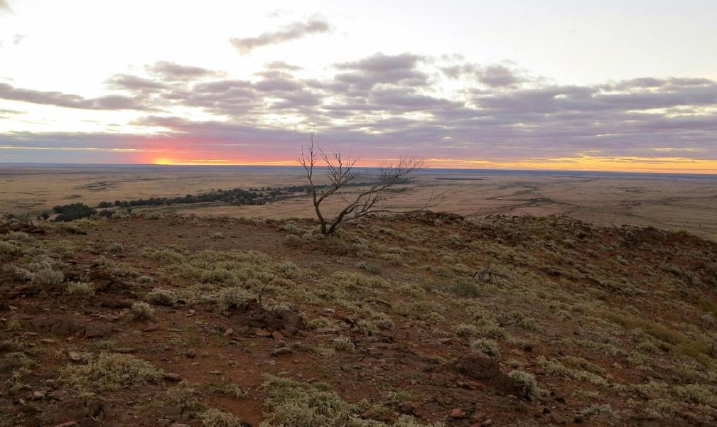
Nature Trail has driven to woop woop (e.g. Mundi Mundi Lookout – per this photo). After our own photo session we elected to return back to Silverton’s friendly street donkeys and thence to our safe accommodation digs in downtown Broken Hill.

The Nike motto is all about organised athletic sport in a ‘Controlled Environment’ supported at all times by specialist medical teams. That motto is not appropriate for Outdoor Recreation, and especially not for remote trekking.
Had Lily, or anyone else, approached us to design and lead a day hiking trip to Bonnum Pic return, here is what we would have done:
[1] We would not have gone, so said no! Even a quick lay-person online check of Bonnum Pic Trail raises red flags of hazard and unacceptable risk. Nature Trail would have politely rejected the request for the following reasons:
- Nature Trail is based in Katoomba, which is situated 200km (3 hour drive) away (each way) from the car park starting location at Wanganderry Pass Trail for the Bonnum Pic Trail. This distance is beyond our Day Hiking Trip range.
- Nature Trail’s tour policy is to undertake our Day Hikes within a 20km driving radius of Katoomba. Thereafter, beyond that radius all trips (hiking and/or road) are offered on a minimum overnight stay basis (camping or accommodated by prior arrangement).
- Nature Trail is a tour operator and does not offer a point-to-point fare based taxi service.
- The transport (road) distance between Oakdale and the Wanganderry Pass Trail car park start/end for the Bonnum Pic Trail is about 75km. The best road route to avoid the Hume Freeway would be via ‘The Greater Blue Mountains Drive’ which passes through many regional villages and towns enroute, so the estimated transport duration would be 1.5 hours each way (total 3 hours). The researched Bonnun Pic Trail has an estimated 7 hours return duration. Plus allowing for pausing (breaks/viewing) and a 20% contingency for unexpected delays, plus the uncertainties of being off-track (poor navigation and difficult terrain) our safe allowable estimates of the hiking trip itself would be closer to 11 hours. So the total trip planned allowance duration from Oakdale to Bonnum Pic return would be 14 hours. This greatly exceeds Nature Trail’s overall Day Trip limit of 9 hours (say 50% more duration). Such is a professional reasonable estimate allowing for normal variables, delays and with a fair (and legal) time buffer for unexpected events. Young individuals are none the wiser of such.
- Nature Trail’s Tour Director is a qualified heavy vehicle driver (NSW HC license) including a public bus authority and for safety reason complies with Australian Fatigue Management guidelines by the Heavy Vehicle National Law and Regulations. Planning a trip that could involve 11 hours straight operation in one day would be unsafe; this despite not operating a heavy vehicle.
- Nature Trail policy is to offer only hiking tours on well defined tracks. Bush bashing is off limits for reasons of safety, environmental conservation, navigation difficulty, and schedule compliance, amongst other operational reasons.
- Online research of the Bonnum Pic Trail reveals high risk matters – extreme exposure (to death by cliff fall), no-track bush-bashing, poor navigation creating high risk of becoming lost and benighted, dehydrated by no drinking water source on hiking route, little if any suitable and safe camping sites on hiking route, no facilities. Woop Woop!
An level-ground and seemingly weather-protected bush camp option early and wisely enroute:
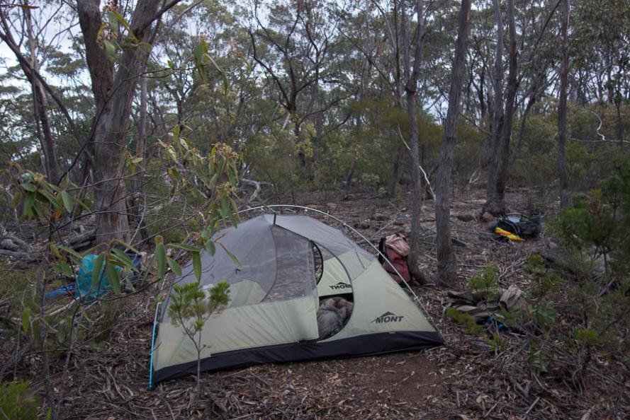
SOURCE: ‘Bonnum Pic (overnight) 27-28 July 2019‘, by Rachel Grindlay [Author’s Note: before the 2019 wildfires], ^https://grindlay.org/2019/07/bonnum-pic-overnight/
This is one last minute enroute option along Bonnum Pic ‘Trail’, a ‘do-able’ rock overhang shelter for an overnight camp located about 500m shy of Bonnum Pic (but technically not a cave):
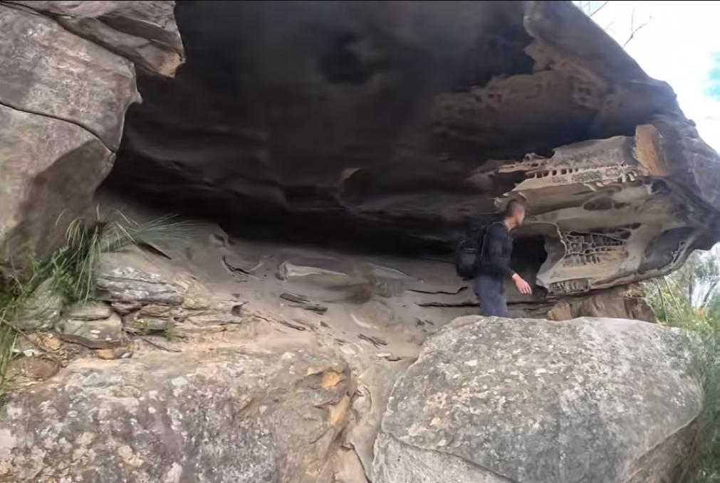
Image courtesy of Project Fit Trekker.
[2] Nature Trail for safety reason only operates hiking tours with between a minimum of 4 and maximum of 7 participants including the trip leader, for many safety reasons. Solo hiking is not undertaken.
Quite separately, Nature Trail also offers Trekking as a distinctly different tour type that involves either 2-Day or Multi-Day trekking, and allows for the same numbered range of a minimum of 4 and maximum of 7 participants including the trip leader, for many safety reasons. Advanced and self-sufficiency for trekking is a prior mandatory requirement.
[3] Such a trip as Bonnum Pic Trail would in our judgement, sensibly and necessarily, be deemed not a Day Hike but an advanced Multi-Day Trek type of trip. It would involve remote camping, participants with proven experience in trekking and rock scrambling, participant self-reliance (trekking kit, sustenance). Read More about Nature Trail’s Treks on this website: ^https://naturetrail.com.au/treks/
[4] Prior to such a trip, the trip leader would first scout, reccie and practice the transport and trekking route. This would include also considering/factoring in a variety of alternative route options and evacuation options where possible. A Trip Journal would be drafted and updated for each pre-trip including road and trail specifications plus GPS waypoints, leg descriptions (eg vegetation type and thickness/passability, hazard types and each of their specific locations/sections, camp site possibilities and detailed trail notes.
[5] The entire trip planning would have been first undertaken. A suggested itinerary would be:
- Pre-Trip Proposal: Weeks prior to the actual delivered trip, the trip leader to arrange a group meeting of all trek applicants at Nature Trail’s Base in Katoomba – brief, share and exchange trip info, specs, queries, standards, share coms (phone/email), etc. (Some may drop out)
- Actual Trip Day 1: Transport drive from Katoomba to Oakdale, rendezvous with trek group participants at either Oakdale or nearby such as Mittagong – stock up with sustenance supplies, then car convoy to Bonnum Pic start at Wanganderry Road Car Park – group bush camp night #1 overnight.
- Actual Trip Day 2: Group trek from (trek start) Wanganderry Pass Trail car park to (base) bush camp site #2 (location TBA) – somewhere bush enroute to Bonnum Pic peak. Slow careful trekking.
- Actual Trip Day 3: Bonnum Pic ascent trek and return to same bush camp site #2 overnight
- Actual Trip Day 4: Trek return from base camp site #2 to Wanganderry Road Car Park – trek group evening debriefing
- Actual Trip Day 5: Transport drive from Wanganderry Road Car Park to Oakdale, thense to group individual nominated disembarcations and road transport return to Nature Trail Katoomba Base.
- However – proposed trip extension (group agreed weeks in advance): Given the considerable transport distance from Nature trail’s base at Katoomba to Wanganderry Road Car Park (and return) some 400km, being 10 hours on the road, this trip could benefit from additional side trips for added variety whilst distant from Katoomba down in the Nattai National Park.
Our suggested online-researched trip extension extra options for group consideration to enhance this multi-day trek (not all, but by mutual selection) weeks in advance (POST (aka ‘afterwards’) the Bonnum Pic Trail):
[Trip Option ‘A’]: To just cancel this trip completely! So just don’t go at all (aka the tried and tested ‘do nothing’ approach can be ‘way’ wise). This is always the safest option, yet of course less fun – yep acknowledged, but one gets to live and venture again.
[Trip Option ‘B’]: Go ahead with this planned trip but purely to hike Bonnum Pic Trail (return) solo as intended, driving there and back same day to Oakdale. Extreme reported hazards so extreme risk, no buddies, no back up, so good luck!
[Trip Extra Option ‘C’]: Book Group Stay Base (for 2-nights) at a nearby short-stay accommodation, such as at ‘Hi-Range Country Cottages’. Pre-arrange and carry-in food and supplies accordingly. Use this as a base for local extra options.
Online Research:
Other stay options:
^https://www.stayz.com.au/d/cottages/166333/high-range
[Trip Extra Option ‘C’]: Venture next day to nearby Hike ‘Starlights Trail‘, Nattai National Park
-
- Starlights Trial is recommend by the NSW NPWS on its website thus:
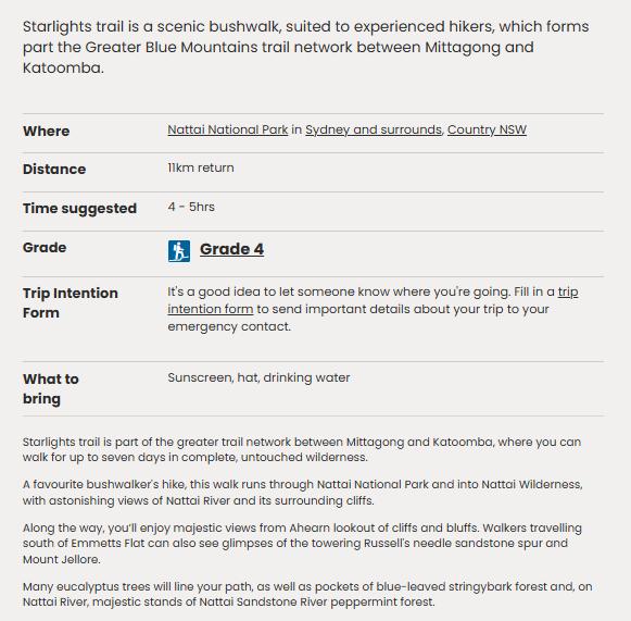
[SOURCE: NPWS, ^https://www.nationalparks.nsw.gov.au/things-to-do/walking-tracks/starlights-trail ]
[Trip Extra Option ‘D’]: Venture next day to nearby Hike ‘Wollondilly Lookout’
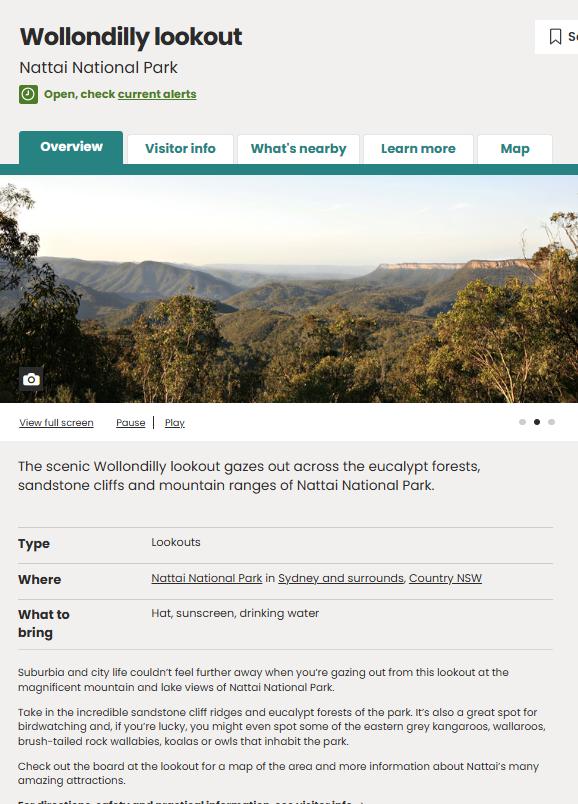
[SOURCE: ^https://www.nationalparks.nsw.gov.au/things-to-do/lookouts/wollondilly-lookout ]
[Trip Extra Option ‘E’]: Venture next day to nearby ‘Couridjah Corridor walk’
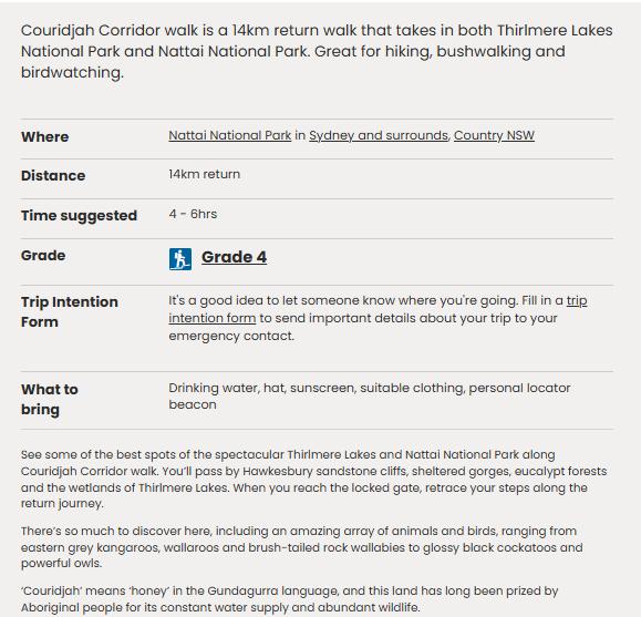
[SOURCE: ^https://www.nationalparks.nsw.gov.au/things-to-do/walking-tracks/couridjah-corridor-walk ]
[Trip Extra Option ‘F’]: Nattai National Park hiking trail options, as listed by All Trails on its website. Each varies in difficulty grade, and many are unofficial and require bushbashing through ecology (aka “adventurous”)
, ^https://www.alltrails.com/parks/australia/new-south-wales/nattai-national-park
All Trails Example: #4 – Starlights Trail, Slott Way Track, and Ahearn’s Lookout
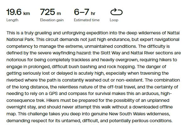
-
- Ahearn’s Lookout
- Dobson’s Cave via Hermits Track
- Starlights Trail, Slott Way Track, and Ahearns Lookout
- Mount Jellore Summit
- Russells Needle
- Rocky Waterhole Creek Lookout
- Buxton Plateau Trail and Ladie’s Waist Lookout
- Hoddles Track
- Mount Jellore via Soapy Flat Road
- Bullio Tunnel
- Sheehes Creek Fire Trail
[Author’s Note: We observe on the All Trails website some ridiculous trek suggestions into woop woop that approach the scale of Myles Dunphy historical epics equivalent to traversing some European countries – like Mittagong to Katoomba (116km) and Beloon Pass from Starlight Trail (50.5km).]
[Trip Extra Option ‘G’]: Venture to nearby Wombeyan Caves, Wombeyan Karst Conservation Reserve, ^https://www.nationalparks.nsw.gov.au/visit-a-park/parks/wombeyan-karst-conservation-reserve
[Trip Extra Option ‘H’]: Transport return to Katoomba north-westward via Shooters Hill.
[Trip Extra Option ‘I’]: Post Trip Debrief Stayover – for such a big trip debrief/chill/stay-over in a village/town in the nearby Southern Highlands region before heading back home a late day later – so Mittagong?, Bowral?, Berrima?, even the closer situated historic colonial village of Picton?…
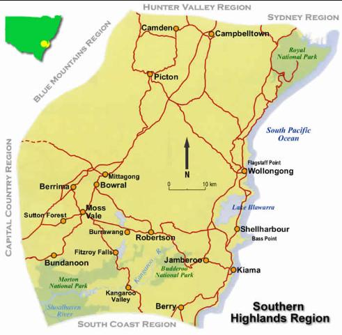
[6] An extensive trekking kit would be required to be carried by the trip leader:
- Personal Locator Beacon (PLB) – we recommend (and have purchased) brand GME, being made in Sydney
- GPS Navigation Device – ‘Hema Maps’ (features roads, hiking trails – made in Brisbane!), else explore ‘Garmin’
- Satphone – active (ideally a Telstra current Iridium with paid up use plan) – not cheap but
- Climbing Rope – 60m single pitch dynamic rock climbing rope (as an emergency back up)
[7] Each participant required to carry and fit for rock scambling safety:
- Head torch x2 (new batteries and pre-checked)
- Camping kit (multi-day)
- Thermals (in waterproof stuff bags)
- Full rain gear (head to toe, readily accessible in top of rucksack)
- Hiking boots (ankle-high) – best quality, best fitting
- Rock Climbing shoes (research this)
- Rock climbing rubber gloves (for better rock scrambing grip)
- Rock climbing helmet (see image below)
- Rock climbing 10 metre spare rope
- Hiking poles (fully length-adjustable)
- Camp-safe enclosed comfy feet-recovery footwear (makes all the difference next day trekking)

Petzl Sirocco® Helmet retails for AUD $317.95. [SOURCE: ^https://www.outdooraction.com.au/collections/climbing-helmets]
[8] A trek plan pre-lodged by the trip leader with Australian Maritime Safety Authority (AMSA).
- Twice daily satphone status reports communications made to Nature trail’s base in Katoomba, plus any operational in-field changes, incidents, emergencies. ^https://beacons.amsa.gov.au/registration/
Yet all amount of proper and expensive gear cannot guarantee a fall when skirting a precipice.
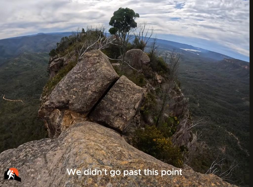
SOURCE: ‘Bonnum Pic – Nattai National Park’, Project Fit Trekker, (YouTube video), ^https://www.youtube.com/watch?v=WULk-HZMmO4

Remember that there will always be other opportunities and other outdoor recreational trips and adventures, provided that you are alive to undertake them. People matter more than trips, despite whatever urge a trip may present at a given moment. (wisdom imparted freely 😍 )
References and Further Reading:
[1] ‘Assistant Commissioner Joseph Cassar and SES Commander Colin Malone provided an update after a body believed to be hiker Lily Hooper was located in the Nattai National Park.’
The 18-year-old left her home on August 12 (2026) for a hike, but her car was later found near the Bonnum Pic Walking Trail car park start, so sparking an almost 400-person search…
^https://www.abc.net.au/news/2026-08-20/missing-18-year-old-bushwalker-lily-hooper-found/107045898
[2] ‘What Happened To Lily Hooper? Everything We Know About The Tragic Search For The Teen‘, 2026-08-21, by Writer Caitlin Napier, Maria Claire media, ^https://www.marieclaire.com.au/news/lily-hooper-bushwalker-body-found/
What Happened To Lily Hooper? Everything We Know About The Tragic Search For The Teen
[3] ‘Investigation launched into bungle that saw teen Lily Hooper wrongly declared alive‘, 2026-08-20, Cydonee Mardon, News Corp, ^https://www.news.com.au/travel/travel-updates/incidents/investigation-launched-into-bungle-that-saw-teen-lily-hooper-wrongly-declared-alive/news-story/4281ecb9ccc27b24995956123ea05113
“A code word was meant to protect the family of missing teenager Lily Hooper when her body was tragically found. Instead it was broadcast to the nation.”
[4] ‘Search continues for missing bushwalker – Southern Highlands‘, Saturday, 2026-08-15, NSW Police website, ^https://www.police.nsw.gov.au/news/news_article?sq_content_src=%2BdXJsPWh0dHBzJTNBJTJGJTJGZWJpenByZC5wb2xpY2UubnN3Lmdvdi5hdSUyRm1lZGlhJTJGMTI2OTk2Lmh0bWwmYWxsPTE%3D
[5] ‘Heartbreaking tributes for teenage hiker Lily Hooper after 18yo’s body found following desperate 8-day search‘, 2026-08-20, by Alexandra Feiam and David Hannant, of NewsWire (News Corp), ^https://www.news.com.au/travel/travel-updates/incidents/hiker-lily-hooper-18-found-after-eight-days-in-nsw-southern-highlands/news-story/653a6cabb11031bb7a3c0594f8797e12
[6] ‘Bonnum Pic‘, (being a prominent scenic rocky outcrop on a remote ridge), by Bushwalking NSW, ^https://bushwalkingnsw.com/walk.php?nid=826
[7] ‘Bonnum Pic‘, by AllTrails, ^https://www.alltrails.com/trail/australia/new-south-wales/bonnum-pic
[8] ‘Family of lost hiker Lily Hooper urge ‘Lily’s Law’ after tragic death‘, 2026-08-24, by
[9] ‘Bushwalker who survived kidney failure on NSW wilderness walk warns of tough conditions‘, 2024-03-31, by Sue Daniel, ABC media, ^https://www.abc.net.au/news/2024-03-31/bushwalker-near-death-blue-mountains-wilderness-walk/103626960
[10] ‘Rescue from the K2K Kanangra to Katoomba route‘, 2019-10-10, by Caro Ryan, Lotsafreshair.com, ^https://lotsafreshair.com/rescue-from-the-k2k-kanangra-to-katoomba-route/
[11] ‘Coroner’s Finding: David Balthazar Iredale (deceased)‘, date of death: 2006-12-11, Finding date: 2009-05-07, ^https://www.coronial.com.au/finding/nsw-legacy-iredalefindings.
“A 17-year-old final year high school student died from dehydration on 11 December 2006 during a bushwalk in the Blue Mountains National Park undertaking what he believed was a Duke of Edinburgh Award expedition.
After becoming separated from companions during descent to Kedumba River, he made seven emergency calls (one to police, five to ambulance) but received ineffective assistance due to critical systemic failures in NSW Ambulance Service protocols and training.
Call handlers repeatedly demanded street addresses despite obvious bushland context, failed to override computer systems designed for urban emergencies, and did not effectively record or relay vital information to rescue services. Contributing factors included inadequate water planning by the three boys, insufficient supervision and approval of the expedition by Sydney Grammar School, hot weather (>37°C), taking a wrong turn, and the deceased’s separation from companions.
The search and rescue response was timely given available information, but earlier access to recorded calls would have enabled faster location and recovery. The coroner identified critical systemic deficiencies in triple 0 emergency call centre operations and made extensive recommendations for protocols reform across multiple agencies.”
[12] ‘Inquest hears mother’s tearful recount of son’s last call home‘, 2009-04-20, ABC media, ^https://www.abc.net.au/news/2009-04-20/inquest-hears-mothers-tearful-recount-of-sons-last/1656660
“The mother of a teenage bushwalker who died in the Blue Mountains in 2006 has described her final conversation with her son to a coronial inquest.
Maryanne Iredale held back tears while giving evidence at the inquest into her son’s death.
David Iredale died after becoming separated from two companions on a bushwalk near Katoomba in 2006.
He was doing the walk in the hope that it would count towards a silver Duke of Edinburgh award.
His parents Stephen and Maryanne Iredale have both given evidence at the inquest into his death, being held in Penrith this morning.
Last call home
His mother told the inquest the 17-year-old called home on the second morning of his walk, just three hours before he got lost. She said he called to wish his brother a happy birthday.
The inquest heard David Iredale asked his mother if she had eaten the mango ice-cream she had made at home, and he said he could do with some of that.
Mrs Iredale said that comment made her think he was thirsty, but he did not sound distressed.
When asked if David Iredale received a map of the walk from his teacher Mr Forbes, Mrs Iredale said definitely.
His father, Dr Iredale, told the inquest he was not worried about his son doing the walk in the middle of summer without adults, because he thought it was an activity under the direct supervision of the school. He said the Year 11 student showed him a form he had received from the school outlining the planned trip.
Both parents told the inquest that the teacher in charge of the awards programme, Mr Forbes, forgot to lend their son a GPS for the walk.
Friend gives evidence
One of David Iredale’s school mates, Brian Ng, also gave evidence.
He said he did not go on the walk because his parents would not let him, but he said he had already been on an unsupervised bushwalk in Hornsby with six of his friends in Year 10. When asked if his teacher Mr Forbes organised that walk, he answered, probably.”
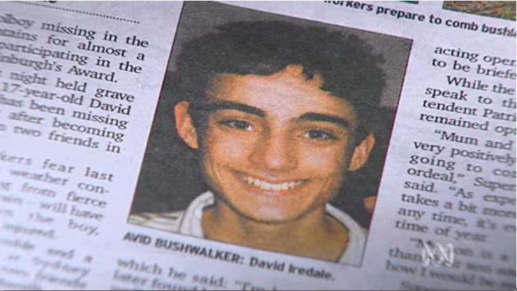
[13] ‘Safer Roads and Highways Group‘ (SARAH), ^https://sarahgroup.org/founder
Safer Australian Roads and Highways (SARAH) Group was set up by Sarah’s father Peter Frazer to ensure more lives are not lost through preventable and clearly foreseeable situations like the one that took Sarah’s life.
“Peter Frazer OAM, President of SARAH Group, has over 40 years’ experience in economic analysis, research, law enforcement & compliance policy, investigations, strategic & operational intelligence, and project management as well as social justice advocacy. On 15 February 2012, Peter’s daughter Sarah was killed by a truck driver in a completely avoidable crash on the Hume Freeway in New South Wales. Since then, he has dedicated his life to improving road safety in Australia and overseas. In March 2012, Peter founded SARAH (Safer Australian Roads and Highways), colloquially known as SarahGroup. Since then, he has used his more than 40 years’ experience in social justice, policy, research, law enforcement and intelligence, to not only positively influence government, corporate and community road safety advocacy, but legislative and infrastructure reform. He created and remains the driving force behind Australia’s National Road Safety Week, as well as the nation’s road safety symbol, the “Yellow Ribbon”.”
[14] ‘Tributes flow for Lily – a “beautiful spirit” ‘, 2026-08-22, by Max Aldred, AAP, ^https://aapnews.aap.com.au/news/tributes-flow-for-lily-a-beautiful-spirit
[15] ‘Distress beacon borrowing programme proposed after teen hiker’s death‘,
Tue 2026-08-25, by Brooke Chandler, ABC Illawarra, ^https://www.abc.net.au/news/2026-08-25/council-to-establish-safety-program-in-memory-of-teen-hiker/107074896
“In short:
Wollondilly Council has promised to establish a bushwalker safety program after the death of 18-year-old hiker Lily Hooper.
Mayor Matt Gould said idea for the program, which would include a distress beacon for hikers, was developed in consultation with Ms Hooper’s family.
What’s next?
The council will collaborate with NSW National Parks and Wildlife Service on the delivery of the programme.”
[16] ‘Nattai National Park‘, on the NSW Government’s official ‘Parks Service’ website, https://www.nationalparks.nsw.gov.au/visit-a-park/parks/nattai-national-park
Quote:
“Head to Nattai National Park for bushwalking or backpack camping in a remote wilderness setting not far from Oakdale and Mittagong, and an easy drive from Sydney.
Nattai National Park has plenty of astonishing beauty on offer, including Nattai River, the dominant Hawkesbury sandstone cliffs, and the inspiring views out over the park from Mount Jellore.
Throughout the park, you’ll spot a large variety of animals, like wallaroos, emus, wallabies, eastern grey kangaroos, wombats, and dingos. There are also over 160 species of birds in the area, including some truly magnificent owls and birds of prey. Keep your eyes open for platypus in the river and squirrel gliders or koalas in the trees.
You can enjoy rugged hiking in an amazing setting of giant, craggy sandstone cliffs and unspoilt bushland nestled amidst the peace and tranquillity of the valley. Try Starlight’s trail or Couridjah Corridor walk. There’s also a remote campground by the Nattai River known as Emitts Flat, which can be found at the end of Starlight’s trail.”
[17] ‘Use Emergency SOS via satellite on your iPhone‘, Apple iPhone, ^https://support.apple.com/en-au/101573
 Loading...

 Reload document
  Open in new tab
 May be, just may be, this could set the standard for emergency communications for every Outdoor Recreation participant…(that is if one has the funds to make it affordable – hello NSW Government! Like think of the Pharmaceutical Benefits Scheme (PBS) designed to save lives affordably?
Lily could then still have been alive.
[18] Published reviews of Bonnum Pic Trail by hikers, All Trails, Hiking (category), ^https://www.alltrails.com/trail/australia/new-south-wales/bonnum-pic
Trailgoers are saying…
(most recent from top):
Highlights include stunning views, diverse terrain, and sightings of native wildlife. Reviewers mention challenges like overgrown paths, navigation difficulties, and steep rock scrambling. Bringing a downloaded map and plenty of water is recommended.
Wassim El-kabbout (Aug 30, 2026)
- Not crowded
- Great views
- Very difficult track must definitely have great navigation skills pre-downloaded map definitely go with a friend plenty of water overgrowns for some parts of the track otherwise awesome adventure
Zee Chehade (Aug 30, 2026)
- No bathrooms [seriously?]
- Obstructions
- Take a buddy, heaps of water, download the AllTrails map and carry a PLB. Heaps of bush bashing and rock climbing so be sure to have the correct gear on (long sleeve top, pants, light jacket, gaiters, boots, hat and sunnies). The trail gets hard after the third viewing point. Be sure to keep checking your map as the ridge gets more narrow and a wrong turn can put you at risk of falling. Definitely don’t recommend going beyond the ‘slide of death’, 100% percent not worth the extra effort or risk. The view is pretty much the same.
- Conditions: Obstructions, Overgrown
Suleyman Kumsuz (Jun 14, 2026)
- No trail at all. If you like bush bashing do it. Otherwise choose somewhere else.
Steve Kirton (May 16, 2026)
- Good views
- Not crowded
- We measured just over 17km & just under 7 hours – roughly 4 hours out & 3 hours back. There’s a lot of bushbashing but the views are worth it. We finished about 100m from the end because trail was a bit vague and we were worried about cliff exposure. Definitely download maps as trail was often hard to find in middle section. Would not recommend to do solo as we had safety in numbers.
Louise Brooks (Apr 27, 2026)
- Great views
- Technical
- Difficult wayfinding
- A great adventure for more advanced hikers. The views are amazing with expansive scenic views and stunning geology. This trail involves lots of rock scrambling and route finding. We did find ourselves off track and doing a fair bit of bush bashing to get back on track. Pants and long sleeves are a must as is the need to bring lots of water. Overall really enjoyed it.
- Difficulty: Strenuous
Tess McGahan (Apr 13, 2026)
- I went with a girlfriend and we honestly didn’t find all the bush bashing really worth it. The path is so overgrown that you are bush bashing an navigating the majority of the way. The views are incredible but just you could have them all the way along the ridge but the path takes you in so you can’t always see the view. Still spectacular just hard yakka
- Conditions: Bugs, Overgrown
Ben Reynolds (Mar 15, 2026)
- Exposure
- In the effort vs reward stakes, this is a middling hike. As many have said, it’s very overgrown and finding the paths is often an exercise in luck. We used the downloaded map to bush bash back much more than we liked. Most of the hike is through scrub and it’s only when you emerge onto the rocky outcrops over the valley that you get the rewards. It’s a really nice view, but geez you have to work for it.
- Conditions: Overgrown, Overgrown
- Difficulty: Hard
Jess C (Jan 9, 2026)
- Good views
- Not crowded
- Some sections with overgrown paths, definitely recommend wearing long pants and sleeves. You follow a property fence line with fire trail, then more overgrown path before arriving at the first mountain view. From there you are mostly exposed on the rocks. Add a few extra degrees on a hot day. The campsite is a beautiful clearing with great views of the valley. The summit is another 1.5km from there with some bouldering. From car park to campsite took us about 2hrs with packs. Worth the views!
- Difficulty: Hard
Jacqui Delahunt (Nov 9, 2025)
- Not crowded
- Great views
- Really enjoyed this trail; varied terrain & amazing views. You do want to be physically fit and be prepared to use your hands as well! Definitely wear long pants – very over grown, even my pants now havea hole. Lots of scratches up to my shoulders! Once you get to the ridgeline there are still parts of bush bashing your way through prickly scrub and bushes even when you are on the path. Definitely use a GPS (I downloaded the map onto my Garmin watch and used that to navigate which saved us hours of confusion, even then we got lost a few times…) We knew we were right next to the path but it was so overgrown we couldn’t find it!. We didn’t go all the way because we didn’t have a rope… but still be prepared to scramble up some pretty big boulders. The views are stunning, lots of wildlife (Roos, goanna, echidna, and saw a red belly as we got back into the car). We were the only ones on the trail. One of my favourites now.
Outdoor Mac (Sep 25, 2025)
- Great views
- Excellent views once you’re up on the ridge, but as others have said – lots of regrowth and bashing through low scrub. Trail is easier to find in some places more than others, cannot recommend GPS / maps enough for this walk. Lots of native wildlife about, especially during the first half.
- Conditions: Bugs, Muddy, Overgrown, Dusty
- Difficulty: Hard
Kelly O (Sep 14, 2025)
- No bathrooms
- Overgrown bushes, hard to direct
- Difficulty: Hard
Amy Nguyen (Sep 14, 2025)
- Very overgrown track but rewarding making it to the end
- Conditions: Overgrown
Jessica Ho (Sep 14, 2025)
- Very overgrown with plants that will scratch you so much sure to clothes that cover the skin. View was nice up top, bring a rope for the death slide. Make sure to use AllTrails as trails can be quite confusing.
Liam La (Sep 14, 2025)
- Not too bad casual Sunday walk. Couple leaves here and there
Difficulty: Strenuous
Grace Fang (Jun 17, 2025)
- It’s not a very hard track for experienced hiker, as long as you don’t want to reach the Alltrails marked location of Bonnum Pic, not sure if it’s accurate as the first trace is still far from there.
Paul Lynch (May 17, 2025)
- Easy to park
- Not crowded
- Great views
- Care needed to keep on track. Easy to lose track.
Nicole G (May 3, 2025)
- Good views
- Views are beautiful and worth it! The trail is quite overgrown so definitely wear long sleeves, also be careful of leeches after rain – all very manageable still!
Mark Passfield (Apr 8, 2025)
- Bit overgrown at the start but fabulous views to be had.
Alex Benedetti (Mar 22, 2025)
- Follow piles of rocks. & closely monitor phone navigation
- Conditions: Overgrown
Emile Gasbarri (Mar 9, 2025)
- Good views
- Extrenely overgrown and bushy, need long pants and shirt. Track was also hard to follow sometimes, definitely need offline GPS. Getting all the way to the end is very challenging and dangerous.
Alan Harwood (Oct 13, 2024)
- Great track for experience hikers as need navigation skills and map/app. Takes longer than expected as no real track in places. Views worth the hike especially in spring with flowers out and wildlife.
Kenton Horsley (Oct 8, 2024)
- Good views
- Very cold when wet, trail a bit vague in spots but easy enough to follow general bearings
Nick Richards (Sep 19, 2024)
- Not crowded
- Great views
- Day hiking at its finest! A tremendous walk. Loved every minute of it. The rock scrambling is really fun. Forget bouldering in the gym, come out here to nature’s playground! Navigation and exposure are the main challenges of this walk. It was about 20 degrees when I did it, and I would not have wanted it much hotter. Very windy and sunny in some sections.
- This is the walk that convinced me to upgrade to AllTrails+, for the downloadable maps. I’m so glad I did, reception is patchy on the walk and I frequently required the map to get back on trail. I appreciated the little rock stacks that had been placed to help keep on trail. Meant that I could walk with my head up, not watching my phone, and only check the map when I felt lost (which happened a lot!) Thanks to previous reviewers. Especially Iveta, her reviews (and video!) were very educational and encouraged me to try this walk.
- Conditions: Overgrown
Sean Wright (Aug 19, 2024)
- Good views
- Easy to park
- Not crowded
- Some over grown sections but trail still easily followable. Look for the cairns on rock outcrops . At times there is more than one route , but all end up in same places.
Emm Bee (Jun 11, 2024)
- Did this as part of a weekend walk to Wanganderry Walls. Weather fine albeit cool and wind. Track a bit overgrown but off-track scrubby and dense. No difficulties with water but that was due to all the previous rain. Views outstanding. Wattles and other flowers out!
Jerry Bour (Apr 18, 2024)
- One of the best serious bushwalks in Nattai NP. Only for very experienced walkers.
Kristi Gilby (Mar 3, 2024)
- As others have said, track is overgrown and hard to find sometimes, but gorgeous views once it opens out. I stopped & headed back 2km short as was getting fairly warm.
- Start early as exposed in places, take a GPS and lots of water!
Leon Rhind (Feb 9, 2024)
- A day to remember …very hard to complete as terrain gets harder and harder. I started at 10am which was too late on such a hot day. Try to start early and choose an overcast day or at least with some cloud cover or wind as the exposure is punishing. Even with 3L of water, I ran out near the end. Be mindful of this as there is ZERO chance of topping up water, so 3L is recommended to take. Even with map downloaded it is still very easy to be off the trail and due to the rocky terrain, this sucks up a lot of time causes a lot of fatigue. I was punished with severe leg cramps and my hike turned into quite the ordeal by the end – again due to the later start time, no clouds and full sun.
- If I redo this hike, it’ll be first light and cloudy. Check your weather conditions before setting out, a PLB and map downloaded is essential.
- Conditions: Rocky, Scramble, Unmarked, No shade
Toru Mori (Sep 26, 2023)
- Wanganderry beauty walk
Abbey La Plana (Jun 25, 2023)
- Done in a very windy condition. Month of June 2023. The track was very hard. Bush bash, so overgrown and very hard to navigate. Did not complete maybe another 3kms left and need to head back because of running out of daylight. Overall, it was a great challenge if only the terrain was not too overgrown. I could have completed it.
Vincent Chauvet (Jun 17, 2023)
- Regrowth city up until the very end, wear pants and long sleeves with shades unlike this doofus. Although it’s salvageable I’d heavily advise a good map system as my phone died which made the return trickie (blind confidence of the cis white male strikes again). [sodomite lurking in Nature?] 4-5 hour return if you’re going fairly fast. Good fun along the ridge.
Taeki Kim (May 6, 2023)
- Hard to find route but incredible view at last
Jerry Bour (Mar 23, 2023)
- This is one of the best bushwalks in NSW. It is not for the faint hearted as it is tough, exposed, over grown and exposed in places. I would rate it a grade 6. Hard and for experienced walkers. Take a rope to help you in places.
- Conditions: Overgrown, Rocky, Scramble, Unmarked, Great!, Slippery
Simon Grant (Mar 23, 2023)
- Very interesting hike, quite steep and rough at times but not too long. Fantastic variety of vegetation to see which changes as you climb.
Cameron Mitchell (Feb 4, 2023)
- Took 7 hrs and still we didn’t get to the full end, probably needed another 1 to 2hrs, and we weren’t going slow either, not sure how they say 5hr walk (usually they are very generous on the estimate) can only assume most do not do the end part from the valley, that’s where it gets interesting, trail at times only seen if right on top of it, and sometimes not even then, new growth makes for a massive amount of bush bashing, but totally enjoyable and challenging
- Conditions: Overgrown, Rocky, Scramble, Unmarked
Mark Passfield (Oct 26, 2022)
- Always a good walk. Wildflowers were amazing. Gets hard towards the end but worth it. We didn’t attempt the “slide of death”!!
- Conditions: Great!
Dave R (Jun 7, 2022)
- Very overgrown in sections, after the fires of 2020 growth has come back with a vengeance! GPS is a must as the trail is not obvious at all in certain sections. Allow extra time as the overgrown sections and lack of visible trail slows you down materially, GPS is a must. Didn’t make it all the way, would need 5 hrs each way in a large group. Shorter time if moving at a pace. Views are amazing once out of the new growth sections, well worth the journey.
- Conditions: Overgrown, Scramble, Great!
Daniel Obando (Jun 4, 2022)
- Complex at times. GPS required. Not to be done alone. The track is totally hidden in many areas
Iveta Valentova (Mar 27, 2022)
- Didn’t walk all the way to the end this time, run out of time. Trail is pretty overgrown at some parts, makes it a bit slower to get through. Still awesome. Bring GPS.
Lora Ye (Jan 26, 2022)
- Due to the overgrown tracks this is a hard (not moderate) hike, especially the exposed climbing at the end. Offline maps and GPS is required for navigation here. There is also a locked fence 2km in. Beautiful views though, well worth the effort!!
Jerry Bour (Jan 20, 2022)
- a great walk with a beautiful destination. we call it the Rock Park.
Daniel Wood (Jan 10, 2021)
- Really enjoyed this hike and great to see the bush coming back to life after the fires. There’s a lot of new growth and signs of wildlife – saw an echidna, kangaroo and lots of birds. The first part of the track is a bit of a scramble through the bush but from 4.5km there are really good views of Wollondilly Valley (you could turn around any point from here if you didn’t want to go all the way or had young children with you). There is not much of a clear trail for most of the hike but there are pink tape markers on tree branches showing, however offline maps are a must as it is very easy to get lost and some of the pink markers are hard to see or far apart. I really would not recommend doing this track without offline maps (there’s also no phone signal for most of the track). I didn’t go further than this route on AllTrails as you need ropes and there are lots of loose rocks near cliff edges but I didn’t feel the need to either as the views are impressive from where I stopped and turned around. To get to the trail, drive to the end of Wanganderry Rd and go through the gate (remember to close the gate). Then park in the turning circle just after the gate. From there, walk down the fire trail a few minutes and you’ll see the signs for the start of the track. Bring lots of water and sun screen – it is very exposed on the rocks and white sand. Overall a very enjoyable trail.
- Conditions: Bugs, Rocky, Scramble, Unmarked
Byron Smits (Oct 19, 2020)
- Due to recent rain fresh growth made the track disappear at about 1km in. We walked 3km in with no trail so turned back to avoid being lost. I wouldn’t suggest this without maps (no reception) or away of finding your way back. Due to the fire most of the signage is burnt and lack of visitors means no path. I will be back to do it again but more prepared to make a new trail as the old one seems lost completely…
- Conditions: Overgrown, Washed out, Unmarked
Amanda Roberts (Sep 26, 2020)
- Yes amazing but … NOT easy. The bush pad is hard to follow and the rock scrambling is not beginner level imo (in my opinion)
Stephen Tabrett (Aug 1, 2020)
- Awesome hike, love the views and the awesome track. Chickened out on the slide of death even though I had a good rope.
Natalie Yates (Jul 12, 2020)
- Easy??? Maybe for a good part but the knifes edge was hectic.
Iveta Valentova (Oct 27, 2019)
First to review
- one way track, full day event. I would divided this walk into 3 sections – 1st forest walk, 2nd dome rock formation part, 3rd – rock scrambling towards Bonnum Pic. True wilderness, we didn’t meet single person in all day. Track is marked just with rock cairns on the way, GPS recommended. Great variety of landscape and amazing views.
[19] ‘Find My iPhone’ search app since iPhone 5 (released in 2012)’
-
- Announced: September 12, 2012, at a press event in Cupertino, California.
-
- Pre-orders: Began on September 14, 2012.
-
- Released: September 21, 2012, in countries including the US, Australia, Canada, and the UK.
[SOURCE: ^https://en.wikipedia.org/wiki/IPhone_5 ]
- Open the Settings app on your iPhone 5
- Tap on iCloud (on older iOS versions) or scroll down to Passwords & Accounts / Accounts & Passwords, then tap iCloud
- Sign in using your Apple ID and password if you are not already logged in
- Scroll down the list of iCloud services and find Find My iPhone
- Toggle the switch to On
- Tap Allow or Use when prompted to permit the app to use your device’s location. [1, 2, 3]

[20] Personal Locator Beacon, GME (Sydney), ^https://www.gme.net.au/au/emergency-safety/mt610g/
[21] Iridium Extreme 9575 Satellite Phone, ^https://satphoneshop.com.au/
[22] ‘The Best Climbing Helmet‘, Outdoor Gear Lab, ^https://www.outdoorgearlab.com/topics/climbing/best-climbing-helmet
[23] ‘How to choose kit for (rock) scrambling‘, by the British Mountaineering Council (BMC), United Kingdom, ^https://www.thebmc.co.uk/en/video-how-to-choose-kit-for-scrambling
Our Values
CARE: for our own actions, for each other, and for the places where we adventure.
Community: strength in collaboration, belonging and shared purpose.
Adventure: inspiration through curiosity, courage and challenge.
Respect: inclusivity in how we listen, understand and behave.
Environment: action that protects places for today and tomorrow.
[24] NSW Topographic Maps (website), Spatial Services, Department of Customer Service, of the New South Wales Government (in turn sourced from Esri, Geoscience Australia, NASA, NGA, USGS (2026), ^https://portal.spatial.nsw.gov.au/portal/apps/webappviewer/index.html?id=06e3c2e0de1e4efda863854048c613c6
[25] ‘Falklands War: The Daring SAS Glacier Rescue That Changed History‘,
^https://www.naval-history.net/F32-South_Georgia_retaken-Paraquat.htm
^https://www.youtube.com/watch?v=lCYvK63mMIs
[26] ‘Bvt. Lt. Col. Louis Francis Barrallier‘ (1773-1853), Wikipedia, ^https://en.wikipedia.org/wiki/Francis_Barrallier
[27] GME PLB ^https://www.gme.net.au/au/beacon-information/
Postscript:
A local community tribute this week remembering Lily, outside Oakdale Public School:
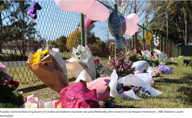
Aged 18, Lily went on from Oakdale Public School to attend Campbelltown Performing Arts High School and graduate.
“Campbelltown Performing Arts High School mourns the loss of student Lily Hooper.
The CPAHS school community is deeply saddened by the news of the passing of our Year 12 2025 student, Lily Hooper.
This loss has had a significant impact on our students, staff and wider school community. Lily will be remembered by our school as a kind, humorous and respectful young woman who lit up every room with her infectious smile, positive energy and determination to live life to its fullest.
She was, and will always remain, a deeply valued member of our school community.
Our heartfelt thoughts are with the Hooper family, Lily’s friends, and all who knew, loved and cared for her.
May Lily’s light continue to live on in all of us who were fortunate enough to know her. 💜”
SOURCE: facebook
Lily, in her adventurous yet short life, at least made it to a good summit.
Proactive Search and Rescue?
This is a concept that worth considering. Lily’s bereaved father’s justified plea for at least some lesson “Lily’s Law” be learned and applied as an added safeguard out of Lily’s tragic and very sad demise?
It is understandable and right. How can such can be mitigated, as a meaningful legacy from repeating this happening to another adventurous soul? We wholeheartedly support his sentiment.
Refer above to ‘MEDIA ARTICLE #4: ‘Family of lost hiker Lily Hooper urge ‘Lily’s Law’ after tragic death’ (August 24, 2026)…
[A] “Better education around bush safety”
[B] “Wider use of a personal locator beacon”
[C] “Wider use of tracking devices”
Let’s start with these and what to do.
[A] “Better education around bush safety”
- Solo hiking/trekking is a ‘no-no’. Even the fittest, most experienced hiker can become unstuck for a variety of reasons. We are all human like even members of the elite SAS!
- “Better education around bush safety”? Well, we suggest a few options to consider, if you’re serious (and not reckless); and be mindful that school teachers don’t cut the grade – they’re classroom teachers, not mountaineers right?
Consider instead:
- Orienteering NSW (^website link)
- TAFE Outdoor Recreation Certificate III/IV/Diploma (^website link) – with a grain of salt caution from experience. Hopefully they’ve raised their safety standards since
- Outward Bound Australia (^website link)
- Bushwalking NSW Training Courses and Resources (^website link)
- Join a Bushwalking NSW registered club (^website link)
- MountainSphere Adventures (^website link)
If you do all the above first, then you’ve got half a chance of coming back- before ten years real life experience! 😎
[B] “Wider use of a personal locator beacon (PLB)”
A PLB in Australia costs around $500, so don’t borrow one with all the bureacratic rigmarole, and scarcity of access. Just buy one and register it with AMSA for each and every trip!
Thus take personal responsibility when going bush!
Nature Trail owns one. It’s an Australian made GME model MT620GR and we recommend it.
[C] “Wider use of tracking devices”
(TBA)
bush with EPIRBs, tracker devices, Garmin, Navman type devices.”
After retracing the route Ms Hooper took, Mr Hooper believes she may have become lost after conditions changed late in the day.
“It’s a hectic track, I was surprised she took it on. I think it was on dark and she got disorientated and she headed in a direction that she didn’t walk in on,” he said. “Like I said the bush can swallow you up.”
Lily Hooper’s father Jim has paid tribute to his teenage daughter whose body was found on Thursday August 20 after she went missing while on a solo hike. He said he had previously tried to discuss bush safety with his daughter, but like many teenagers, she was confident in her abilities. “I locked horns with her about this sort of stuff which saddens me in a lot of ways because there was a lot of you know ‘what do you know dad’ stuff and you know kids think they know better,” Mr Hooper said.
[Bullet proof?]
Although they are grieving an unbearable loss, the family has taken some comfort from having Ms Hooper back.
“Out of the three scenarios of getting her back alive, getting her back (deceased) and then not getting her back we got the middle one,” Mr Hooper said. “Not ideal but at least we got her back.”
“Oh, just as a tribute to Lily. You know, like I say, she’s an advocate for young women.”
The family now says other young people can learn from Lily.
“She will leave a legacy, I hope, for girls, young girls, you know, to get out and about and enjoy life like she did.”.
Lily’s family is planning a big farewell off for the girl who threw everything at life.
He said the family was not angry over the heartbreaking communication breakdown following the discovery of her body. Coded messages between emergency agencies led to Ms Hooper’s family believing for eight minutes that she had been found alive. The miscommunication widely spread, even reaching NSW Premier Chris Minns, who announced it to parliament. But elation soon turned to deflation after the code was relayed and it was made clear Ms Hooper had died.
“No, not at all. I’m not in any way angry at the police or the police commissioner or the Premier,” he told 7News.
NSW Police Commissioner Mal Lanyon and Mr Minns have since apologised for the miscommunication.
Mr Hooper said he was grateful for the lengths that rescue parties, including NSW Police and volunteers from the SES, went to try and recover his daughter.
The tragedy has sparked an outpouring of grief across the nation and shattered the young woman’s local community.
“Beautiful Lily, may your soul rest peacefully … May your family find solace and comfort in knowing that you passed from this world doing what you loved to do and being with nature – you certainly touched the hearts of our Camden & Wollondilly communities,” one resident wrote on social media.
“Lily, you will always be remembered for the love and joy you brought to our community, your memory will live on in our hearts and minds,” another said.
Members of her community turned out to a candlelight vigil in Willis Park on Friday evening, barely 24 hours after learning of the devastating loss.
“A community coming together to support the Hooper family through this devastating time. Rest easy, fly high and shine bright Lily,” one commenter wrote on social media following the event.
The death of hiker Lily Hooper has led to an outpouring of grief in the community.
A community candlelight vigil was held on Friday to remember hiker Lily Hooper, who was found dead after a weeks long search. Picture: Facebook
A community candlelight vigil was held on Friday to remember hiker Lily Hooper, who was found dead after a weeks long search. Picture: Facebook
Ms Hooper’s alma mater Campbelltown Performing Arts High School shared a message to their community remembering the 18-year-old, who graduated less than 12 months ago.
‘Shine bright beautiful Lily’: 18yo mourned
‘Bottle of water’: Code word fail in Lily search
“Lily will be remembered by our school as a kind, humorous and respectful young woman who lit up every room with her infectious smile, positive energy and determination to live life to its fullest,” the school’s statement read. “She was, and will always remain, a deeply valued member of our school community. “May Lily’s light continue to live on in all of us who were fortunate enough to know her.”
*
So this is bureaucratic copper stonewalling and “nothing to do with Police here.” Yet should a copper challenge this or look sideways they get sacked? No wonder NSW Police continue to face chronic retention and recruitment challenges.

The NSW Police Force has faced thousands of officer vacancies and high numbers of personnel on leave or exiting the service. READ MORE: ^https://www.abc.net.au/news/2024-09-28/police-officers-shortage-overwork-unions/104384048

Mister Plod
In previous times, a visiting hiker could just walk into Katoomba Police Station and fill in a one-page paper form to loan a Personal Locator Beacon (PLB). We’ve been there and done that ourselves long in the past. Katoomba Police used to have 12 PLB’s in stock and the system worked well and simply by just filling teh basics on a one page paper form.
Then came bureaucracy from on high. Ready for this? This is the current PLB borrowing process as shown below. PLB hire across the entire Blue Mountains World Heritage Area of 1 million hectares) currently is only available at the following three delegated facility locations:
[1] Blue Mountains Heritage Centre, of the NSW ‘National’ Parks and Wildlife Service | 270 Govetts Leap Road, Blackheath, NSW, 2785 | Open 9am to 4pm daily | ^https://www.nationalparks.nsw.gov.au/things-to-do/visitor-centres/blue-mountains-heritage-centre
[2] Katoomba Police Station (an unmanned digital kiosk stand) at 217 Katoomba Street, Katoomba New South Wales | Open 24 hours
[3] Springwood Police Station, 4 Jerseywold Ave Springwood New South Wales 2777 | Phone: 02 4751 0299 | Open 24 hours
So other strategic entry points to the Greater Blue Mountains World Heritage Area, are without such a facility.
[A] Blue Mountains Council (Civic Place Katoomba, Echo Point Tourist Office Katoomba, Glenbook Tourist Office):“Nup, what’s a PLB? That’s Parks Service department.”
[B] Wollondilly Council (Picton): “Where’s Nattai?”
[C] Wingecarribee Council (Moss Vale, Southern Highlands): “Not our responsibility, we’re Southern Highlands’
[D] Lithgow Council (Mort Street, Lithgow): “We’re closed like Wolgan Valley until further notice”
[E] Hawkesbury Council (366 George Street, Windsor): “Floods are our priority, not Mountains stuff.”
[F] Mid-Western Regional Council (86 Market Street, Mudgee, 2850): “We just think wine, and more wine.”
[G] Central Coast Council (2 Hely Street, Wyong NSW 2259): “Nope, think Gosford city and Wyong city – like budding outer Sydney northward.”
[H] Singleton Council (12-14 Queen Street, Singleton NSW 2330): “Where are the Blue Mountains anyway?”
That NPWS official ‘Trip Notification Form’…
Before you start you need
Name, email address and phone number of your emergency contact.
Details of all members in your group.
Trip details, start and finish locations, departure and return date and time.
Details of your equipment. For example, your satellite phone number and Personal Locator Beacon (PLB) hex number/Unique Identification Number (UIN).”
Who bloody knows all that on the fly? So few can be bothered!
Here we go check the mandatory fields required to complete this form:
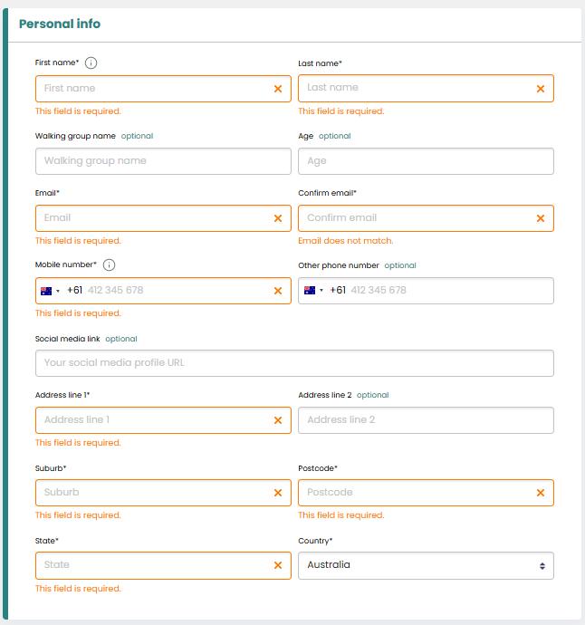
[SOURCE: NPWS, ^https://bookings.nationalparks.nsw.gov.au/public/npws/trips/intention?site=NPWS&parkId=&park=&attractionId=&attraction=&loggedIn=0, Accessed 2026-09-12].
[Author’s Note: The mandatory fields “This field is required” on the digital form must be filled in before an applicant can progress to many subsequent online pages in order to even begin to hire some PLB process progresses to the NEXT page. The pages are in the dozens! The questions are, like submitting your DNA code. Yeah we know our DNA code in our pocket, NOT! We’ve personally tested this at Katoomba Police Station and deem this to be a friggin joke that no-one will complete! One could have hiked the trip and back earlier than completing the bloody online stupid form!
We note the last clause of the form:
“I understand that if I submit this form, it does not under any circumstances guarantee that NSW Police or NPWS will start a search and rescue operation if I do not return from my trip, even if my emergency contact(s) notify NSW Police that I am missing.”
How reassuring?